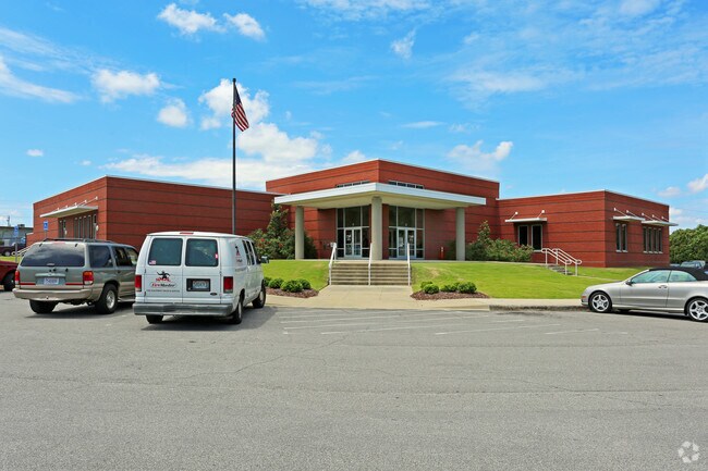
Property Record
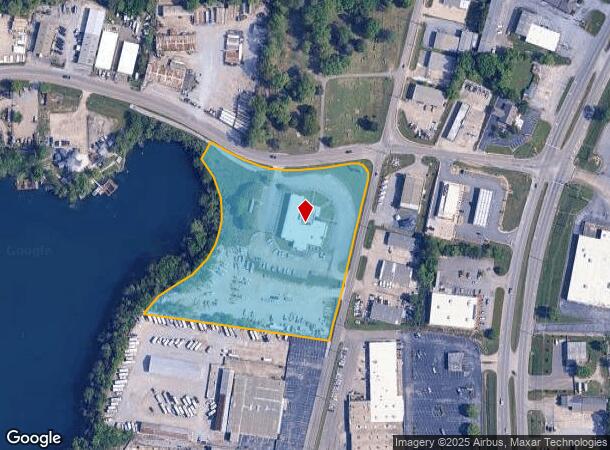
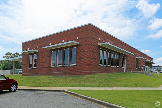
Alabama Power - Pelham, Pelham, AL 35124
NEARBY LISTINGS FOR SALE OR LEASE
Property Detail
Alabama Power - Pelham
13-6-14-1-001-015-000
BEG INT S RW IND PK DR & W RW CO RD 283 TH SW 570 TH NW 580 TH NLY ALG AN ARC 626.9 TH NE 54.87 TO S RW TH ELY TO POB
Officebuilding
Shelby
X
Alabama
01117C0212E
6 AC
2024
I-65 Corr/S Shelby County
2024
Birmingham
030315
Birmingham-Hoover, AL
15,597 SF
DEMOGRAPHICS near Alabama Power - Pelham
1 Mile
3 Mile
5 Mile
2024 Total Population
3,690
38,128
79,016
2029 Population
3,966
41,519
84,747
Pop Growth 2024-2029
+ 7.48%
+ 8.89%
+ 7.25%
Average Age
39
39
39
2024 Total Households
1,531
14,308
29,835
HH Growth 2024-2029
+ 7.64%
+ 8.95%
+ 7.20%
Median Household Inc
$64,188
$79,726
$87,328
Avg Household Size
2.40
2.60
2.60
2024 Avg HH Vehicles
2.00
2.00
2.00
Median Home Value
$178,235
$224,516
$258,508
Median Year Built
1994
1994
1994
Nearby Places
Map Layers
Map Styles
 Street
 Aerial
- Restaurants
- Banks
- Shops
- Fitness
- Groceries
PUBLIC TRANSPORTATION
AIRPORT
Birmingham-Shuttlesworth International
DRIVE
WALK
Distance
Birmingham-Shuttlesworth International
33 min
23.5 mi
Freight Ports
Port of Mobile
DRIVE
WALK
Distance
Port of Mobile
261 min
239.1 mi
Nearby Properties
Address
Land Use
TOTAL SIZE
Lot Size
Zoning
Address
Land Use
TOTAL SIZE
Lot Size
Zoning
2,100 SF
6.50 AC
Address
Land Use
TOTAL SIZE
Lot Size
Zoning
5,574 SF
14.87 AC
Address
Land Use
TOTAL SIZE
Lot Size
Zoning
2,891 SF
18.10 AC
Address
Land Use
TOTAL SIZE
Lot Size
Zoning
3,872 SF
20.35 AC
Address
Land Use
TOTAL SIZE
Lot Size
Zoning
10,500 SF
21 AC
Address
Land Use
TOTAL SIZE
Lot Size
Zoning
230,053 SF
23 AC
Address
Land Use
TOTAL SIZE
Lot Size
Zoning
5,070 SF
15.38 AC
Address
Land Use
TOTAL SIZE
Lot Size
Zoning
118,303 SF
22.89 AC
Address
Land Use
TOTAL SIZE
Lot Size
Zoning
132,835 SF
8.70 AC
Address
Land Use
TOTAL SIZE
Lot Size
Zoning
268,750 SF
9.93 AC
Address
Land Use
TOTAL SIZE
Lot Size
Zoning
84,355 SF
15.65 AC
Address
Land Use
TOTAL SIZE
Lot Size
Zoning
114,082 SF
11 AC
Address
Land Use
TOTAL SIZE
Lot Size
Zoning
43,419 SF
7.81 AC
Address
Land Use
TOTAL SIZE
Lot Size
Zoning
73,327 SF
9.76 AC
Address
Land Use
TOTAL SIZE
Lot Size
Zoning
2,826 SF
74.16 AC
Address
Land Use
TOTAL SIZE
Lot Size
Zoning
7,000 SF
19 AC
Address
Land Use
TOTAL SIZE
Lot Size
Zoning
46,031 SF
9.86 AC
Address
Land Use
TOTAL SIZE
Lot Size
Zoning
34,395 SF
10.51 AC
Address
Land Use
TOTAL SIZE
Lot Size
Zoning
10,250 SF
21.16 AC
Address
Land Use
TOTAL SIZE
Lot Size
Zoning
85,743 SF
38.11 AC
Address
Land Use
TOTAL SIZE
Lot Size
Zoning
105,809 SF
5.02 AC
Address
Land Use
TOTAL SIZE
Lot Size
Zoning
3,414 SF
7.03 AC
Address
Land Use
TOTAL SIZE
Lot Size
Zoning
32,200 SF
20 AC
Address
Land Use
TOTAL SIZE
Lot Size
Zoning
94,901 SF
10.78 AC
Address
Land Use
TOTAL SIZE
Lot Size
Zoning
51,264 SF
6.98 AC
Address
Land Use
TOTAL SIZE
Lot Size
Zoning
92,690 SF
14 AC
Address
Land Use
TOTAL SIZE
Lot Size
Zoning
43,206 SF
6.80 AC
Address
Land Use
TOTAL SIZE
Lot Size
Zoning
41,120 SF
10.24 AC
Address
Land Use
TOTAL SIZE
Lot Size
Zoning
122,715 SF
16.54 AC
The World's #1 Commercial Real Estate Marketplace
Connect with us
© 2025 CoStar Group
The information above has been obtained from sources believed reliable. While we do not doubt its accuracy we have not verified it and make no guarantee, warranty or representation about it. It is your responsibility to independently confirm its accuracy and completeness. Any projections, opinions, assumptions, or estimates used are for example only and do not represent the current or future performance of the property. The value of this transaction to you depends on tax and other factors which should be evaluated by your tax, financial, and legal advisors. You and your advisors should conduct a careful, independent investigation of the property to determine to your satisfaction the suitability of the property for your needs.