Property Record
Churchill Dr, Sumter, SC 29153


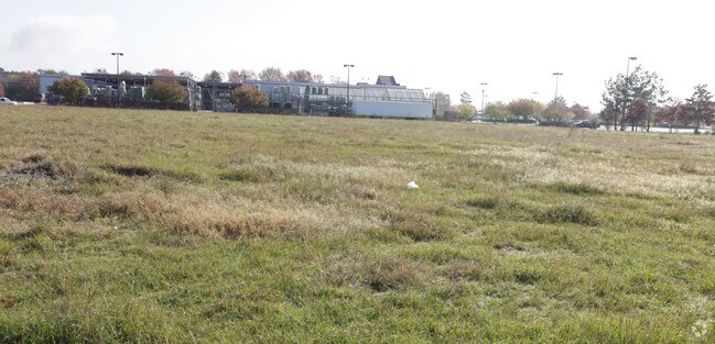

Property Detail
Churchill Dr
Sumter, SC
Z45-17 65.27 AC
202-00-01-013
SUMTER
Agriculturalland
South Carolina
AE The base floodplain where base flood elevations are provided. AE Zones are now used on new format FIRMs instead of A1-A30 Zones.
65.27 AC
2023
Orangeburg/Sumter
2025
Other Market Areas
000700
NEARBY LISTINGS FOR SALE OR LEASE
DEMOGRAPHICS near Churchill Dr
1 mile
3 mile
5 mile
2025 Total Population
2,737
21,340
50,687
2030 Population
2,719
21,124
50,407
Pop Growth 2025-2030
(0.66%)
(1.01%)
(0.55%)
Average Age
37
39
40
2025 Total Households
1,081
8,832
20,651
HH Growth 2025-2030
(0.56%)
(0.96%)
(0.50%)
Median Household Inc
$80,641
$66,505
$58,369
Avg Household Size
2.50
2.30
2.30
2025 Avg HH Vehicles
2.00
2.00
2.00
Median Home Value
$218,148
$240,968
$213,133
Median Year Built
1993
1989
1984
Nearby Places
Map Layers
Map Styles
 Street
 Aerial
Transit
 Traffic
 Biking
Places
Listings with unknown addresses are not visible on the map
- Restaurants
- Banks
- Shops
- Fitness
- Groceries
SALE & LEASE HISTORY
LISTING DATE
SALE/LEASE

Sep 24, 2016
For Sale
Nearby Properties
Address
Land Use
TOTAL SIZE
Lot Size
Zoning
Address
Land Use
TOTAL SIZE
Lot Size
Zoning
39,235 SF
707.49 AC
Address
Land Use
TOTAL SIZE
Lot Size
Zoning
172,485 SF
29.12 AC
COMM
Address
Land Use
TOTAL SIZE
Lot Size
Zoning
91,066 SF
17.76 AC
Address
Land Use
TOTAL SIZE
Lot Size
Zoning
69,350 SF
4.20 AC
B-1
Address
Land Use
TOTAL SIZE
Lot Size
Zoning
49,783 SF
23.75 AC
Address
Land Use
TOTAL SIZE
Lot Size
Zoning
4,583 SF
64.97 AC
R-15
Address
Land Use
TOTAL SIZE
Lot Size
Zoning
29,235 SF
21.18 AC
G-C
Address
Land Use
TOTAL SIZE
Lot Size
Zoning
121,695 SF
14.82 AC
COMM
Address
Land Use
TOTAL SIZE
Lot Size
Zoning
1 SF
63.73 AC
I-1
Address
Land Use
TOTAL SIZE
Lot Size
Zoning
129,767 SF
28 AC
Address
Land Use
TOTAL SIZE
Lot Size
Zoning
52,556 SF
21.66 AC
Address
Land Use
TOTAL SIZE
Lot Size
Zoning
1 SF
8.72 AC
MFR
Address
Land Use
TOTAL SIZE
Lot Size
Zoning
446.25 AC
Address
Land Use
TOTAL SIZE
Lot Size
Zoning
35,396 SF
6.44 AC
Address
Land Use
TOTAL SIZE
Lot Size
Zoning
15,666 SF
2.80 AC
COMM
Address
Land Use
TOTAL SIZE
Lot Size
Zoning
73,036 SF
10.59 AC
Address
Land Use
TOTAL SIZE
Lot Size
Zoning
61,285 SF
6.60 AC
Address
Land Use
TOTAL SIZE
Lot Size
Zoning
11.78 AC
Address
Land Use
TOTAL SIZE
Lot Size
Zoning
15,128 SF
5.86 AC
PO
Address
Land Use
TOTAL SIZE
Lot Size
Zoning
35,631 SF
5 AC
Address
Land Use
TOTAL SIZE
Lot Size
Zoning
29,920 SF
5 AC
R
Address
Land Use
TOTAL SIZE
Lot Size
Zoning
1 SF
38.67 AC
Address
Land Use
TOTAL SIZE
Lot Size
Zoning
12,096 SF
4.57 AC
GC
Address
Land Use
TOTAL SIZE
Lot Size
Zoning
4,717 SF
1.68 AC
GC
Address
Land Use
TOTAL SIZE
Lot Size
Zoning
Address
Land Use
TOTAL SIZE
Lot Size
Zoning
14,001 SF
2 AC
COMM
Address
Land Use
TOTAL SIZE
Lot Size
Zoning
799,374 SF
40.54 AC
Address
Land Use
TOTAL SIZE
Lot Size
Zoning
18,223 SF
6.10 AC
Address
Land Use
TOTAL SIZE
Lot Size
Zoning
62,500 SF
10.68 AC
R-15
Address
Land Use
TOTAL SIZE
Lot Size
Zoning
13,874 SF
3.60 AC
The World's #1 Commercial Real Estate Marketplace
Connect with us
© 2026 CoStar Group
The information above has been obtained from sources believed reliable. While we do not doubt its accuracy we have not verified it and make no guarantee, warranty or representation about it. It is your responsibility to independently confirm its accuracy and completeness. Any projections, opinions, assumptions, or estimates used are for example only and do not represent the current or future performance of the property. The value of this transaction to you depends on tax and other factors which should be evaluated by your tax, financial, and legal advisors. You and your advisors should conduct a careful, independent investigation of the property to determine to your satisfaction the suitability of the property for your needs.