Property Record
Allen Rd & Alexandria Dr, Mansfield, NJ 08022


NEARBY LISTINGS FOR SALE OR LEASE
-
-
View all Mansfield listings for sale on LoopNet.com
Property Detail
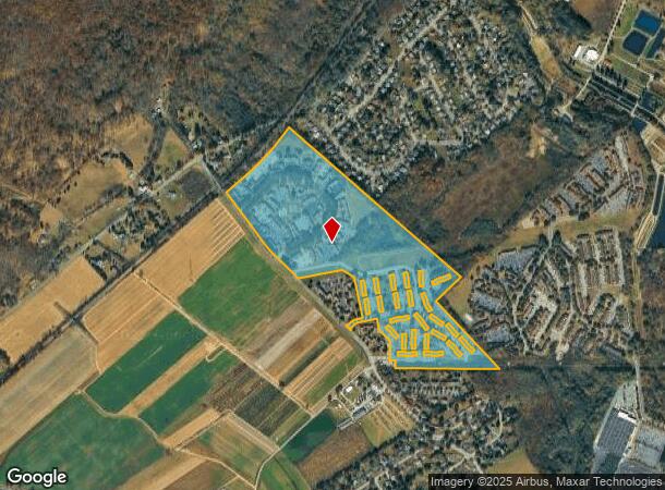
Allen Rd & Alexandria Dr
Allentown-Bethlehem-Easton, PA-NJ
WARREN VILLAGE CONDO BLDG 8 UNIT 3A-08E
16-01102-0000-00003-03
Warren
Apartment
New Jersey
X
3.3
34041C0253E
35.21 AC
2024
Warren County
2025
Northern New Jersey
701401
DEMOGRAPHICS near Allen Rd & Alexandria Dr
1 Mile
3 Mile
5 Mile
2024 Total Population
5,415
26,549
42,869
2029 Population
5,523
26,767
43,135
Pop Growth 2024-2029
+ 1.99%
+ 0.82%
+ 0.62%
Average Age
40
42
42
2024 Total Households
2,214
10,298
16,208
HH Growth 2024-2029
+ 2.21%
+ 1.01%
+ 0.80%
Median Household Inc
$76,136
$95,417
$110,662
Avg Household Size
2.30
2.50
2.60
2024 Avg HH Vehicles
2.00
2.00
2.00
Median Home Value
$358,968
$352,550
$390,482
Median Year Built
1979
1978
1979
Nearby Places
Map Layers
Map Styles
 Street
 Aerial
- Restaurants
- Banks
- Shops
- Fitness
- Groceries
PUBLIC TRANSPORTATION
COMMUTER RAIL
Hackettstown (Montclair-Boonton Line - NJ Transit Commuter Rail (NJ Transit), Morris & Essex Morristown Line - NJ Transit Commuter Rail (NJ Transit))
DRIVE
WALK
Distance
Hackettstown (Montclair-Boonton Line - NJ Transit Commuter Rail (NJ Transit), Morris & Essex Morristown Line - NJ Transit Commuter Rail (NJ Transit))
6 min
1.8 mi
Freight Ports
Maher Terminal
DRIVE
WALK
Distance
Maher Terminal
70 min
49.5 mi
Nearby Properties
Address
Land Use
TOTAL SIZE
Lot Size
Zoning
Address
Land Use
TOTAL SIZE
Lot Size
Zoning
521,918 SF
61.60 AC
LM
Address
Land Use
TOTAL SIZE
Lot Size
Zoning
16,916 SF
39.96 AC
R30
Address
Land Use
TOTAL SIZE
Lot Size
Zoning
Address
Land Use
TOTAL SIZE
Lot Size
Zoning
1,798 SF
46.98 AC
R-1
Address
Land Use
TOTAL SIZE
Lot Size
Zoning
122,877 SF
36.64 AC
B-2
Address
Land Use
TOTAL SIZE
Lot Size
Zoning
255,000 SF
39.57 AC
Address
Land Use
TOTAL SIZE
Lot Size
Zoning
187,660 SF
15 AC
HF
Address
Land Use
TOTAL SIZE
Lot Size
Zoning
133,042 SF
23.25 AC
HC
Address
Land Use
TOTAL SIZE
Lot Size
Zoning
5.02 AC
R-1
Address
Land Use
TOTAL SIZE
Lot Size
Zoning
29.81 AC
OR/I
Address
Land Use
TOTAL SIZE
Lot Size
Zoning
Address
Land Use
TOTAL SIZE
Lot Size
Zoning
12.60 AC
R1R2
Address
Land Use
TOTAL SIZE
Lot Size
Zoning
6.80 AC
C2
Address
Land Use
TOTAL SIZE
Lot Size
Zoning
156,298 SF
16.96 AC
Address
Land Use
TOTAL SIZE
Lot Size
Zoning
127,307 SF
26.84 AC
C2
Address
Land Use
TOTAL SIZE
Lot Size
Zoning
13.51 AC
RCH
Address
Land Use
TOTAL SIZE
Lot Size
Zoning
180,814 SF
15 AC
LM
Address
Land Use
TOTAL SIZE
Lot Size
Zoning
1,352 SF
166.25 AC
C
Address
Land Use
TOTAL SIZE
Lot Size
Zoning
49,430 SF
5 AC
HF
Address
Land Use
TOTAL SIZE
Lot Size
Zoning
116,386 SF
33.90 AC
R125
Address
Land Use
TOTAL SIZE
Lot Size
Zoning
15,760 SF
5.47 AC
APT
Address
Land Use
TOTAL SIZE
Lot Size
Zoning
2,046 SF
13.54 AC
C2
Address
Land Use
TOTAL SIZE
Lot Size
Zoning
1,908 SF
6.35 AC
HC
Address
Land Use
TOTAL SIZE
Lot Size
Zoning
14.40 AC
R-1
Address
Land Use
TOTAL SIZE
Lot Size
Zoning
10 AC
OR/I
Address
Land Use
TOTAL SIZE
Lot Size
Zoning
41,361 SF
8.86 AC
HF
Address
Land Use
TOTAL SIZE
Lot Size
Zoning
45,090 SF
4.78 AC
LM
Address
Land Use
TOTAL SIZE
Lot Size
Zoning
30.55 AC
OR/I
Address
Land Use
TOTAL SIZE
Lot Size
Zoning
69,380 SF
3.58 AC
HF
The World's #1 Commercial Real Estate Marketplace
Connect with us
© 2025 CoStar Group
The information above has been obtained from sources believed reliable. While we do not doubt its accuracy we have not verified it and make no guarantee, warranty or representation about it. It is your responsibility to independently confirm its accuracy and completeness. Any projections, opinions, assumptions, or estimates used are for example only and do not represent the current or future performance of the property. The value of this transaction to you depends on tax and other factors which should be evaluated by your tax, financial, and legal advisors. You and your advisors should conduct a careful, independent investigation of the property to determine to your satisfaction the suitability of the property for your needs.