Property Record
Almand Rd Nw, Conyers, GA 30012
Property Detail
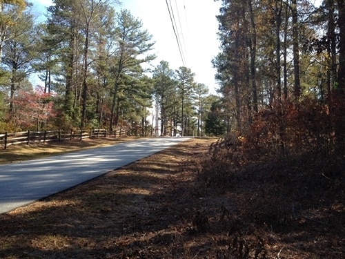
Almand Rd Nw
036-0-02-0013
LL289 LD16 ALMAND RD
Agriculturalland
ROCKDALE
AR
Georgia
AE The base floodplain where base flood elevations are provided. AE Zones are now used on new format FIRMs instead of A1-A30 Zones.
50.75 AC
2025
I-20 East/Conyers
2025
Atlanta
060101
Atlanta-Sandy Springs-Roswell, GA
NEARBY LISTINGS FOR SALE OR LEASE
DEMOGRAPHICS near Almand Rd Nw
1 mile
3 mile
5 mile
2025 Total Population
1,831
23,794
66,577
2030 Population
1,902
24,803
69,372
Pop Growth 2025-2030
+ 3.88%
+ 4.24%
+ 4.20%
Average Age
42
39
38
2025 Total Households
654
8,272
23,347
HH Growth 2025-2030
+ 4.13%
+ 4.46%
+ 4.35%
Median Household Inc
$83,639
$67,868
$70,901
Avg Household Size
2.70
2.70
2.70
2025 Avg HH Vehicles
2.00
2.00
2.00
Median Home Value
$266,447
$243,251
$288,144
Median Year Built
1980
1986
1990
Nearby Places
Map Layers
Map Styles
 Street
 Aerial
Layers
 Traffic
 Biking
Places
Listings with unknown addresses are not visible on the map
- Restaurants
- Banks
- Shops
- Fitness
- Groceries
PUBLIC TRANSPORTATION
AIRPORT
Hartsfield - Jackson Atlanta International
Drive
Walk
Distance
Hartsfield - Jackson Atlanta International
41 min
28.7 mi
Freight Ports
Georgia Ports - Savannah
Drive
Walk
Distance
Georgia Ports - Savannah
284 min
243.7 mi
Nearby Properties
Address
Land Use
TOTAL SIZE
Lot Size
Zoning
Address
Land Use
TOTAL SIZE
Lot Size
Zoning
458,448 SF
12.98 AC
OI
Address
Land Use
TOTAL SIZE
Lot Size
Zoning
28,024 SF
11.24 AC
R1
Address
Land Use
TOTAL SIZE
Lot Size
Zoning
3,256 SF
22.05 AC
RM
Address
Land Use
TOTAL SIZE
Lot Size
Zoning
55,928 SF
14.63 AC
BN
Address
Land Use
TOTAL SIZE
Lot Size
Zoning
3,066 SF
22.44 AC
R3/R1
Address
Land Use
TOTAL SIZE
Lot Size
Zoning
3,648 SF
26.50 AC
R3/R1
Address
Land Use
TOTAL SIZE
Lot Size
Zoning
417,378 SF
31.95 AC
M1
Address
Land Use
TOTAL SIZE
Lot Size
Zoning
3,888 SF
21.05 AC
RM/C
Address
Land Use
TOTAL SIZE
Lot Size
Zoning
17,800 SF
11.36 AC
RM/C
Address
Land Use
TOTAL SIZE
Lot Size
Zoning
159,014 SF
3.88 AC
RM
Address
Land Use
TOTAL SIZE
Lot Size
Zoning
28,012 SF
4.04 AC
OI
Address
Land Use
TOTAL SIZE
Lot Size
Zoning
713,040 SF
67.04 AC
M1
Address
Land Use
TOTAL SIZE
Lot Size
Zoning
65,460 SF
32.41 AC
M1
Address
Land Use
TOTAL SIZE
Lot Size
Zoning
196,560 SF
12.06 AC
MI
Address
Land Use
TOTAL SIZE
Lot Size
Zoning
14,575 SF
14.55 AC
OI
Address
Land Use
TOTAL SIZE
Lot Size
Zoning
1,968 SF
26.91 AC
M2
Address
Land Use
TOTAL SIZE
Lot Size
Zoning
105,600 SF
8.75 AC
M1
Address
Land Use
TOTAL SIZE
Lot Size
Zoning
145,159 SF
1.13 AC
BN
Address
Land Use
TOTAL SIZE
Lot Size
Zoning
100,400 SF
19.73 AC
MI
Address
Land Use
TOTAL SIZE
Lot Size
Zoning
3,057 SF
27.27 AC
RM
Address
Land Use
TOTAL SIZE
Lot Size
Zoning
29.96 AC
R1
Address
Land Use
TOTAL SIZE
Lot Size
Zoning
57,417 SF
11.25 AC
BN
Address
Land Use
TOTAL SIZE
Lot Size
Zoning
36,140 SF
2.74 AC
OI
Address
Land Use
TOTAL SIZE
Lot Size
Zoning
3,060 SF
13.42 AC
M1
Address
Land Use
TOTAL SIZE
Lot Size
Zoning
20,942 SF
22.78 AC
BG
Address
Land Use
TOTAL SIZE
Lot Size
Zoning
34,370 SF
5.04 AC
OI
Address
Land Use
TOTAL SIZE
Lot Size
Zoning
45,482 SF
0.98 AC
RG
Address
Land Use
TOTAL SIZE
Lot Size
Zoning
69,088 SF
9.37 AC
BG
Address
Land Use
TOTAL SIZE
Lot Size
Zoning
16,100 SF
5.10 AC
BG
Address
Land Use
TOTAL SIZE
Lot Size
Zoning
273,459 SF
12.12 AC
M1
The World's #1 Commercial Real Estate Marketplace
Connect with us
© 2026 CoStar Group
The information above has been obtained from sources believed reliable. While we do not doubt its accuracy we have not verified it and make no guarantee, warranty or representation about it. It is your responsibility to independently confirm its accuracy and completeness. Any projections, opinions, assumptions, or estimates used are for example only and do not represent the current or future performance of the property. The value of this transaction to you depends on tax and other factors which should be evaluated by your tax, financial, and legal advisors. You and your advisors should conduct a careful, independent investigation of the property to determine to your satisfaction the suitability of the property for your needs.