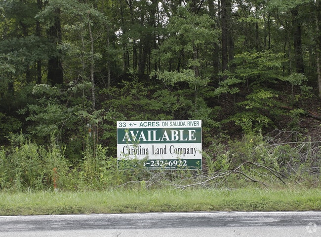
Property Record
Anderson Rd, Greenville, SC 29611
NEARBY LISTINGS FOR SALE OR LEASE
Property Detail
Anderson Rd
Greenville-Anderson-Mauldin, SC
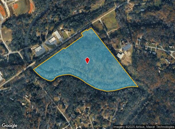
MAP 0254.00
0254.00-03-001.00
Greenville
Residentialacreage
South Carolina
AE
001.00
45007C0062E
35.28 AC
2024
West Side Greenville
2024
Greenville/Spartanburg
003601
DEMOGRAPHICS near Anderson Rd
1 Mile
3 Mile
5 Mile
2024 Total Population
2,407
28,892
99,985
2029 Population
2,614
31,435
109,765
Pop Growth 2024-2029
+ 8.60%
+ 8.80%
+ 9.78%
Average Age
38
38
39
2024 Total Households
908
10,967
40,007
HH Growth 2024-2029
+ 8.70%
+ 8.87%
+ 10.03%
Median Household Inc
$42,724
$49,889
$52,537
Avg Household Size
2.60
2.60
2.40
2024 Avg HH Vehicles
2.00
2.00
2.00
Median Home Value
$210,677
$170,445
$203,392
Median Year Built
1984
1981
1984
Nearby Places
Map Layers
Map Styles
 Street
 Aerial
- Restaurants
- Banks
- Shops
- Fitness
- Groceries
PUBLIC TRANSPORTATION
COMMUTER RAIL
Greenville Amtrak Station (Crescent - Amtrak)
DRIVE
WALK
Distance
Greenville Amtrak Station (Crescent - Amtrak)
13 min
6.2 mi
AIRPORT
Greenville Spartanburg International
DRIVE
WALK
Distance
Greenville Spartanburg International
30 min
19.0 mi
Freight Ports
North Charleston Terminal
DRIVE
WALK
Distance
North Charleston Terminal
235 min
207.4 mi
Nearby Properties
Address
Land Use
TOTAL SIZE
Lot Size
Zoning
Address
Land Use
TOTAL SIZE
Lot Size
Zoning
5.60 AC
RM
Address
Land Use
TOTAL SIZE
Lot Size
Zoning
16.09 AC
S1
Address
Land Use
TOTAL SIZE
Lot Size
Zoning
0.45 AC
OD
Address
Land Use
TOTAL SIZE
Lot Size
Zoning
14 AC
S1
Address
Land Use
TOTAL SIZE
Lot Size
Zoning
4.70 AC
RM
Address
Land Use
TOTAL SIZE
Lot Size
Zoning
2.38 AC
C2,OD
Address
Land Use
TOTAL SIZE
Lot Size
Zoning
14,544 SF
22.61 AC
Address
Land Use
TOTAL SIZE
Lot Size
Zoning
8.80 AC
I1
Address
Land Use
TOTAL SIZE
Lot Size
Zoning
14 AC
I1
Address
Land Use
TOTAL SIZE
Lot Size
Zoning
152.65 AC
I1
Address
Land Use
TOTAL SIZE
Lot Size
Zoning
45.18 AC
I1
Address
Land Use
TOTAL SIZE
Lot Size
Zoning
20.98 AC
OD
Address
Land Use
TOTAL SIZE
Lot Size
Zoning
3.14 AC
S1
Address
Land Use
TOTAL SIZE
Lot Size
Zoning
3.20 AC
S1
Address
Land Use
TOTAL SIZE
Lot Size
Zoning
86.32 AC
I1,RS
Address
Land Use
TOTAL SIZE
Lot Size
Zoning
2.34 AC
I1
Address
Land Use
TOTAL SIZE
Lot Size
Zoning
1,346 SF
4.51 AC
R75
Address
Land Use
TOTAL SIZE
Lot Size
Zoning
2.85 AC
C2
Address
Land Use
TOTAL SIZE
Lot Size
Zoning
3.80 AC
S1
Address
Land Use
TOTAL SIZE
Lot Size
Zoning
683 SF
16.53 AC
Address
Land Use
TOTAL SIZE
Lot Size
Zoning
4,778 SF
10.45 AC
Address
Land Use
TOTAL SIZE
Lot Size
Zoning
1.99 AC
S1
Address
Land Use
TOTAL SIZE
Lot Size
Zoning
0.16 AC
C2
Address
Land Use
TOTAL SIZE
Lot Size
Zoning
0.59 AC
C2
Address
Land Use
TOTAL SIZE
Lot Size
Zoning
32.02 AC
RMA
Address
Land Use
TOTAL SIZE
Lot Size
Zoning
1.58 AC
C2
Address
Land Use
TOTAL SIZE
Lot Size
Zoning
576 SF
9.88 AC
RMA
Address
Land Use
TOTAL SIZE
Lot Size
Zoning
30.96 AC
RM
The World's #1 Commercial Real Estate Marketplace
Connect with us
© 2025 CoStar Group
The information above has been obtained from sources believed reliable. While we do not doubt its accuracy we have not verified it and make no guarantee, warranty or representation about it. It is your responsibility to independently confirm its accuracy and completeness. Any projections, opinions, assumptions, or estimates used are for example only and do not represent the current or future performance of the property. The value of this transaction to you depends on tax and other factors which should be evaluated by your tax, financial, and legal advisors. You and your advisors should conduct a careful, independent investigation of the property to determine to your satisfaction the suitability of the property for your needs.