Property Record
Andrews Rd, Opelika, AL 36804
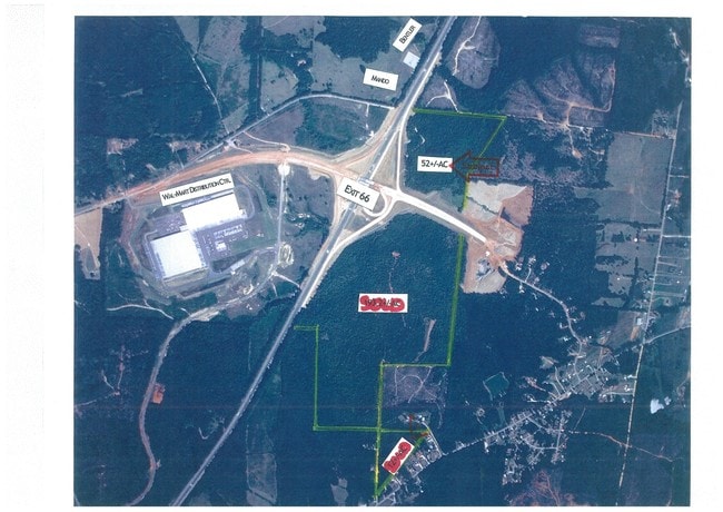
NEARBY LISTINGS FOR SALE OR LEASE
Property Detail
Andrews Rd
03-07-26-0-000-003.001
PART SEC 26 T20N R27E: COM NE COR; W 1160'S TO BEG; SW 400'S ; S 730'S TO ROW; NW 1275'S ON ROW TO I-85; NE 645'S ON E ROW I-
Timberlandforesttreesagricultural
Lee
A
Alabama
01081C0085G
23.80 AC
2025
Lee County
2025
Columbus GA
041702
Auburn-Opelika, AL
DEMOGRAPHICS near Andrews Rd
1 Mile
3 Mile
5 Mile
2024 Total Population
173
2,850
13,393
2029 Population
190
3,131
14,648
Pop Growth 2024-2029
+ 9.83%
+ 9.86%
+ 9.37%
Average Age
40
40
40
2024 Total Households
65
1,073
5,254
HH Growth 2024-2029
+ 10.77%
+ 9.79%
+ 9.27%
Median Household Inc
$48,333
$58,548
$61,769
Avg Household Size
2.50
2.60
2.50
2024 Avg HH Vehicles
2.00
2.00
2.00
Median Home Value
$176,190
$173,639
$180,599
Median Year Built
1996
1996
1994
Nearby Places
Map Layers
Map Styles
 Street
 Aerial
- Restaurants
- Banks
- Shops
- Fitness
- Groceries
PUBLIC TRANSPORTATION
AIRPORT
Columbus
DRIVE
WALK
Distance
Columbus
46 min
34.7 mi
Freight Ports
Port of Panama City
DRIVE
WALK
Distance
Port of Panama City
264 min
202.0 mi
Nearby Properties
Address
Land Use
TOTAL SIZE
Lot Size
Zoning
Address
Land Use
TOTAL SIZE
Lot Size
Zoning
15,464 SF
105.62 AC
Address
Land Use
TOTAL SIZE
Lot Size
Zoning
485,568 SF
104.20 AC
Address
Land Use
TOTAL SIZE
Lot Size
Zoning
401,660 SF
Address
Land Use
TOTAL SIZE
Lot Size
Zoning
271,921 SF
50 AC
Address
Land Use
TOTAL SIZE
Lot Size
Zoning
498,160 SF
29.90 AC
Address
Land Use
TOTAL SIZE
Lot Size
Zoning
28,003 SF
41.72 AC
Address
Land Use
TOTAL SIZE
Lot Size
Zoning
67,970 SF
20 AC
Address
Land Use
TOTAL SIZE
Lot Size
Zoning
26,018 SF
31.04 AC
Address
Land Use
TOTAL SIZE
Lot Size
Zoning
162,553 SF
50 AC
Address
Land Use
TOTAL SIZE
Lot Size
Zoning
5,457 SF
26.95 AC
Address
Land Use
TOTAL SIZE
Lot Size
Zoning
173,736 SF
31.39 AC
Address
Land Use
TOTAL SIZE
Lot Size
Zoning
105,000 SF
30 AC
Address
Land Use
TOTAL SIZE
Lot Size
Zoning
12,000 SF
20 AC
Address
Land Use
TOTAL SIZE
Lot Size
Zoning
5,260 SF
9.60 AC
Address
Land Use
TOTAL SIZE
Lot Size
Zoning
121,350 SF
Address
Land Use
TOTAL SIZE
Lot Size
Zoning
142,391 SF
38.43 AC
Address
Land Use
TOTAL SIZE
Lot Size
Zoning
6,802 SF
17 AC
Address
Land Use
TOTAL SIZE
Lot Size
Zoning
34,125 SF
10 AC
Address
Land Use
TOTAL SIZE
Lot Size
Zoning
80,500 SF
Address
Land Use
TOTAL SIZE
Lot Size
Zoning
60,150 SF
Address
Land Use
TOTAL SIZE
Lot Size
Zoning
304.30 AC
Address
Land Use
TOTAL SIZE
Lot Size
Zoning
31,530 SF
Address
Land Use
TOTAL SIZE
Lot Size
Zoning
503 AC
Address
Land Use
TOTAL SIZE
Lot Size
Zoning
110.29 AC
Address
Land Use
TOTAL SIZE
Lot Size
Zoning
795 SF
Address
Land Use
TOTAL SIZE
Lot Size
Zoning
4,770 SF
3.21 AC
Address
Land Use
TOTAL SIZE
Lot Size
Zoning
2,400 SF
3.80 AC
Address
Land Use
TOTAL SIZE
Lot Size
Zoning
4,720 SF
3.56 AC
Address
Land Use
TOTAL SIZE
Lot Size
Zoning
40.70 AC
Address
Land Use
TOTAL SIZE
Lot Size
Zoning
0.76 AC
The World's #1 Commercial Real Estate Marketplace
Connect with us
© 2026 CoStar Group
The information above has been obtained from sources believed reliable. While we do not doubt its accuracy we have not verified it and make no guarantee, warranty or representation about it. It is your responsibility to independently confirm its accuracy and completeness. Any projections, opinions, assumptions, or estimates used are for example only and do not represent the current or future performance of the property. The value of this transaction to you depends on tax and other factors which should be evaluated by your tax, financial, and legal advisors. You and your advisors should conduct a careful, independent investigation of the property to determine to your satisfaction the suitability of the property for your needs.