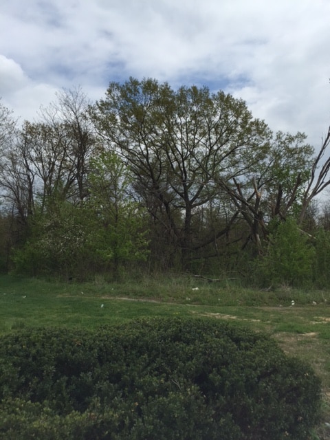
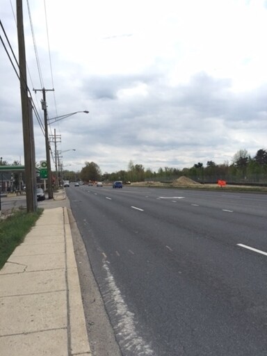
Property Record
Annapolis Rd, Odenton, MD 21113

Property Detail
Annapolis Rd
04-000-04160404
.211 ACRE ANNAPOLIS RD ODENTON
Commercialacreage
ANNE ARUNDEL
O-NOD
Maryland
B and X Area of moderate flood hazard, usually the area between the limits of the 100-year and 500-year floods.
0.19 AC
2024
BWI/Anne Arundel
2025
Baltimore
740900
Baltimore-Columbia-Towson, MD
3,744 SF
NEARBY LISTINGS FOR SALE OR LEASE
DEMOGRAPHICS near Annapolis Rd
1 mile
3 mile
5 mile
2025 Total Population
11,925
74,078
136,459
2030 Population
12,002
75,022
138,279
Pop Growth 2025-2030
+ 0.65%
+ 1.27%
+ 1.33%
Average Age
34
36
38
2025 Total Households
4,569
26,988
50,536
HH Growth 2025-2030
+ 0.59%
+ 1.24%
+ 1.28%
Median Household Inc
$100,626
$116,757
$119,418
Avg Household Size
2.50
2.60
2.60
2025 Avg HH Vehicles
2.00
2.00
2.00
Median Home Value
$362,992
$439,233
$453,077
Median Year Built
1998
1995
1995
Nearby Places
Map Layers
Map Styles
 Street
 Aerial
Transit
 Traffic
 Biking
Places
Listings with unknown addresses are not visible on the map
- Restaurants
- Banks
- Shops
- Fitness
- Groceries
PUBLIC TRANSPORTATION
COMMUTER RAIL
Odenton (Penn Line - Maryland Area Regional Commuter Trains (The MARC))
Drive
Walk
Distance
Odenton (Penn Line - Maryland Area Regional Commuter Trains (The MARC))
7 min
2.7 mi
Jessup (Camden Line - Maryland Area Regional Commuter Trains (The MARC))
Drive
Walk
Distance
Jessup (Camden Line - Maryland Area Regional Commuter Trains (The MARC))
10 min
4.7 mi
AIRPORT
Baltimore/Washington International Thurgood Marshall
Drive
Walk
Distance
Baltimore/Washington International Thurgood Marshall
17 min
8.8 mi
Ronald Reagan Washington Ntl
Drive
Walk
Distance
Ronald Reagan Washington Ntl
51 min
31.9 mi
Freight Ports
Port of Baltimore
Drive
Walk
Distance
Port of Baltimore
28 min
16.8 mi
SALE & LEASE HISTORY
LISTING DATE
SALE/LEASE

Sep 24, 2016
For Sale
Mar 03, 2017
For Sale
Nearby Properties
Address
Land Use
TOTAL SIZE
Lot Size
Zoning
Address
Land Use
TOTAL SIZE
Lot Size
Zoning
8,192 SF
13,053.34 AC
R1
Address
Land Use
TOTAL SIZE
Lot Size
Zoning
472,057 SF
15.16 AC
OCOR
Address
Land Use
TOTAL SIZE
Lot Size
Zoning
155,020 SF
19.86 AC
R22
Address
Land Use
TOTAL SIZE
Lot Size
Zoning
41.07 AC
R15
Address
Land Use
TOTAL SIZE
Lot Size
Zoning
432,928 SF
6.33 AC
O-COR
Address
Land Use
TOTAL SIZE
Lot Size
Zoning
376,918 SF
8.55 AC
W1
Address
Land Use
TOTAL SIZE
Lot Size
Zoning
88,272 SF
3.43 AC
OTRA
Address
Land Use
TOTAL SIZE
Lot Size
Zoning
279,318 SF
14.38 AC
R22
Address
Land Use
TOTAL SIZE
Lot Size
Zoning
14.65 AC
R15
Address
Land Use
TOTAL SIZE
Lot Size
Zoning
255,561 SF
15.93 AC
R22
Address
Land Use
TOTAL SIZE
Lot Size
Zoning
499,471 SF
10.10 AC
O-COR
Address
Land Use
TOTAL SIZE
Lot Size
Zoning
311,870 SF
10.03 AC
Address
Land Use
TOTAL SIZE
Lot Size
Zoning
296,453 SF
16.23 AC
R15
Address
Land Use
TOTAL SIZE
Lot Size
Zoning
342,024 SF
30.72 AC
W1B
Address
Land Use
TOTAL SIZE
Lot Size
Zoning
230,204 SF
6.74 AC
O COR
Address
Land Use
TOTAL SIZE
Lot Size
Zoning
126,960 SF
13.72 AC
MXDR
Address
Land Use
TOTAL SIZE
Lot Size
Zoning
162,729 SF
10.18 AC
W1
Address
Land Use
TOTAL SIZE
Lot Size
Zoning
135,000 SF
11.69 AC
W1
Address
Land Use
TOTAL SIZE
Lot Size
Zoning
130,200 SF
6.60 AC
W1
Address
Land Use
TOTAL SIZE
Lot Size
Zoning
130,200 SF
7.05 AC
W-1
Address
Land Use
TOTAL SIZE
Lot Size
Zoning
328,950 SF
8.65 AC
W1
Address
Land Use
TOTAL SIZE
Lot Size
Zoning
265,645 SF
12.79 AC
R15
Address
Land Use
TOTAL SIZE
Lot Size
Zoning
120,160 SF
5.61 AC
W1
Address
Land Use
TOTAL SIZE
Lot Size
Zoning
448,300 SF
9.80 AC
W-1
Address
Land Use
TOTAL SIZE
Lot Size
Zoning
24.49 AC
C3
Address
Land Use
TOTAL SIZE
Lot Size
Zoning
169,100 SF
22.85 AC
C3
Address
Land Use
TOTAL SIZE
Lot Size
Zoning
473,214 SF
6.78 AC
W1
Address
Land Use
TOTAL SIZE
Lot Size
Zoning
185,440 SF
3.53 AC
W2
Address
Land Use
TOTAL SIZE
Lot Size
Zoning
155,269 SF
13.27 AC
O-EOD
Address
Land Use
TOTAL SIZE
Lot Size
Zoning
342,464 SF
22.95 AC
O-IND
The World's #1 Commercial Real Estate Marketplace
Connect with us
© 2026 CoStar Group
The information above has been obtained from sources believed reliable. While we do not doubt its accuracy we have not verified it and make no guarantee, warranty or representation about it. It is your responsibility to independently confirm its accuracy and completeness. Any projections, opinions, assumptions, or estimates used are for example only and do not represent the current or future performance of the property. The value of this transaction to you depends on tax and other factors which should be evaluated by your tax, financial, and legal advisors. You and your advisors should conduct a careful, independent investigation of the property to determine to your satisfaction the suitability of the property for your needs.