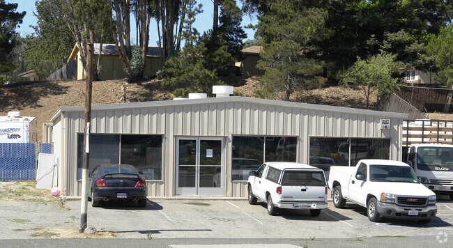
Property Record
Appian Way, El Sobrante, CA 94803


NEARBY LISTINGS FOR SALE OR LEASE
Property Detail
Appian Way
Oakland-Fremont-Berkeley, CA
San Pablo Rancho
426-261-056-3
TRACT 4767 POR LOT 1
Storebuilding
Contra Costa
X
California
06013C0231G
1
2025
0.16 AC
2025
Richmond/San Pablo
360200
East Bay/Oakland
2,400 SF
DEMOGRAPHICS near Appian Way
1 mile
3 mile
5 mile
2024 Total Population
15,206
111,823
240,228
2029 Population
15,097
110,654
237,856
Pop Growth 2024-2029
(0.72%)
(1.05%)
(0.99%)
Average Age
43
42
40
2024 Total Households
5,333
38,750
79,331
HH Growth 2024-2029
(0.73%)
(1.12%)
(1.04%)
Median Household Inc
$95,424
$97,307
$90,242
Avg Household Size
2.80
2.80
2.90
2024 Avg HH Vehicles
2.00
2.00
2.00
Median Home Value
$722,317
$712,745
$721,254
Median Year Built
1967
1972
1966
Nearby Places
Map Layers
Map Styles
 Street
 Aerial
Transit
 Traffic
 Biking
Places
Listings with unknown addresses are not visible on the map
- Restaurants
- Banks
- Shops
- Fitness
- Groceries
PUBLIC TRANSPORTATION
COMMUTER RAIL
Drive
Walk
Distance
13 min
6.2 mi
AIRPORT
Metro Oakland International
Drive
Walk
Distance
Metro Oakland International
36 min
24.8 mi
San Francisco International
Drive
Walk
Distance
San Francisco International
48 min
32.4 mi
Freight Ports
Port of Richmond
Drive
Walk
Distance
Port of Richmond
21 min
11.9 mi
Nearby Properties
Address
Land Use
TOTAL SIZE
Lot Size
Zoning
Address
Land Use
TOTAL SIZE
Lot Size
Zoning
892,224 SF
46.87 AC
Address
Land Use
TOTAL SIZE
Lot Size
Zoning
268,936 SF
2.20 AC
Address
Land Use
TOTAL SIZE
Lot Size
Zoning
252,714 SF
14.68 AC
C
Address
Land Use
TOTAL SIZE
Lot Size
Zoning
459,003 SF
21.30 AC
Address
Land Use
TOTAL SIZE
Lot Size
Zoning
179,961 SF
1.05 AC
Address
Land Use
TOTAL SIZE
Lot Size
Zoning
267,304 SF
1.87 AC
Address
Land Use
TOTAL SIZE
Lot Size
Zoning
245,680 SF
18.89 AC
Address
Land Use
TOTAL SIZE
Lot Size
Zoning
70,250 SF
9.55 AC
Address
Land Use
TOTAL SIZE
Lot Size
Zoning
190,471 SF
11.32 AC
Address
Land Use
TOTAL SIZE
Lot Size
Zoning
171,052 SF
12.06 AC
M3
Address
Land Use
TOTAL SIZE
Lot Size
Zoning
135,904 SF
7.12 AC
Address
Land Use
TOTAL SIZE
Lot Size
Zoning
14,722 SF
5.69 AC
Address
Land Use
TOTAL SIZE
Lot Size
Zoning
41,400 SF
6.32 AC
Address
Land Use
TOTAL SIZE
Lot Size
Zoning
177,724 SF
63.32 AC
M-2
Address
Land Use
TOTAL SIZE
Lot Size
Zoning
118,658 SF
8.57 AC
Address
Land Use
TOTAL SIZE
Lot Size
Zoning
178,277 SF
58.72 AC
Address
Land Use
TOTAL SIZE
Lot Size
Zoning
61,875 SF
3.62 AC
Address
Land Use
TOTAL SIZE
Lot Size
Zoning
60,196 SF
13.44 AC
Address
Land Use
TOTAL SIZE
Lot Size
Zoning
85,225 SF
8.34 AC
Address
Land Use
TOTAL SIZE
Lot Size
Zoning
61,403 SF
8.38 AC
Address
Land Use
TOTAL SIZE
Lot Size
Zoning
72,927 SF
3.47 AC
Address
Land Use
TOTAL SIZE
Lot Size
Zoning
6,440 SF
8.14 AC
Address
Land Use
TOTAL SIZE
Lot Size
Zoning
17,660 SF
1.99 AC
Address
Land Use
TOTAL SIZE
Lot Size
Zoning
53,000 SF
3.74 AC
Address
Land Use
TOTAL SIZE
Lot Size
Zoning
123,704 SF
6.72 AC
Address
Land Use
TOTAL SIZE
Lot Size
Zoning
12,707 SF
4.08 AC
Address
Land Use
TOTAL SIZE
Lot Size
Zoning
76,455 SF
9.61 AC
Address
Land Use
TOTAL SIZE
Lot Size
Zoning
81,296 SF
6.94 AC
Address
Land Use
TOTAL SIZE
Lot Size
Zoning
11,919 SF
52.56 AC
Address
Land Use
TOTAL SIZE
Lot Size
Zoning
124,080 SF
9.78 AC
The World's #1 Commercial Real Estate Marketplace
Connect with us
© 2026 CoStar Group
The information above has been obtained from sources believed reliable. While we do not doubt its accuracy we have not verified it and make no guarantee, warranty or representation about it. It is your responsibility to independently confirm its accuracy and completeness. Any projections, opinions, assumptions, or estimates used are for example only and do not represent the current or future performance of the property. The value of this transaction to you depends on tax and other factors which should be evaluated by your tax, financial, and legal advisors. You and your advisors should conduct a careful, independent investigation of the property to determine to your satisfaction the suitability of the property for your needs.