Property Record
Applewhite Rd, San Antonio, TX 78264
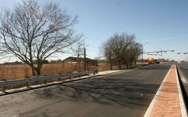

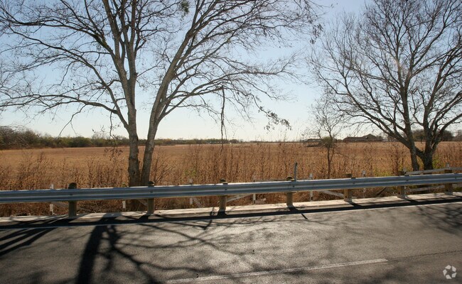

Property Detail
Applewhite Rd
San Antonio-New Braunfels, TX
CB 4013 TR-D6 ABS 577
04013-000-0047
BEXAR
Privatepreserveopenspacevacantlandforestlandconservation
Texas
A Areas with a 1% annual chance of flooding and a 26% chance of flooding over the life of a 30-year mortgage.
47
2024
500.22 AC
2025
South
152100
San Antonio
NEARBY LISTINGS FOR SALE OR LEASE
-
-
View all San Antonio listings for sale on LoopNet.com
DEMOGRAPHICS near Applewhite Rd
1 mile
3 mile
5 mile
2025 Total Population
402
4,427
21,434
2030 Population
430
4,713
22,900
Pop Growth 2025-2030
+ 6.97%
+ 6.46%
+ 6.84%
Average Age
38
38
37
2025 Total Households
121
1,330
6,452
HH Growth 2025-2030
+ 7.44%
+ 6.62%
+ 6.91%
Median Household Inc
$73,635
$67,220
$58,685
Avg Household Size
3.20
3.20
3.20
2025 Avg HH Vehicles
3.00
3.00
2.00
Median Home Value
$205,556
$173,505
$149,930
Median Year Built
1995
1994
1995
Nearby Places
Map Layers
Map Styles
 Street
 Aerial
Layers
 Traffic
 Biking
Places
Listings with unknown addresses are not visible on the map
- Restaurants
- Banks
- Shops
- Fitness
- Groceries
PUBLIC TRANSPORTATION
AIRPORT
San Antonio International
Drive
Walk
Distance
San Antonio International
50 min
28.7 mi
Freight Ports
Port of Corpus Christi
Drive
Walk
Distance
Port of Corpus Christi
145 min
128.3 mi
Nearby Properties
Address
Land Use
TOTAL SIZE
Lot Size
Zoning
Address
Land Use
TOTAL SIZE
Lot Size
Zoning
678.76 AC
Address
Land Use
TOTAL SIZE
Lot Size
Zoning
486.11 AC
Address
Land Use
TOTAL SIZE
Lot Size
Zoning
43,512 SF
29.75 AC
Address
Land Use
TOTAL SIZE
Lot Size
Zoning
400 SF
361.41 AC
Address
Land Use
TOTAL SIZE
Lot Size
Zoning
363.64 AC
Address
Land Use
TOTAL SIZE
Lot Size
Zoning
488 SF
329.28 AC
Address
Land Use
TOTAL SIZE
Lot Size
Zoning
246.25 AC
Address
Land Use
TOTAL SIZE
Lot Size
Zoning
271.41 AC
Address
Land Use
TOTAL SIZE
Lot Size
Zoning
99.64 AC
Address
Land Use
TOTAL SIZE
Lot Size
Zoning
99.64 AC
Address
Land Use
TOTAL SIZE
Lot Size
Zoning
224.15 AC
Address
Land Use
TOTAL SIZE
Lot Size
Zoning
143.57 AC
Address
Land Use
TOTAL SIZE
Lot Size
Zoning
680 SF
10.78 AC
Address
Land Use
TOTAL SIZE
Lot Size
Zoning
115.75 AC
Address
Land Use
TOTAL SIZE
Lot Size
Zoning
184.98 AC
Address
Land Use
TOTAL SIZE
Lot Size
Zoning
720 SF
48.47 AC
Address
Land Use
TOTAL SIZE
Lot Size
Zoning
137.65 AC
Address
Land Use
TOTAL SIZE
Lot Size
Zoning
146.20 AC
Address
Land Use
TOTAL SIZE
Lot Size
Zoning
Address
Land Use
TOTAL SIZE
Lot Size
Zoning
151.60 AC
Address
Land Use
TOTAL SIZE
Lot Size
Zoning
3,280 SF
186.35 AC
Address
Land Use
TOTAL SIZE
Lot Size
Zoning
1,696 SF
149.02 AC
Address
Land Use
TOTAL SIZE
Lot Size
Zoning
93.70 AC
Address
Land Use
TOTAL SIZE
Lot Size
Zoning
95.13 AC
Address
Land Use
TOTAL SIZE
Lot Size
Zoning
288.82 AC
Address
Land Use
TOTAL SIZE
Lot Size
Zoning
19,390 SF
2 AC
Address
Land Use
TOTAL SIZE
Lot Size
Zoning
27.93 AC
Address
Land Use
TOTAL SIZE
Lot Size
Zoning
26.54 AC
The World's #1 Commercial Real Estate Marketplace
Connect with us
© 2026 CoStar Group
The information above has been obtained from sources believed reliable. While we do not doubt its accuracy we have not verified it and make no guarantee, warranty or representation about it. It is your responsibility to independently confirm its accuracy and completeness. Any projections, opinions, assumptions, or estimates used are for example only and do not represent the current or future performance of the property. The value of this transaction to you depends on tax and other factors which should be evaluated by your tax, financial, and legal advisors. You and your advisors should conduct a careful, independent investigation of the property to determine to your satisfaction the suitability of the property for your needs.