Property Record
0 Armsdale Rd, Jacksonville, FL 32218
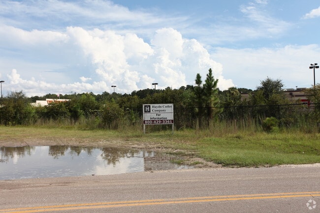

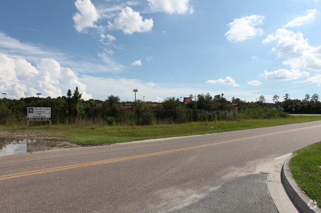
This Property Is For Sale
NEARBY LISTINGS FOR SALE OR LEASE
Property Detail
0 Armsdale Rd
Jacksonville, FL
Section Land
019964-0000
04-1S-26E 1.78 PT NW1/4 OF NE1/4 RECD O/R 18607-2002
Commercialacreage
Duval
X
Florida
12031C0179H
1.78 AC
2024
Northeast Jacksonville
2025
Jacksonville (Florida)
010308
DEMOGRAPHICS near 0 Armsdale Rd
1 Mile
3 Mile
5 Mile
2024 Total Population
3,915
36,058
85,390
2029 Population
4,180
37,983
90,314
Pop Growth 2024-2029
+ 6.77%
+ 5.34%
+ 5.77%
Average Age
37
38
39
2024 Total Households
1,371
13,400
32,753
HH Growth 2024-2029
+ 6.86%
+ 5.39%
+ 5.95%
Median Household Inc
$59,122
$55,035
$50,853
Avg Household Size
2.70
2.60
2.50
2024 Avg HH Vehicles
2.00
2.00
2.00
Median Home Value
$225,781
$194,517
$174,441
Median Year Built
2002
1991
1982
Nearby Places
Map Layers
Map Styles
 Street
 Aerial
- Restaurants
- Banks
- Shops
- Fitness
- Groceries
PUBLIC TRANSPORTATION
COMMUTER RAIL
Jacksonville (Silver Meteor - Amtrak, Silver Star - Amtrak)
DRIVE
WALK
Distance
Jacksonville (Silver Meteor - Amtrak, Silver Star - Amtrak)
13 min
8.4 mi
AIRPORT
Jacksonville International
DRIVE
WALK
Distance
Jacksonville International
13 min
6.4 mi
Freight Ports
Jacksonville Port
DRIVE
WALK
Distance
Jacksonville Port
21 min
14.2 mi
Nearby Properties
Address
Land Use
TOTAL SIZE
Lot Size
Zoning
Address
Land Use
TOTAL SIZE
Lot Size
Zoning
2,547,783 SF
5,204.78 AC
PUD
Address
Land Use
TOTAL SIZE
Lot Size
Zoning
877,030 SF
135.59 AC
IBP
Address
Land Use
TOTAL SIZE
Lot Size
Zoning
658,743 SF
36.71 AC
PUD
Address
Land Use
TOTAL SIZE
Lot Size
Zoning
556,924 SF
29.11 AC
PUD
Address
Land Use
TOTAL SIZE
Lot Size
Zoning
395,655 SF
21.86 AC
PUD
Address
Land Use
TOTAL SIZE
Lot Size
Zoning
214,742 SF
20.13 AC
PUD
Address
Land Use
TOTAL SIZE
Lot Size
Zoning
284,023 SF
25.30 AC
RMD-C
Address
Land Use
TOTAL SIZE
Lot Size
Zoning
287,410 SF
43.31 AC
RMD-C
Address
Land Use
TOTAL SIZE
Lot Size
Zoning
321,938 SF
29.46 AC
CCG-1
Address
Land Use
TOTAL SIZE
Lot Size
Zoning
210,520 SF
34.87 AC
PUD
Address
Land Use
TOTAL SIZE
Lot Size
Zoning
336,566 SF
25.63 AC
PUD
Address
Land Use
TOTAL SIZE
Lot Size
Zoning
283,689 SF
21.28 AC
RLD-60
Address
Land Use
TOTAL SIZE
Lot Size
Zoning
149,367 SF
810.98 AC
PUD
Address
Land Use
TOTAL SIZE
Lot Size
Zoning
744.81 AC
PUD
Address
Land Use
TOTAL SIZE
Lot Size
Zoning
254,693 SF
40.76 AC
RMD-D
Address
Land Use
TOTAL SIZE
Lot Size
Zoning
225,829 SF
140.47 AC
PBF-1
Address
Land Use
TOTAL SIZE
Lot Size
Zoning
39,251 SF
55.24 AC
PUD
Address
Land Use
TOTAL SIZE
Lot Size
Zoning
229,225 SF
15.98 AC
PUD
Address
Land Use
TOTAL SIZE
Lot Size
Zoning
226,596 SF
13.23 AC
PUD
Address
Land Use
TOTAL SIZE
Lot Size
Zoning
240,692 SF
30.32 AC
CCG-1
Address
Land Use
TOTAL SIZE
Lot Size
Zoning
157.33 AC
PUD
Address
Land Use
TOTAL SIZE
Lot Size
Zoning
57,495 SF
1.95 AC
CCG-1
Address
Land Use
TOTAL SIZE
Lot Size
Zoning
104,322 SF
5.20 AC
PBF-3
Address
Land Use
TOTAL SIZE
Lot Size
Zoning
126,930 SF
20.47 AC
PUD
Address
Land Use
TOTAL SIZE
Lot Size
Zoning
116,632 SF
10.07 AC
RMD-C
Address
Land Use
TOTAL SIZE
Lot Size
Zoning
77.99 AC
IBP
Address
Land Use
TOTAL SIZE
Lot Size
Zoning
138,588 SF
9.51 AC
PUD
Address
Land Use
TOTAL SIZE
Lot Size
Zoning
139,063 SF
13.95 AC
RMD-C
Address
Land Use
TOTAL SIZE
Lot Size
Zoning
238,052 SF
30.81 AC
RHD-A
Address
Land Use
TOTAL SIZE
Lot Size
Zoning
82,610 SF
9.46 AC
PBF-2
The World's #1 Commercial Real Estate Marketplace
Connect with us
© 2025 CoStar Group
The information above has been obtained from sources believed reliable. While we do not doubt its accuracy we have not verified it and make no guarantee, warranty or representation about it. It is your responsibility to independently confirm its accuracy and completeness. Any projections, opinions, assumptions, or estimates used are for example only and do not represent the current or future performance of the property. The value of this transaction to you depends on tax and other factors which should be evaluated by your tax, financial, and legal advisors. You and your advisors should conduct a careful, independent investigation of the property to determine to your satisfaction the suitability of the property for your needs.