Property Record
1183 S Armstrong Ave, Fresno, CA 93727
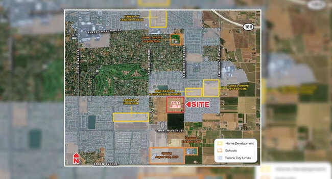


NEARBY LISTINGS FOR SALE OR LEASE
Property Detail
1183 S Armstrong Ave
316-160-43S
SUR RT 1 AC IN NE1/4 OF NW1/4 SEC 15 T14R21
Recreationalacreage
Fresno
X
California
06019C2135H
1.03 AC
2025
E Outlying Fresno County
2025
Fresno
001413
Fresno, CA
4,152 SF
DEMOGRAPHICS near 1183 S Armstrong Ave
1 Mile
3 Mile
5 Mile
2024 Total Population
11,429
54,008
149,820
2029 Population
11,831
55,404
152,403
Pop Growth 2024-2029
+ 3.52%
+ 2.58%
+ 1.72%
Average Age
35
35
34
2024 Total Households
3,076
15,240
42,146
HH Growth 2024-2029
+ 3.48%
+ 2.59%
+ 1.76%
Median Household Inc
$111,552
$94,337
$74,530
Avg Household Size
3.70
3.50
3.40
2024 Avg HH Vehicles
3.00
2.00
2.00
Median Home Value
$446,212
$415,183
$383,804
Median Year Built
2006
1996
1980
Nearby Places
Map Layers
Map Styles
 Street
 Aerial
- Restaurants
- Banks
- Shops
- Fitness
- Groceries
PUBLIC TRANSPORTATION
AIRPORT
Fresno Yosemite International
DRIVE
WALK
Distance
Fresno Yosemite International
12 min
7.0 mi
Freight Ports
Port of Stockton
DRIVE
WALK
Distance
Port of Stockton
162 min
135.6 mi
SALE & LEASE HISTORY
LISTING DATE
SALE/LEASE

Oct 09, 2020
For Sale
Nearby Properties
Address
Land Use
TOTAL SIZE
Lot Size
Zoning
Address
Land Use
TOTAL SIZE
Lot Size
Zoning
74,499 SF
17.48 AC
M3
Address
Land Use
TOTAL SIZE
Lot Size
Zoning
2,008 SF
20.14 AC
M1
Address
Land Use
TOTAL SIZE
Lot Size
Zoning
177,312 SF
28.12 AC
R1
Address
Land Use
TOTAL SIZE
Lot Size
Zoning
216,342 SF
28.49 AC
Address
Land Use
TOTAL SIZE
Lot Size
Zoning
372,862 SF
42.43 AC
R1
Address
Land Use
TOTAL SIZE
Lot Size
Zoning
175,310 SF
19.22 AC
CMX
Address
Land Use
TOTAL SIZE
Lot Size
Zoning
249,126 SF
17.33 AC
SPLIT
Address
Land Use
TOTAL SIZE
Lot Size
Zoning
102,765 SF
8.90 AC
M1
Address
Land Use
TOTAL SIZE
Lot Size
Zoning
76,720 SF
10.78 AC
Address
Land Use
TOTAL SIZE
Lot Size
Zoning
97,174 SF
10.17 AC
C2
Address
Land Use
TOTAL SIZE
Lot Size
Zoning
69,015 SF
8.15 AC
C1
Address
Land Use
TOTAL SIZE
Lot Size
Zoning
20,038 SF
2 AC
CP
Address
Land Use
TOTAL SIZE
Lot Size
Zoning
95,792 SF
2.31 AC
Address
Land Use
TOTAL SIZE
Lot Size
Zoning
62,400 SF
5.82 AC
C3
Address
Land Use
TOTAL SIZE
Lot Size
Zoning
59,442 SF
2.65 AC
R3
Address
Land Use
TOTAL SIZE
Lot Size
Zoning
52,776 SF
0.79 AC
CR/CZ
Address
Land Use
TOTAL SIZE
Lot Size
Zoning
33,350 SF
3.15 AC
C2
Address
Land Use
TOTAL SIZE
Lot Size
Zoning
150,080 SF
7.99 AC
M1
Address
Land Use
TOTAL SIZE
Lot Size
Zoning
43,007 SF
3.76 AC
R1C
Address
Land Use
TOTAL SIZE
Lot Size
Zoning
25,600 SF
1.99 AC
IL
Address
Land Use
TOTAL SIZE
Lot Size
Zoning
48,941 SF
38.19 AC
AE20
Address
Land Use
TOTAL SIZE
Lot Size
Zoning
90,940 SF
5.31 AC
R2
Address
Land Use
TOTAL SIZE
Lot Size
Zoning
41,156 SF
4.64 AC
Address
Land Use
TOTAL SIZE
Lot Size
Zoning
42,630 SF
0.59 AC
CR/CZ
Address
Land Use
TOTAL SIZE
Lot Size
Zoning
520,265 SF
59.56 AC
SPLIT
Address
Land Use
TOTAL SIZE
Lot Size
Zoning
217,130 SF
10.53 AC
SL
Address
Land Use
TOTAL SIZE
Lot Size
Zoning
57,407 SF
3.68 AC
R2
Address
Land Use
TOTAL SIZE
Lot Size
Zoning
23,749 SF
2.83 AC
C3
Address
Land Use
TOTAL SIZE
Lot Size
Zoning
52,065 SF
1.89 AC
C2
The World's #1 Commercial Real Estate Marketplace
Connect with us
© 2026 CoStar Group
The information above has been obtained from sources believed reliable. While we do not doubt its accuracy we have not verified it and make no guarantee, warranty or representation about it. It is your responsibility to independently confirm its accuracy and completeness. Any projections, opinions, assumptions, or estimates used are for example only and do not represent the current or future performance of the property. The value of this transaction to you depends on tax and other factors which should be evaluated by your tax, financial, and legal advisors. You and your advisors should conduct a careful, independent investigation of the property to determine to your satisfaction the suitability of the property for your needs.