Property Record
Ashbrook Rd, Cherry Hill, NJ 08034
Save to a Folder
{{folder.Name}}
{{folder.ListingIds.length}} Properties
{{folder.ListingIds.length}} Property
Create a New Folder
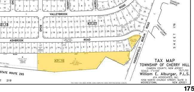
Property Detail
Ashbrook Rd
Philadelphia-Camden-Wilmington, PA-NJ-DE-MD
FACILITY NAME: ADMINISTRATIVE BLDG.
09-00431-14-00013
CAMDEN
Governmentalpublicusegeneral
New Jersey
B and X Area of moderate flood hazard, usually the area between the limits of the 100-year and 500-year floods.
7
0
0.03 AC
2026
North Camden County
603601
Philadelphia
NEARBY LISTINGS FOR SALE OR LEASE
-
-
View all Cherry Hill listings for sale on LoopNet.com
DEMOGRAPHICS near Ashbrook Rd
1 mile
3 mile
5 mile
2025 Total Population
6,777
98,990
283,569
2030 Population
6,910
100,751
288,430
Pop Growth 2025-2030
+ 1.96%
+ 1.78%
+ 1.71%
Average Age
43
42
41
2025 Total Households
2,588
39,166
114,334
HH Growth 2025-2030
+ 1.85%
+ 1.79%
+ 1.75%
Median Household Inc
$117,852
$110,272
$99,045
Avg Household Size
2.50
2.50
2.40
2025 Avg HH Vehicles
2.00
2.00
2.00
Median Home Value
$370,372
$399,426
$347,790
Median Year Built
1964
1963
1965
Nearby Places
Map Layers
Map Styles
 Street
 Aerial
Layers
 Traffic
 Biking
Places
Listings with unknown addresses are not visible on the map
- Restaurants
- Banks
- Shops
- Fitness
- Groceries
PUBLIC TRANSPORTATION
COMMUTER RAIL
Cherry Hill (Atlantic City Line - NJ Transit Commuter Rail (NJ Transit))
Drive
Walk
Distance
Cherry Hill (Atlantic City Line - NJ Transit Commuter Rail (NJ Transit))
9 min
4.7 mi
Lindenwold (Njt) (Atlantic City Line - NJ Transit Commuter Rail (NJ Transit))
Drive
Walk
Distance
Lindenwold (Njt) (Atlantic City Line - NJ Transit Commuter Rail (NJ Transit))
9 min
4.9 mi
AIRPORT
Philadelphia International
Drive
Walk
Distance
Philadelphia International
28 min
17.4 mi
Trenton Mercer
Drive
Walk
Distance
Trenton Mercer
52 min
38.1 mi
Freight Ports
Broadway Terminal - Pier 5
Drive
Walk
Distance
Broadway Terminal - Pier 5
13 min
8.9 mi
Nearby Properties
Address
Land Use
TOTAL SIZE
Lot Size
Zoning
Address
Land Use
TOTAL SIZE
Lot Size
Zoning
Address
Land Use
TOTAL SIZE
Lot Size
Zoning
23.82 AC
Address
Land Use
TOTAL SIZE
Lot Size
Zoning
18.79 AC
Address
Land Use
TOTAL SIZE
Lot Size
Zoning
231,652 SF
24.41 AC
B
Address
Land Use
TOTAL SIZE
Lot Size
Zoning
25,536 SF
18.71 AC
Address
Land Use
TOTAL SIZE
Lot Size
Zoning
39,080 SF
18.60 AC
C2
Address
Land Use
TOTAL SIZE
Lot Size
Zoning
1.48 AC
PCR
Address
Land Use
TOTAL SIZE
Lot Size
Zoning
35 AC
R1
Address
Land Use
TOTAL SIZE
Lot Size
Zoning
14.11 AC
RG
Address
Land Use
TOTAL SIZE
Lot Size
Zoning
164,434 SF
30.98 AC
TC
Address
Land Use
TOTAL SIZE
Lot Size
Zoning
56,408 SF
11.25 AC
TC
Address
Land Use
TOTAL SIZE
Lot Size
Zoning
40,487 SF
32.42 AC
SH
Address
Land Use
TOTAL SIZE
Lot Size
Zoning
12.68 AC
RG
Address
Land Use
TOTAL SIZE
Lot Size
Zoning
48,840 SF
11.04 AC
TC
Address
Land Use
TOTAL SIZE
Lot Size
Zoning
112,443 SF
15.75 AC
TC
Address
Land Use
TOTAL SIZE
Lot Size
Zoning
16,796 SF
RH
Address
Land Use
TOTAL SIZE
Lot Size
Zoning
Address
Land Use
TOTAL SIZE
Lot Size
Zoning
38.13 AC
CP
Address
Land Use
TOTAL SIZE
Lot Size
Zoning
57.50 AC
Address
Land Use
TOTAL SIZE
Lot Size
Zoning
50,464 SF
20.22 AC
RH
Address
Land Use
TOTAL SIZE
Lot Size
Zoning
48,840 SF
9.55 AC
TC
Address
Land Use
TOTAL SIZE
Lot Size
Zoning
27.83 AC
Address
Land Use
TOTAL SIZE
Lot Size
Zoning
5.23 AC
Address
Land Use
TOTAL SIZE
Lot Size
Zoning
86,568 SF
11.30 AC
TC
Address
Land Use
TOTAL SIZE
Lot Size
Zoning
40,116 SF
2.84 AC
TC
Address
Land Use
TOTAL SIZE
Lot Size
Zoning
Address
Land Use
TOTAL SIZE
Lot Size
Zoning
69,604 SF
11.99 AC
R10
Address
Land Use
TOTAL SIZE
Lot Size
Zoning
8.18 AC
Address
Land Use
TOTAL SIZE
Lot Size
Zoning
9.27 AC
Address
Land Use
TOTAL SIZE
Lot Size
Zoning
The World's #1 Commercial Real Estate Marketplace
Connect with us
© 2026 CoStar Group
The information above has been obtained from sources believed reliable. While we do not doubt its accuracy we have not verified it and make no guarantee, warranty or representation about it. It is your responsibility to independently confirm its accuracy and completeness. Any projections, opinions, assumptions, or estimates used are for example only and do not represent the current or future performance of the property. The value of this transaction to you depends on tax and other factors which should be evaluated by your tax, financial, and legal advisors. You and your advisors should conduct a careful, independent investigation of the property to determine to your satisfaction the suitability of the property for your needs.