Property Record
1935 N Hollywood Blvd, Las Vegas, NV 89156
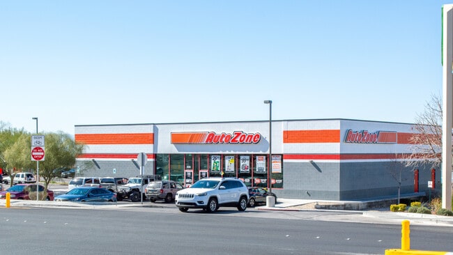


Property Detail
1935 N Hollywood Blvd
140-22-715-006
HOLLYMEAD PLAT BOOK 129 PAGE 81 PT LOT 1
Storebuilding
Clark
C2
Nevada
B and X Area of moderate flood hazard, usually the area between the limits of the 100-year and 500-year floods.
1
2026
0.68 AC
2026
Northeast Las Vegas
004917
Las Vegas
6,840 SF
Las Vegas-Henderson-North Las Vegas, NV
NEARBY LISTINGS FOR SALE OR LEASE
DEMOGRAPHICS near 1935 N Hollywood Blvd
1 mile
3 mile
5 mile
2025 Total Population
21,739
90,964
284,954
2030 Population
22,593
94,700
297,302
Pop Growth 2025-2030
+ 3.93%
+ 4.11%
+ 4.33%
Average Age
38
36
36
2025 Total Households
7,059
27,879
88,742
HH Growth 2025-2030
+ 3.99%
+ 4.14%
+ 4.41%
Median Household Inc
$70,806
$65,960
$55,628
Avg Household Size
3.00
3.20
3.10
2025 Avg HH Vehicles
2.00
2.00
2.00
Median Home Value
$353,987
$352,442
$313,049
Median Year Built
1992
1991
1989
Nearby Places
Map Layers
Map Styles
 Street
 Aerial
Layers
 Traffic
 Biking
Places
Listings with unknown addresses are not visible on the map
- Restaurants
- Banks
- Shops
- Fitness
- Groceries
PUBLIC TRANSPORTATION
AIRPORT
Harry Reid International
Drive
Walk
Distance
Harry Reid International
26 min
15.4 mi
Boulder City Municipal
Drive
Walk
Distance
Boulder City Municipal
41 min
26.7 mi
SALE & LEASE HISTORY
LISTING DATE
SALE/LEASE

May 21, 2018
For Sale
Mar 23, 2020
For Sale
Nearby Properties
Address
Land Use
TOTAL SIZE
Lot Size
Zoning
Address
Land Use
TOTAL SIZE
Lot Size
Zoning
90.41 AC
Address
Land Use
TOTAL SIZE
Lot Size
Zoning
7.24 AC
PF
Address
Land Use
TOTAL SIZE
Lot Size
Zoning
342,160 SF
37.72 AC
RT
Address
Land Use
TOTAL SIZE
Lot Size
Zoning
43.25 AC
PF
Address
Land Use
TOTAL SIZE
Lot Size
Zoning
20.91 AC
PF
Address
Land Use
TOTAL SIZE
Lot Size
Zoning
1,008 SF
31.47 AC
PF
Address
Land Use
TOTAL SIZE
Lot Size
Zoning
4.34 AC
RE
Address
Land Use
TOTAL SIZE
Lot Size
Zoning
19.30 AC
RE
Address
Land Use
TOTAL SIZE
Lot Size
Zoning
223,422 SF
18.21 AC
R3
Address
Land Use
TOTAL SIZE
Lot Size
Zoning
3,183 SF
18.35 AC
R3
Address
Land Use
TOTAL SIZE
Lot Size
Zoning
9.11 AC
PF
Address
Land Use
TOTAL SIZE
Lot Size
Zoning
228,760 SF
12.72 AC
Address
Land Use
TOTAL SIZE
Lot Size
Zoning
326,165 SF
17.37 AC
Address
Land Use
TOTAL SIZE
Lot Size
Zoning
11.81 AC
RE
Address
Land Use
TOTAL SIZE
Lot Size
Zoning
4,236 SF
0.61 AC
R4
Address
Land Use
TOTAL SIZE
Lot Size
Zoning
13.84 AC
PF
Address
Land Use
TOTAL SIZE
Lot Size
Zoning
133,481 SF
6.17 AC
MD
Address
Land Use
TOTAL SIZE
Lot Size
Zoning
20 AC
PF
Address
Land Use
TOTAL SIZE
Lot Size
Zoning
36.52 AC
PF
Address
Land Use
TOTAL SIZE
Lot Size
Zoning
33,009 SF
16.84 AC
PF
Address
Land Use
TOTAL SIZE
Lot Size
Zoning
3,260 SF
0.04 AC
Address
Land Use
TOTAL SIZE
Lot Size
Zoning
5,478 SF
8.87 AC
R4
Address
Land Use
TOTAL SIZE
Lot Size
Zoning
2,304 SF
12.36 AC
RPD16
Address
Land Use
TOTAL SIZE
Lot Size
Zoning
270,984 SF
11.69 AC
M1
Address
Land Use
TOTAL SIZE
Lot Size
Zoning
269,182 SF
12.86 AC
M1
Address
Land Use
TOTAL SIZE
Lot Size
Zoning
269,182 SF
13.03 AC
M1
Address
Land Use
TOTAL SIZE
Lot Size
Zoning
269,182 SF
12.85 AC
M1
Address
Land Use
TOTAL SIZE
Lot Size
Zoning
16.55 AC
Address
Land Use
TOTAL SIZE
Lot Size
Zoning
2,286 SF
4.51 AC
Address
Land Use
TOTAL SIZE
Lot Size
Zoning
1,590 SF
3.80 AC
The World's #1 Commercial Real Estate Marketplace
Connect with us
© 2026 CoStar Group
The information above has been obtained from sources believed reliable. While we do not doubt its accuracy we have not verified it and make no guarantee, warranty or representation about it. It is your responsibility to independently confirm its accuracy and completeness. Any projections, opinions, assumptions, or estimates used are for example only and do not represent the current or future performance of the property. The value of this transaction to you depends on tax and other factors which should be evaluated by your tax, financial, and legal advisors. You and your advisors should conduct a careful, independent investigation of the property to determine to your satisfaction the suitability of the property for your needs.