Property Record
Avalon Bch, Milton, FL 32583


Property Detail
Avalon Bch
04-1S-29-0000-00201-0000
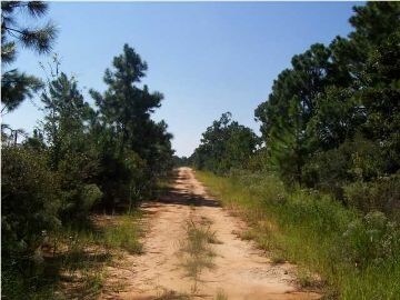
*DESCRIPTION UPDATED FOR 2024* E 1400 FT OF FOLLOWING LYING S OF I-10: BEG AT ON S R/W I-10 AT W R/W OF 10TH AVE PER PLAT OF AVALON BEACH THN S ON W LN OF 10TH AVE & SWLY EXT THEREOF TO ESCAMBIA BAY THN NWLY ON BAY TO A PT 300 FT W OF BNDRY OF BLKS 2
Miscellaneous
SANTA ROSA
RR1
Florida
VE and V1-30 Coastal areas with a 1% or greater chance of flooding and an additional hazard associated with storm waves. These areas have a 26% chance of flooding over the life of a 30-year mortgage.
59.69 AC
2024
Avalon Beach/Milton
2025
Pensacola
0107023096
Pensacola-Ferry Pass-Brent, FL
NEARBY LISTINGS FOR SALE OR LEASE
DEMOGRAPHICS near Avalon Bch
1 mile
3 mile
5 mile
2025 Total Population
249
3,954
33,977
2030 Population
271
4,306
35,635
Pop Growth 2025-2030
+ 8.84%
+ 8.90%
+ 4.88%
Average Age
43
42
41
2025 Total Households
98
1,525
13,843
HH Growth 2025-2030
+ 8.16%
+ 8.66%
+ 4.51%
Median Household Inc
$111,413
$106,989
$88,197
Avg Household Size
2.50
2.60
2.40
2025 Avg HH Vehicles
2.00
2.00
2.00
Median Home Value
$425,000
$374,520
$293,993
Median Year Built
2002
2001
1984
Nearby Places
Map Layers
Map Styles
 Street
 Aerial
Layers
 Traffic
 Biking
Places
Listings with unknown addresses are not visible on the map
- Restaurants
- Banks
- Shops
- Fitness
- Groceries
PUBLIC TRANSPORTATION
AIRPORT
Pensacola International
Drive
Walk
Distance
Pensacola International
26 min
13.9 mi
Freight Ports
Port of Mobile
Drive
Walk
Distance
Port of Mobile
75 min
64.0 mi
SALE & LEASE HISTORY
LISTING DATE
SALE/LEASE

Aug 19, 2019
For Sale
Apr 18, 2018
For Sale
Nearby Properties
Address
Land Use
TOTAL SIZE
Lot Size
Zoning
Address
Land Use
TOTAL SIZE
Lot Size
Zoning
615,804 SF
16.46 AC
M2
Address
Land Use
TOTAL SIZE
Lot Size
Zoning
40,026 SF
1.79 AC
HCD
Address
Land Use
TOTAL SIZE
Lot Size
Zoning
37,232 SF
303.14 AC
HCD
Address
Land Use
TOTAL SIZE
Lot Size
Zoning
5,800 SF
148.82 AC
M2
Address
Land Use
TOTAL SIZE
Lot Size
Zoning
15,370 SF
12.15 AC
M2
Address
Land Use
TOTAL SIZE
Lot Size
Zoning
10,095 SF
1.03 AC
HCD
Address
Land Use
TOTAL SIZE
Lot Size
Zoning
9,081 SF
1.88 AC
HCD
Address
Land Use
TOTAL SIZE
Lot Size
Zoning
40,994 SF
57.36 AC
RR1
Address
Land Use
TOTAL SIZE
Lot Size
Zoning
10,008 SF
1.10 AC
HCD
Address
Land Use
TOTAL SIZE
Lot Size
Zoning
1,485 SF
3.14 AC
HCD
Address
Land Use
TOTAL SIZE
Lot Size
Zoning
11,241 SF
1.50 AC
HCD
Address
Land Use
TOTAL SIZE
Lot Size
Zoning
25,323 SF
2 AC
HCD
Address
Land Use
TOTAL SIZE
Lot Size
Zoning
627 SF
2.07 AC
HCD
Address
Land Use
TOTAL SIZE
Lot Size
Zoning
21,064 SF
3.10 AC
HCD
Address
Land Use
TOTAL SIZE
Lot Size
Zoning
4,327 SF
0.83 AC
HCD
Address
Land Use
TOTAL SIZE
Lot Size
Zoning
6,006 SF
0.83 AC
HCD
Address
Land Use
TOTAL SIZE
Lot Size
Zoning
12,854 SF
0.14 AC
M2
Address
Land Use
TOTAL SIZE
Lot Size
Zoning
8,516 SF
18.67 AC
AG-RR
Address
Land Use
TOTAL SIZE
Lot Size
Zoning
1.96 AC
HCD
Address
Land Use
TOTAL SIZE
Lot Size
Zoning
5,166 SF
36.44 AC
AG-RR
Address
Land Use
TOTAL SIZE
Lot Size
Zoning
15.95 AC
M2
Address
Land Use
TOTAL SIZE
Lot Size
Zoning
5,523 SF
3 AC
R1
Address
Land Use
TOTAL SIZE
Lot Size
Zoning
5,460 SF
0.86 AC
R2
Address
Land Use
TOTAL SIZE
Lot Size
Zoning
5,178 SF
0.47 AC
HCD
Address
Land Use
TOTAL SIZE
Lot Size
Zoning
6,400 SF
94.72 AC
RR1
Address
Land Use
TOTAL SIZE
Lot Size
Zoning
4,800 SF
1.10 AC
HCD
The World's #1 Commercial Real Estate Marketplace
Connect with us
© 2026 CoStar Group
The information above has been obtained from sources believed reliable. While we do not doubt its accuracy we have not verified it and make no guarantee, warranty or representation about it. It is your responsibility to independently confirm its accuracy and completeness. Any projections, opinions, assumptions, or estimates used are for example only and do not represent the current or future performance of the property. The value of this transaction to you depends on tax and other factors which should be evaluated by your tax, financial, and legal advisors. You and your advisors should conduct a careful, independent investigation of the property to determine to your satisfaction the suitability of the property for your needs.