Property Record
70 Vac Cor, Lancaster, CA 93535

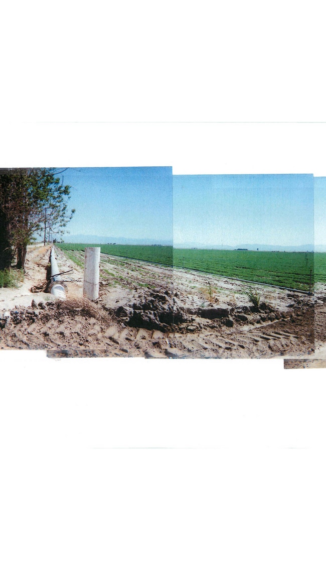

This Property Is For Sale
NEARBY LISTINGS FOR SALE OR LEASE
Property Detail
70 Vac Cor
Los Angeles-Long Beach-Glendale, CA
N 1/2 OF NW 1/4 (EX OF STS) OF SEC 24 T 7N R 11W
3384-009-001
Los Angeles
Agriculturalland
California
X
24
06037C0450F
80.15 AC
2024
NE LA County Outlying
2025
Los Angeles
900508
DEMOGRAPHICS near 70 Vac Cor
1 mile
3 mile
5 mile
2024 Total Population
30
662
16,341
2029 Population
31
669
15,826
Pop Growth 2024-2029
+ 3.33%
+ 1.06%
(3.15%)
Average Age
40
40
35
2024 Total Households
10
218
4,382
HH Growth 2024-2029
0.00%
+ 0.46%
(3.29%)
Median Household Inc
$67,500
$55,000
$52,262
Avg Household Size
2.90
3.00
3.50
2024 Avg HH Vehicles
3.00
3.00
2.00
Median Home Value
$350,000
$345,833
$284,689
Median Year Built
1982
1980
1989
Nearby Places
Map Layers
Map Styles
 Street
 Aerial
Transit
 Traffic
 Biking
Places
Listings with unknown addresses are not visible on the map
- Restaurants
- Banks
- Shops
- Fitness
- Groceries
PUBLIC TRANSPORTATION
COMMUTER RAIL
Lancaster (Antelope Valley Line - Southern California Regional Rail Authority (Metrolink))
Drive
Walk
Distance
Lancaster (Antelope Valley Line - Southern California Regional Rail Authority (Metrolink))
12 min
8.2 mi
Freight Ports
Port of Long Beach
Drive
Walk
Distance
Port of Long Beach
118 min
96.9 mi
Nearby Properties
Address
Land Use
TOTAL SIZE
Lot Size
Zoning
Address
Land Use
TOTAL SIZE
Lot Size
Zoning
74,797 SF
15.44 AC
LCA21*
Address
Land Use
TOTAL SIZE
Lot Size
Zoning
279.67 AC
LCA21*
Address
Land Use
TOTAL SIZE
Lot Size
Zoning
6,826 SF
19.71 AC
LCA11*
Address
Land Use
TOTAL SIZE
Lot Size
Zoning
5,482 SF
98.77 AC
POM11/2-A2
Address
Land Use
TOTAL SIZE
Lot Size
Zoning
3,411 SF
80.71 AC
LCA21*
Address
Land Use
TOTAL SIZE
Lot Size
Zoning
1 SF
121.43 AC
LCA21*
Address
Land Use
TOTAL SIZE
Lot Size
Zoning
160.73 AC
LRR2.5
Address
Land Use
TOTAL SIZE
Lot Size
Zoning
158.16 AC
LCC4-R1750
Address
Land Use
TOTAL SIZE
Lot Size
Zoning
4,598 SF
2.24 AC
LCA21*
Address
Land Use
TOTAL SIZE
Lot Size
Zoning
2,520 SF
2.57 AC
LCA 11
Address
Land Use
TOTAL SIZE
Lot Size
Zoning
1,374 SF
78.59 AC
LCA21*
Address
Land Use
TOTAL SIZE
Lot Size
Zoning
5,344 SF
78.51 AC
LCA21*
Address
Land Use
TOTAL SIZE
Lot Size
Zoning
5,236 SF
1.41 AC
LCC4*
Address
Land Use
TOTAL SIZE
Lot Size
Zoning
3,047 SF
2.57 AC
LCA11*
Address
Land Use
TOTAL SIZE
Lot Size
Zoning
20.48 AC
LCA21*
Address
Land Use
TOTAL SIZE
Lot Size
Zoning
2,643 SF
2.57 AC
LCA11*
Address
Land Use
TOTAL SIZE
Lot Size
Zoning
10.03 AC
LCA22*
Address
Land Use
TOTAL SIZE
Lot Size
Zoning
2,696 SF
2.57 AC
LCA22*
Address
Land Use
TOTAL SIZE
Lot Size
Zoning
2,887 SF
9.53 AC
LCA21*
Address
Land Use
TOTAL SIZE
Lot Size
Zoning
2,184 SF
2.57 AC
LCA22*
Address
Land Use
TOTAL SIZE
Lot Size
Zoning
159.23 AC
LCA21*
Address
Land Use
TOTAL SIZE
Lot Size
Zoning
3,320 SF
81.58 AC
LCA21
Address
Land Use
TOTAL SIZE
Lot Size
Zoning
4,902 SF
4.70 AC
LCA11*
Address
Land Use
TOTAL SIZE
Lot Size
Zoning
1,728 SF
40 AC
LCA21*
Address
Land Use
TOTAL SIZE
Lot Size
Zoning
1,830 SF
9.53 AC
LCM2
Address
Land Use
TOTAL SIZE
Lot Size
Zoning
2,336 SF
2.57 AC
LCA22*
Address
Land Use
TOTAL SIZE
Lot Size
Zoning
2 SF
124.01 AC
LCA12*
Address
Land Use
TOTAL SIZE
Lot Size
Zoning
2,160 SF
5 AC
LCA22*
Address
Land Use
TOTAL SIZE
Lot Size
Zoning
2,103 SF
2.19 AC
LCA11*
Address
Land Use
TOTAL SIZE
Lot Size
Zoning
2,118 SF
20.26 AC
LCRA10000*
The World's #1 Commercial Real Estate Marketplace
Connect with us
© 2026 CoStar Group
The information above has been obtained from sources believed reliable. While we do not doubt its accuracy we have not verified it and make no guarantee, warranty or representation about it. It is your responsibility to independently confirm its accuracy and completeness. Any projections, opinions, assumptions, or estimates used are for example only and do not represent the current or future performance of the property. The value of this transaction to you depends on tax and other factors which should be evaluated by your tax, financial, and legal advisors. You and your advisors should conduct a careful, independent investigation of the property to determine to your satisfaction the suitability of the property for your needs.