Property Record
Avery Dr, Magnolia, DE 19962
Property Detail
Avery Dr
Dover, DE
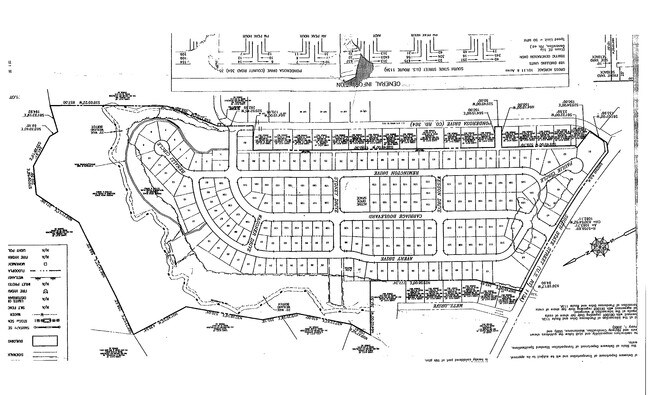
MAGNOLIA ESTATES, LOT #50
7-00-10402-01-1800-000
KENT
Residentialacreage
Delaware
RS1
50
B and X Area of moderate flood hazard, usually the area between the limits of the 100-year and 500-year floods.
0.27 AC
2025
Kent County
2025
Philadelphia
041300
NEARBY LISTINGS FOR SALE OR LEASE
DEMOGRAPHICS near Avery Dr
1 mile
3 mile
5 mile
2025 Total Population
4,307
27,339
61,044
2030 Population
4,563
28,825
64,074
Pop Growth 2025-2030
+ 5.94%
+ 5.44%
+ 4.96%
Average Age
41
39
40
2025 Total Households
1,578
10,602
23,551
HH Growth 2025-2030
+ 6.08%
+ 7.35%
+ 5.89%
Median Household Inc
$90,520
$89,772
$75,557
Avg Household Size
2.70
2.50
2.50
2025 Avg HH Vehicles
2.00
2.00
2.00
Median Home Value
$400,760
$388,107
$336,205
Median Year Built
2009
2002
1995
Nearby Places
Map Layers
Map Styles
 Street
 Aerial
Layers
 Traffic
 Biking
Places
Listings with unknown addresses are not visible on the map
- Restaurants
- Banks
- Shops
- Fitness
- Groceries
SALE & LEASE HISTORY
LISTING DATE
SALE/LEASE

Sep 24, 2016
For Sale
May 19, 2017
For Sale
Mar 11, 2019
For Sale
Mar 06, 2018
For Sale
Nearby Properties
Address
Land Use
TOTAL SIZE
Lot Size
Zoning
Address
Land Use
TOTAL SIZE
Lot Size
Zoning
136,308 SF
2,301.50 AC
R20
Address
Land Use
TOTAL SIZE
Lot Size
Zoning
135,552 SF
39.05 AC
AC
Address
Land Use
TOTAL SIZE
Lot Size
Zoning
434.50 AC
DAFB
Address
Land Use
TOTAL SIZE
Lot Size
Zoning
190,988 SF
19.90 AC
NA
Address
Land Use
TOTAL SIZE
Lot Size
Zoning
62,728 SF
25 AC
AC
Address
Land Use
TOTAL SIZE
Lot Size
Zoning
2,768 SF
335.80 AC
AC
Address
Land Use
TOTAL SIZE
Lot Size
Zoning
64,067 SF
33.61 AC
AC
Address
Land Use
TOTAL SIZE
Lot Size
Zoning
41,040 SF
3.40 AC
RM
Address
Land Use
TOTAL SIZE
Lot Size
Zoning
323.98 AC
AP/10
Address
Land Use
TOTAL SIZE
Lot Size
Zoning
34,020 SF
20.46 AC
BN
Address
Land Use
TOTAL SIZE
Lot Size
Zoning
12,300 SF
186.50 AC
AC
Address
Land Use
TOTAL SIZE
Lot Size
Zoning
50,428 SF
19.30 AC
BG
Address
Land Use
TOTAL SIZE
Lot Size
Zoning
33,120 SF
7.90 AC
IG
Address
Land Use
TOTAL SIZE
Lot Size
Zoning
58,578 SF
3.30 AC
BG
Address
Land Use
TOTAL SIZE
Lot Size
Zoning
60,878 SF
6.80 AC
BG
Address
Land Use
TOTAL SIZE
Lot Size
Zoning
33,674 SF
20 AC
AC
Address
Land Use
TOTAL SIZE
Lot Size
Zoning
21,864 SF
233.90 AC
AC
Address
Land Use
TOTAL SIZE
Lot Size
Zoning
60,679 SF
8.13 AC
NA
Address
Land Use
TOTAL SIZE
Lot Size
Zoning
39,141 SF
4 AC
BG
Address
Land Use
TOTAL SIZE
Lot Size
Zoning
42,765 SF
9.10 AC
NA
Address
Land Use
TOTAL SIZE
Lot Size
Zoning
1,376 SF
128.02 AC
AC
Address
Land Use
TOTAL SIZE
Lot Size
Zoning
19,905 SF
4.20 AC
RS1
Address
Land Use
TOTAL SIZE
Lot Size
Zoning
37,980 SF
4.30 AC
BN
Address
Land Use
TOTAL SIZE
Lot Size
Zoning
9,384 SF
40.17 AC
AC
Address
Land Use
TOTAL SIZE
Lot Size
Zoning
49,061 SF
7.26 AC
RMH
Address
Land Use
TOTAL SIZE
Lot Size
Zoning
14,040 SF
4.90 AC
BN
Address
Land Use
TOTAL SIZE
Lot Size
Zoning
2,922 SF
28.80 AC
AC
Address
Land Use
TOTAL SIZE
Lot Size
Zoning
27,297 SF
5.20 AC
NA
Address
Land Use
TOTAL SIZE
Lot Size
Zoning
50,655 SF
5.40 AC
NA
Address
Land Use
TOTAL SIZE
Lot Size
Zoning
9,040 SF
6.30 AC
BG
The World's #1 Commercial Real Estate Marketplace
Connect with us
© 2026 CoStar Group
The information above has been obtained from sources believed reliable. While we do not doubt its accuracy we have not verified it and make no guarantee, warranty or representation about it. It is your responsibility to independently confirm its accuracy and completeness. Any projections, opinions, assumptions, or estimates used are for example only and do not represent the current or future performance of the property. The value of this transaction to you depends on tax and other factors which should be evaluated by your tax, financial, and legal advisors. You and your advisors should conduct a careful, independent investigation of the property to determine to your satisfaction the suitability of the property for your needs.