Property Record
Avery Dr, Magnolia, DE 19962
NEARBY LISTINGS FOR SALE OR LEASE
-
-
View all Magnolia listings for sale on LoopNet.com
Property Detail
Avery Dr
Dover, DE
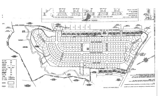
Magnolia Estates
7-00-10402-01-4400-000
MAGNOLIA ESTATES, LOT #49
Residentialacreage
Kent
X
Delaware
10001C0253J
49
2024
0.31 AC
2025
Kent County
041300
Philadelphia
DEMOGRAPHICS near Avery Dr
1 Mile
3 Mile
5 Mile
2024 Total Population
3,971
24,812
57,830
2029 Population
4,201
26,456
61,892
Pop Growth 2024-2029
+ 5.79%
+ 6.63%
+ 7.02%
Average Age
40
39
39
2024 Total Households
1,471
8,862
21,667
HH Growth 2024-2029
+ 6.19%
+ 6.92%
+ 7.28%
Median Household Inc
$89,310
$81,304
$68,684
Avg Household Size
2.70
2.80
2.60
2024 Avg HH Vehicles
2.00
2.00
2.00
Median Home Value
$349,157
$330,888
$282,054
Median Year Built
2006
1997
1992
Nearby Places
Map Layers
Map Styles
 Street
 Aerial
- Restaurants
- Banks
- Shops
- Fitness
- Groceries
SALE & LEASE HISTORY
LISTING DATE
SALE/LEASE

Sep 24, 2016
For Sale
May 19, 2017
For Sale
Mar 11, 2019
For Sale
Mar 06, 2018
For Sale
Nearby Properties
Address
Land Use
TOTAL SIZE
Lot Size
Zoning
Address
Land Use
TOTAL SIZE
Lot Size
Zoning
136,308 SF
2,301.50 AC
R20
Address
Land Use
TOTAL SIZE
Lot Size
Zoning
135,552 SF
39.05 AC
AC
Address
Land Use
TOTAL SIZE
Lot Size
Zoning
434.50 AC
DAFB
Address
Land Use
TOTAL SIZE
Lot Size
Zoning
62,728 SF
25 AC
AC
Address
Land Use
TOTAL SIZE
Lot Size
Zoning
2,768 SF
335.80 AC
AC
Address
Land Use
TOTAL SIZE
Lot Size
Zoning
64,067 SF
33.61 AC
AC
Address
Land Use
TOTAL SIZE
Lot Size
Zoning
41,040 SF
3.40 AC
RM
Address
Land Use
TOTAL SIZE
Lot Size
Zoning
1,175 SF
53.20 AC
RMH
Address
Land Use
TOTAL SIZE
Lot Size
Zoning
323.98 AC
AP/10
Address
Land Use
TOTAL SIZE
Lot Size
Zoning
50,428 SF
19.30 AC
BG
Address
Land Use
TOTAL SIZE
Lot Size
Zoning
33,120 SF
7.90 AC
IG
Address
Land Use
TOTAL SIZE
Lot Size
Zoning
58,578 SF
3.30 AC
BG
Address
Land Use
TOTAL SIZE
Lot Size
Zoning
60,878 SF
6.80 AC
BG
Address
Land Use
TOTAL SIZE
Lot Size
Zoning
33,674 SF
20 AC
AC
Address
Land Use
TOTAL SIZE
Lot Size
Zoning
21,864 SF
233.90 AC
AC
Address
Land Use
TOTAL SIZE
Lot Size
Zoning
60,679 SF
8.13 AC
NA
Address
Land Use
TOTAL SIZE
Lot Size
Zoning
39,141 SF
4 AC
BG
Address
Land Use
TOTAL SIZE
Lot Size
Zoning
42,765 SF
9.10 AC
NA
Address
Land Use
TOTAL SIZE
Lot Size
Zoning
1,376 SF
128.02 AC
AC
Address
Land Use
TOTAL SIZE
Lot Size
Zoning
19,905 SF
4.20 AC
RS1
Address
Land Use
TOTAL SIZE
Lot Size
Zoning
37,980 SF
4.30 AC
BN
Address
Land Use
TOTAL SIZE
Lot Size
Zoning
9,384 SF
40.17 AC
AC
Address
Land Use
TOTAL SIZE
Lot Size
Zoning
19,352 SF
14.77 AC
RM
Address
Land Use
TOTAL SIZE
Lot Size
Zoning
49,061 SF
7.26 AC
RMH
Address
Land Use
TOTAL SIZE
Lot Size
Zoning
14,040 SF
4.90 AC
BN
Address
Land Use
TOTAL SIZE
Lot Size
Zoning
2,922 SF
28.80 AC
AC
Address
Land Use
TOTAL SIZE
Lot Size
Zoning
9,040 SF
6.30 AC
BG
Address
Land Use
TOTAL SIZE
Lot Size
Zoning
43,243 SF
2.30 AC
BG
Address
Land Use
TOTAL SIZE
Lot Size
Zoning
43,680 SF
2.20 AC
RM
Address
Land Use
TOTAL SIZE
Lot Size
Zoning
4,800 SF
12.50 AC
RMH
The World's #1 Commercial Real Estate Marketplace
Connect with us
© 2025 CoStar Group
The information above has been obtained from sources believed reliable. While we do not doubt its accuracy we have not verified it and make no guarantee, warranty or representation about it. It is your responsibility to independently confirm its accuracy and completeness. Any projections, opinions, assumptions, or estimates used are for example only and do not represent the current or future performance of the property. The value of this transaction to you depends on tax and other factors which should be evaluated by your tax, financial, and legal advisors. You and your advisors should conduct a careful, independent investigation of the property to determine to your satisfaction the suitability of the property for your needs.