No Photo
Property Record
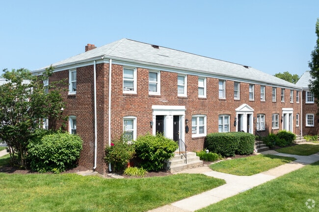
Avondale Rd, Baltimore, MD 21222

Property Detail
Avondale Rd
Baltimore-Columbia-Towson, MD
.679AC DAY VILLAGE
12-2500002193
BALTIMORE
Apartment
Maryland
DR16
1
AE The base floodplain where base flood elevations are provided. AE Zones are now used on new format FIRMs instead of A1-A30 Zones.
4.73 AC
2024
Dundalk
2025
Baltimore
420200
NEARBY LISTINGS FOR SALE OR LEASE
-
-
View all Baltimore listings for sale on LoopNet.com
DEMOGRAPHICS near Avondale Rd
1 mile
3 mile
5 mile
2025 Total Population
7,283
58,418
126,097
2030 Population
7,432
58,687
125,576
Pop Growth 2025-2030
+ 2.05%
+ 0.46%
(0.41%)
Average Age
39
39
39
2025 Total Households
2,825
22,148
48,785
HH Growth 2025-2030
+ 1.98%
+ 0.45%
(0.48%)
Median Household Inc
$53,886
$61,076
$70,498
Avg Household Size
2.60
2.60
2.50
2025 Avg HH Vehicles
1.00
2.00
2.00
Median Home Value
$222,833
$218,014
$250,134
Median Year Built
1950
1954
1953
Nearby Places
Map Layers
Map Styles
 Street
 Aerial
Layers
 Traffic
 Biking
Places
Listings with unknown addresses are not visible on the map
- Restaurants
- Banks
- Shops
- Fitness
- Groceries
PUBLIC TRANSPORTATION
COMMUTER RAIL
Camden Station Marc (CAMDEN - WASHINGTON - Maryland Transit Administration)
Drive
Walk
Distance
Camden Station Marc (CAMDEN - WASHINGTON - Maryland Transit Administration)
18 min
9.2 mi
AIRPORT
Baltimore/Washington International Thurgood Marshall
Drive
Walk
Distance
Baltimore/Washington International Thurgood Marshall
25 min
15.6 mi
Freight Ports
Port of Baltimore
Drive
Walk
Distance
Port of Baltimore
16 min
7.2 mi
Nearby Properties
Address
Land Use
TOTAL SIZE
Lot Size
Zoning
Address
Land Use
TOTAL SIZE
Lot Size
Zoning
1,877,670 SF
90.21 AC
Address
Land Use
TOTAL SIZE
Lot Size
Zoning
Address
Land Use
TOTAL SIZE
Lot Size
Zoning
979,200 SF
49.24 AC
Address
Land Use
TOTAL SIZE
Lot Size
Zoning
859,500 SF
64.32 AC
MH-IM
Address
Land Use
TOTAL SIZE
Lot Size
Zoning
1,500,400 SF
93.63 AC
Address
Land Use
TOTAL SIZE
Lot Size
Zoning
1,282,700 SF
66.23 AC
Address
Land Use
TOTAL SIZE
Lot Size
Zoning
263 AC
0M030
Address
Land Use
TOTAL SIZE
Lot Size
Zoning
347,000 SF
42.73 AC
DR
Address
Land Use
TOTAL SIZE
Lot Size
Zoning
161,190 SF
115.02 AC
Address
Land Use
TOTAL SIZE
Lot Size
Zoning
698,880 SF
60.82 AC
Address
Land Use
TOTAL SIZE
Lot Size
Zoning
519,489 SF
45.05 AC
Address
Land Use
TOTAL SIZE
Lot Size
Zoning
812,250 SF
45.19 AC
Address
Land Use
TOTAL SIZE
Lot Size
Zoning
603,980 SF
30.68 AC
Address
Land Use
TOTAL SIZE
Lot Size
Zoning
291,062 SF
47.39 AC
Address
Land Use
TOTAL SIZE
Lot Size
Zoning
Address
Land Use
TOTAL SIZE
Lot Size
Zoning
735,681 SF
44.98 AC
Address
Land Use
TOTAL SIZE
Lot Size
Zoning
449,920 SF
26.42 AC
Address
Land Use
TOTAL SIZE
Lot Size
Zoning
278,006 SF
49.85 AC
DR
Address
Land Use
TOTAL SIZE
Lot Size
Zoning
401,280 SF
25.38 AC
Address
Land Use
TOTAL SIZE
Lot Size
Zoning
33.65 AC
DR16
Address
Land Use
TOTAL SIZE
Lot Size
Zoning
72,600 SF
35.27 AC
Address
Land Use
TOTAL SIZE
Lot Size
Zoning
399,600 SF
21.59 AC
Address
Land Use
TOTAL SIZE
Lot Size
Zoning
139.18 AC
MI
Address
Land Use
TOTAL SIZE
Lot Size
Zoning
666,800 SF
17.50 AC
OIC
Address
Land Use
TOTAL SIZE
Lot Size
Zoning
213,997 SF
45.22 AC
DR
Address
Land Use
TOTAL SIZE
Lot Size
Zoning
75.99 AC
Address
Land Use
TOTAL SIZE
Lot Size
Zoning
13.72 AC
DR16
Address
Land Use
TOTAL SIZE
Lot Size
Zoning
104,410 SF
3.85 AC
DR
Address
Land Use
TOTAL SIZE
Lot Size
Zoning
24,300 SF
1.62 AC
MHIM
Address
Land Use
TOTAL SIZE
Lot Size
Zoning
3,099 SF
16.10 AC
BM
The World's #1 Commercial Real Estate Marketplace
Connect with us
© 2026 CoStar Group
The information above has been obtained from sources believed reliable. While we do not doubt its accuracy we have not verified it and make no guarantee, warranty or representation about it. It is your responsibility to independently confirm its accuracy and completeness. Any projections, opinions, assumptions, or estimates used are for example only and do not represent the current or future performance of the property. The value of this transaction to you depends on tax and other factors which should be evaluated by your tax, financial, and legal advisors. You and your advisors should conduct a careful, independent investigation of the property to determine to your satisfaction the suitability of the property for your needs.