Property Record
Ayers Pl, Cincinnati, OH 45242


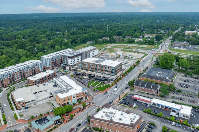
Property Detail
Ayers Pl
Cincinnati, OH-KY-IN
MONTGOMERY RD, AYERS PL,CAMERON LN & ROOSA ST 2.0514 AC LOT 2E1.9671 AC GRND ELEV UP TO 798.82 FT IRR0.0843 AC GRND PAR IRRMONTGOMERY QUARTER
603-0004-0211
HAMILTON
Municipalproperty
Ohio
B and X Area of moderate flood hazard, usually the area between the limits of the 100-year and 500-year floods.
2
2025
2.05 AC
2025
Kenwood
023902
Cincinnati/Dayton
NEARBY LISTINGS FOR SALE OR LEASE
DEMOGRAPHICS near Ayers Pl
1 mile
3 mile
5 mile
2025 Total Population
6,247
52,549
137,318
2030 Population
6,397
52,970
138,556
Pop Growth 2025-2030
+ 2.40%
+ 0.80%
+ 0.90%
Average Age
44
42
42
2025 Total Households
2,309
21,002
56,217
HH Growth 2025-2030
+ 2.38%
+ 0.78%
+ 0.90%
Median Household Inc
$135,274
$111,766
$98,602
Avg Household Size
2.60
2.40
2.40
2025 Avg HH Vehicles
2.00
2.00
2.00
Median Home Value
$556,818
$395,874
$351,738
Median Year Built
1972
1968
1967
Nearby Places
Map Layers
Map Styles
 Street
 Aerial
Layers
 Traffic
 Biking
Places
Listings with unknown addresses are not visible on the map
- Restaurants
- Banks
- Shops
- Fitness
- Groceries
PUBLIC TRANSPORTATION
AIRPORT
Cincinnati/Northern Kentucky International
Drive
Walk
Distance
Cincinnati/Northern Kentucky International
41 min
26.4 mi
SALE & LEASE HISTORY
LISTING DATE
SALE/LEASE

Nov 04, 2022
For Lease
Feb 28, 2018
For Lease
Aug 08, 2018
For Lease
Nearby Properties
Address
Land Use
TOTAL SIZE
Lot Size
Zoning
Address
Land Use
TOTAL SIZE
Lot Size
Zoning
31.26 AC
E
Address
Land Use
TOTAL SIZE
Lot Size
Zoning
74.81 AC
Address
Land Use
TOTAL SIZE
Lot Size
Zoning
8.11 AC
E
Address
Land Use
TOTAL SIZE
Lot Size
Zoning
317,592 SF
29.46 AC
E
Address
Land Use
TOTAL SIZE
Lot Size
Zoning
12.43 AC
OO
Address
Land Use
TOTAL SIZE
Lot Size
Zoning
Address
Land Use
TOTAL SIZE
Lot Size
Zoning
6.03 AC
Address
Land Use
TOTAL SIZE
Lot Size
Zoning
Address
Land Use
TOTAL SIZE
Lot Size
Zoning
49.51 AC
Address
Land Use
TOTAL SIZE
Lot Size
Zoning
119.08 AC
R1
Address
Land Use
TOTAL SIZE
Lot Size
Zoning
280,900 SF
11.14 AC
D2
Address
Land Use
TOTAL SIZE
Lot Size
Zoning
15.91 AC
E
Address
Land Use
TOTAL SIZE
Lot Size
Zoning
5.78 AC
Address
Land Use
TOTAL SIZE
Lot Size
Zoning
58.52 AC
Address
Land Use
TOTAL SIZE
Lot Size
Zoning
Address
Land Use
TOTAL SIZE
Lot Size
Zoning
35.74 AC
Address
Land Use
TOTAL SIZE
Lot Size
Zoning
29.79 AC
M1
Address
Land Use
TOTAL SIZE
Lot Size
Zoning
6.10 AC
H
Address
Land Use
TOTAL SIZE
Lot Size
Zoning
124.81 AC
Address
Land Use
TOTAL SIZE
Lot Size
Zoning
29.95 AC
Address
Land Use
TOTAL SIZE
Lot Size
Zoning
Address
Land Use
TOTAL SIZE
Lot Size
Zoning
2.08 AC
Address
Land Use
TOTAL SIZE
Lot Size
Zoning
17,055 SF
6.51 AC
D1
Address
Land Use
TOTAL SIZE
Lot Size
Zoning
0.77 AC
EE
Address
Land Use
TOTAL SIZE
Lot Size
Zoning
Address
Land Use
TOTAL SIZE
Lot Size
Zoning
Address
Land Use
TOTAL SIZE
Lot Size
Zoning
Address
Land Use
TOTAL SIZE
Lot Size
Zoning
4,599 SF
29.03 AC
R4
Address
Land Use
TOTAL SIZE
Lot Size
Zoning
138,040 SF
176.17 AC
Address
Land Use
TOTAL SIZE
Lot Size
Zoning
5.09 AC
The World's #1 Commercial Real Estate Marketplace
Connect with us
© 2026 CoStar Group
The information above has been obtained from sources believed reliable. While we do not doubt its accuracy we have not verified it and make no guarantee, warranty or representation about it. It is your responsibility to independently confirm its accuracy and completeness. Any projections, opinions, assumptions, or estimates used are for example only and do not represent the current or future performance of the property. The value of this transaction to you depends on tax and other factors which should be evaluated by your tax, financial, and legal advisors. You and your advisors should conduct a careful, independent investigation of the property to determine to your satisfaction the suitability of the property for your needs.