Property Record
Ballyhack Rd, Patterson, NY 12563
Save to a Folder
{{folder.Name}}
{{folder.ListingIds.length}} Properties
{{folder.ListingIds.length}} Property
Create a New Folder
Property Detail
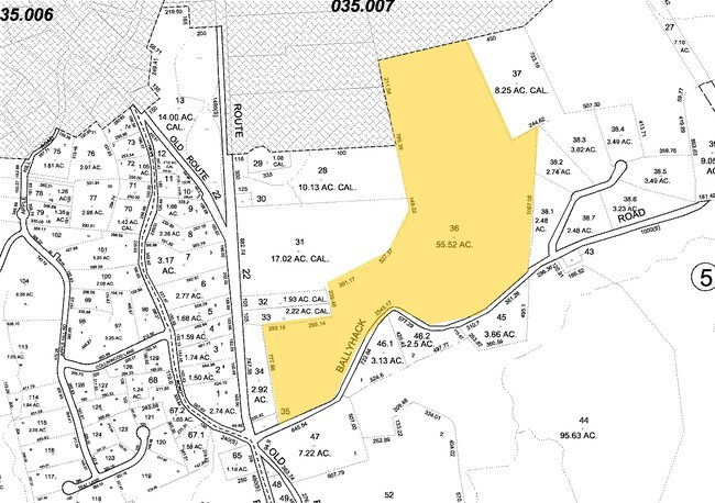
Ballyhack Rd
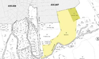
372400-035-000-0005-037-000-0000
PUTNAM
Vacantlandnec
New York
R4
36.00
B and X Area of moderate flood hazard, usually the area between the limits of the 100-year and 500-year floods.
8.25 AC
2024
Brewster
2025
Westchester/So Connecticut
010202
New York-Jersey City-White Plains, NY-NJ
NEARBY LISTINGS FOR SALE OR LEASE
DEMOGRAPHICS near Ballyhack Rd
1 mile
3 mile
5 mile
2025 Total Population
704
15,974
45,923
2030 Population
701
16,121
46,228
Pop Growth 2025-2030
(0.43%)
+ 0.92%
+ 0.66%
Average Age
43
44
43
2025 Total Households
237
5,545
16,265
HH Growth 2025-2030
0.00%
+ 0.96%
+ 0.64%
Median Household Inc
$211,905
$121,675
$122,438
Avg Household Size
3.00
2.70
2.70
2025 Avg HH Vehicles
3.00
2.00
2.00
Median Home Value
$552,885
$419,287
$433,854
Median Year Built
1983
1971
1970
Nearby Places
Map Layers
Map Styles
 Street
 Aerial
Layers
 Traffic
 Biking
Places
Listings with unknown addresses are not visible on the map
- Restaurants
- Banks
- Shops
- Fitness
- Groceries
PUBLIC TRANSPORTATION
COMMUTER RAIL
Patterson Station (Harlem Line - Metro-North Commuter Railroad Company (Metro-North))
Drive
Walk
Distance
Patterson Station (Harlem Line - Metro-North Commuter Railroad Company (Metro-North))
10 min
5.9 mi
Southeast Station (Harlem Line - Metro-North Commuter Railroad Company (Metro-North))
Drive
Walk
Distance
Southeast Station (Harlem Line - Metro-North Commuter Railroad Company (Metro-North))
17 min
7.2 mi
AIRPORT
Westchester County
Drive
Walk
Distance
Westchester County
41 min
30.7 mi
New York Stewart International
Drive
Walk
Distance
New York Stewart International
53 min
36.4 mi
Freight Ports
Port of New Haven
Drive
Walk
Distance
Port of New Haven
76 min
50.4 mi
Nearby Properties
Address
Land Use
TOTAL SIZE
Lot Size
Zoning
Address
Land Use
TOTAL SIZE
Lot Size
Zoning
1,498,293 SF
361.91 AC
R4
Address
Land Use
TOTAL SIZE
Lot Size
Zoning
290,658 SF
50.83 AC
R160
Address
Land Use
TOTAL SIZE
Lot Size
Zoning
170,015 SF
70.32 AC
R160
Address
Land Use
TOTAL SIZE
Lot Size
Zoning
146,484 SF
23.06 AC
SR 22
Address
Land Use
TOTAL SIZE
Lot Size
Zoning
116,000 SF
13.29 AC
SP Z
Address
Land Use
TOTAL SIZE
Lot Size
Zoning
12,064 SF
12.10 AC
C1
Address
Land Use
TOTAL SIZE
Lot Size
Zoning
109,593 SF
16.65 AC
C1
Address
Land Use
TOTAL SIZE
Lot Size
Zoning
122,538 SF
29.02 AC
MWFH
Address
Land Use
TOTAL SIZE
Lot Size
Zoning
48,811 SF
11.66 AC
OP2
Address
Land Use
TOTAL SIZE
Lot Size
Zoning
97,708 SF
11.42 AC
OP2
Address
Land Use
TOTAL SIZE
Lot Size
Zoning
150,000 SF
10.40 AC
OP2
Address
Land Use
TOTAL SIZE
Lot Size
Zoning
131,719 SF
19.05 AC
OP2
Address
Land Use
TOTAL SIZE
Lot Size
Zoning
63,221 SF
10 AC
SP Z
Address
Land Use
TOTAL SIZE
Lot Size
Zoning
178,472 SF
2.74 AC
R4
Address
Land Use
TOTAL SIZE
Lot Size
Zoning
29,369 SF
19.29 AC
SP Z
Address
Land Use
TOTAL SIZE
Lot Size
Zoning
131,700 SF
7.82 AC
OP2
Address
Land Use
TOTAL SIZE
Lot Size
Zoning
61,114 SF
6.06 AC
OP2
Address
Land Use
TOTAL SIZE
Lot Size
Zoning
109,516 SF
12.84 AC
SR 22
Address
Land Use
TOTAL SIZE
Lot Size
Zoning
101,890 SF
6.02 AC
OP1
Address
Land Use
TOTAL SIZE
Lot Size
Zoning
61,854 SF
8.93 AC
SR 22
Address
Land Use
TOTAL SIZE
Lot Size
Zoning
72,560 SF
11.25 AC
OP2
Address
Land Use
TOTAL SIZE
Lot Size
Zoning
Address
Land Use
TOTAL SIZE
Lot Size
Zoning
41,082 SF
21 AC
R4
Address
Land Use
TOTAL SIZE
Lot Size
Zoning
12,871 SF
277.38 AC
R4
Address
Land Use
TOTAL SIZE
Lot Size
Zoning
58,450 SF
7.38 AC
C1
Address
Land Use
TOTAL SIZE
Lot Size
Zoning
Address
Land Use
TOTAL SIZE
Lot Size
Zoning
55,331 SF
95.63 AC
R4
Address
Land Use
TOTAL SIZE
Lot Size
Zoning
Address
Land Use
TOTAL SIZE
Lot Size
Zoning
46.30 AC
SP Z
Address
Land Use
TOTAL SIZE
Lot Size
Zoning
4,000 SF
43.18 AC
RMF
The World's #1 Commercial Real Estate Marketplace
Connect with us
© 2026 CoStar Group
The information above has been obtained from sources believed reliable. While we do not doubt its accuracy we have not verified it and make no guarantee, warranty or representation about it. It is your responsibility to independently confirm its accuracy and completeness. Any projections, opinions, assumptions, or estimates used are for example only and do not represent the current or future performance of the property. The value of this transaction to you depends on tax and other factors which should be evaluated by your tax, financial, and legal advisors. You and your advisors should conduct a careful, independent investigation of the property to determine to your satisfaction the suitability of the property for your needs.