Property Record
Baptiste Dr, Paola, KS 66071

Property Detail
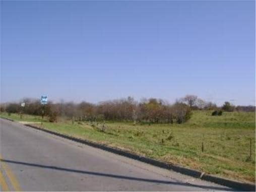
Baptiste Dr
Kansas City, MO-KS
PAOLA CROSSING 2ND PLAT, S15, T17, R23, ACRES 26.52, NWC S2 NE4 S367.9' SE323.7' SW264.4' SE167.3' S418.7' NE1883.3' W1691.40
135-15-0-00-00-006.00-0
MIAMI
Commercialnec
Kansas
B and X Area of moderate flood hazard, usually the area between the limits of the 100-year and 500-year floods.
26.52 AC
2025
Outer South Kansas City
2025
Kansas City
100601
NEARBY LISTINGS FOR SALE OR LEASE
-
-
View all Paola listings for sale on LoopNet.com
DEMOGRAPHICS near Baptiste Dr
1 mile
3 mile
5 mile
2025 Total Population
2,408
7,055
8,724
2030 Population
2,474
7,304
9,023
Pop Growth 2025-2030
+ 2.74%
+ 3.53%
+ 3.43%
Average Age
42
42
42
2025 Total Households
1,026
2,904
3,563
HH Growth 2025-2030
+ 2.83%
+ 3.62%
+ 3.56%
Median Household Inc
$60,361
$73,335
$76,852
Avg Household Size
2.20
2.30
2.30
2025 Avg HH Vehicles
2.00
2.00
2.00
Median Home Value
$210,526
$242,258
$260,451
Median Year Built
1970
1969
1973
Nearby Places
Map Layers
Map Styles
 Street
 Aerial
Layers
 Traffic
 Biking
Places
Listings with unknown addresses are not visible on the map
- Restaurants
- Banks
- Shops
- Fitness
- Groceries
SALE & LEASE HISTORY
LISTING DATE
SALE/LEASE

May 01, 2018
For Sale
Nearby Properties
Address
Land Use
TOTAL SIZE
Lot Size
Zoning
Address
Land Use
TOTAL SIZE
Lot Size
Zoning
45,759 SF
63.69 AC
Address
Land Use
TOTAL SIZE
Lot Size
Zoning
29,348 SF
0.81 AC
Address
Land Use
TOTAL SIZE
Lot Size
Zoning
52,836 SF
7.26 AC
Address
Land Use
TOTAL SIZE
Lot Size
Zoning
11,250 SF
30.50 AC
Address
Land Use
TOTAL SIZE
Lot Size
Zoning
64,224 SF
37.95 AC
Address
Land Use
TOTAL SIZE
Lot Size
Zoning
27,400 SF
0.77 AC
Address
Land Use
TOTAL SIZE
Lot Size
Zoning
7,200 SF
15.23 AC
PGA
Address
Land Use
TOTAL SIZE
Lot Size
Zoning
29,054 SF
18.25 AC
Address
Land Use
TOTAL SIZE
Lot Size
Zoning
8,424 SF
1.86 AC
Address
Land Use
TOTAL SIZE
Lot Size
Zoning
37,296 SF
1.74 AC
Address
Land Use
TOTAL SIZE
Lot Size
Zoning
17,264 SF
2.45 AC
Address
Land Use
TOTAL SIZE
Lot Size
Zoning
2,248 SF
0.27 AC
Address
Land Use
TOTAL SIZE
Lot Size
Zoning
23,563 SF
5.25 AC
Address
Land Use
TOTAL SIZE
Lot Size
Zoning
25,784 SF
1.73 AC
Address
Land Use
TOTAL SIZE
Lot Size
Zoning
8,791 SF
0.13 AC
Address
Land Use
TOTAL SIZE
Lot Size
Zoning
144,904 SF
18.23 AC
Address
Land Use
TOTAL SIZE
Lot Size
Zoning
25,048 SF
4.88 AC
Address
Land Use
TOTAL SIZE
Lot Size
Zoning
684 SF
18.52 AC
PGA
Address
Land Use
TOTAL SIZE
Lot Size
Zoning
175.83 AC
Address
Land Use
TOTAL SIZE
Lot Size
Zoning
3,532 SF
2.96 AC
Address
Land Use
TOTAL SIZE
Lot Size
Zoning
2,400 SF
2.91 AC
Address
Land Use
TOTAL SIZE
Lot Size
Zoning
14,828 SF
8.93 AC
Address
Land Use
TOTAL SIZE
Lot Size
Zoning
89,440 SF
40.97 AC
PGA
Address
Land Use
TOTAL SIZE
Lot Size
Zoning
6,606 SF
9.80 AC
Address
Land Use
TOTAL SIZE
Lot Size
Zoning
13,552 SF
4.50 AC
PGA
Address
Land Use
TOTAL SIZE
Lot Size
Zoning
108,696 SF
12.01 AC
Address
Land Use
TOTAL SIZE
Lot Size
Zoning
5,992 SF
0.70 AC
Address
Land Use
TOTAL SIZE
Lot Size
Zoning
15,000 SF
4.27 AC
Address
Land Use
TOTAL SIZE
Lot Size
Zoning
12,626 SF
0.55 AC
Address
Land Use
TOTAL SIZE
Lot Size
Zoning
3,825 SF
0.48 AC
The World's #1 Commercial Real Estate Marketplace
Connect with us
© 2026 CoStar Group
The information above has been obtained from sources believed reliable. While we do not doubt its accuracy we have not verified it and make no guarantee, warranty or representation about it. It is your responsibility to independently confirm its accuracy and completeness. Any projections, opinions, assumptions, or estimates used are for example only and do not represent the current or future performance of the property. The value of this transaction to you depends on tax and other factors which should be evaluated by your tax, financial, and legal advisors. You and your advisors should conduct a careful, independent investigation of the property to determine to your satisfaction the suitability of the property for your needs.