Property Record
Bastrop Hwy, Austin, TX 78742
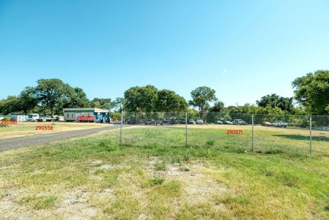

Property Detail
Bastrop Hwy
Austin-Round Rock-San Marcos, TX
ABS 24 DELVALLE S ACR .323
290571
TRAVIS
Vacantlandnec
Texas
B and X Area of moderate flood hazard, usually the area between the limits of the 100-year and 500-year floods.
0.36 AC
2025
Southeast
2025
Austin
002310
NEARBY LISTINGS FOR SALE OR LEASE
DEMOGRAPHICS near Bastrop Hwy
1 mile
3 mile
5 mile
2025 Total Population
3,776
46,447
175,273
2030 Population
4,020
49,670
186,521
Pop Growth 2025-2030
+ 6.46%
+ 6.94%
+ 6.42%
Average Age
34
34
35
2025 Total Households
1,148
18,582
73,466
HH Growth 2025-2030
+ 7.23%
+ 7.52%
+ 7.16%
Median Household Inc
$42,370
$75,320
$84,870
Avg Household Size
3.00
2.40
2.20
2025 Avg HH Vehicles
2.00
2.00
2.00
Median Home Value
$92,804
$415,950
$500,672
Median Year Built
2002
2005
2003
Nearby Places
Map Layers
Map Styles
 Street
 Aerial
Transit
 Traffic
 Biking
Places
Listings with unknown addresses are not visible on the map
- Restaurants
- Banks
- Shops
- Fitness
- Groceries
PUBLIC TRANSPORTATION
COMMUTER RAIL
Austin (Texas Eagle - Amtrak)
Drive
Walk
Distance
Austin (Texas Eagle - Amtrak)
13 min
6.8 mi
AIRPORT
Austin-Bergstrom International
Drive
Walk
Distance
Austin-Bergstrom International
15 min
6.7 mi
Freight Ports
Calhoun Port
Drive
Walk
Distance
Calhoun Port
180 min
150.2 mi
SALE & LEASE HISTORY
LISTING DATE
SALE/LEASE

Oct 31, 2023
For Sale
Nearby Properties
Address
Land Use
TOTAL SIZE
Lot Size
Zoning
Address
Land Use
TOTAL SIZE
Lot Size
Zoning
9,768 SF
386.80 AC
Address
Land Use
TOTAL SIZE
Lot Size
Zoning
942.08 AC
Address
Land Use
TOTAL SIZE
Lot Size
Zoning
307,610 SF
8.95 AC
Address
Land Use
TOTAL SIZE
Lot Size
Zoning
290,643 SF
13.59 AC
Address
Land Use
TOTAL SIZE
Lot Size
Zoning
91,639 SF
35.97 AC
Address
Land Use
TOTAL SIZE
Lot Size
Zoning
558,324 SF
45.12 AC
Address
Land Use
TOTAL SIZE
Lot Size
Zoning
255,483 SF
35 AC
Address
Land Use
TOTAL SIZE
Lot Size
Zoning
190,546 SF
5.85 AC
Address
Land Use
TOTAL SIZE
Lot Size
Zoning
301,125 SF
5.23 AC
Address
Land Use
TOTAL SIZE
Lot Size
Zoning
236,503 SF
6.86 AC
Address
Land Use
TOTAL SIZE
Lot Size
Zoning
272,084 SF
3.87 AC
Address
Land Use
TOTAL SIZE
Lot Size
Zoning
266,871 SF
9.13 AC
Address
Land Use
TOTAL SIZE
Lot Size
Zoning
297,552 SF
15.93 AC
Address
Land Use
TOTAL SIZE
Lot Size
Zoning
215,109 SF
4.09 AC
Address
Land Use
TOTAL SIZE
Lot Size
Zoning
193,788 SF
107.16 AC
Address
Land Use
TOTAL SIZE
Lot Size
Zoning
270,688 SF
8.37 AC
Address
Land Use
TOTAL SIZE
Lot Size
Zoning
206,608 SF
10.61 AC
Address
Land Use
TOTAL SIZE
Lot Size
Zoning
278,730 SF
19.78 AC
Address
Land Use
TOTAL SIZE
Lot Size
Zoning
451,140 SF
26.32 AC
Address
Land Use
TOTAL SIZE
Lot Size
Zoning
256,256 SF
9.79 AC
Address
Land Use
TOTAL SIZE
Lot Size
Zoning
231,473 SF
6.87 AC
Address
Land Use
TOTAL SIZE
Lot Size
Zoning
262,576 SF
15.68 AC
Address
Land Use
TOTAL SIZE
Lot Size
Zoning
231,634 SF
2.78 AC
Address
Land Use
TOTAL SIZE
Lot Size
Zoning
237,900 SF
9.22 AC
Address
Land Use
TOTAL SIZE
Lot Size
Zoning
323,360 SF
20.93 AC
Address
Land Use
TOTAL SIZE
Lot Size
Zoning
162,000 SF
12.62 AC
Address
Land Use
TOTAL SIZE
Lot Size
Zoning
172,423 SF
3.71 AC
Address
Land Use
TOTAL SIZE
Lot Size
Zoning
271,566 SF
13.83 AC
Address
Land Use
TOTAL SIZE
Lot Size
Zoning
368,244 SF
93.34 AC
Address
Land Use
TOTAL SIZE
Lot Size
Zoning
353,770 SF
23.97 AC
The World's #1 Commercial Real Estate Marketplace
Connect with us
© 2026 CoStar Group
The information above has been obtained from sources believed reliable. While we do not doubt its accuracy we have not verified it and make no guarantee, warranty or representation about it. It is your responsibility to independently confirm its accuracy and completeness. Any projections, opinions, assumptions, or estimates used are for example only and do not represent the current or future performance of the property. The value of this transaction to you depends on tax and other factors which should be evaluated by your tax, financial, and legal advisors. You and your advisors should conduct a careful, independent investigation of the property to determine to your satisfaction the suitability of the property for your needs.