Property Record
Baugh Springs Rd Sw, Mc Donald, TN 37353


NEARBY LISTINGS FOR SALE OR LEASE
-
-
View all Mc Donald listings for sale on LoopNet.com
Property Detail
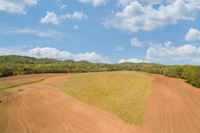
Baugh Springs Rd Sw
Cleveland, TN
DISTRICT: 2
063-005.03
Bradley
Agriculturalland
Tennessee
X
16.90 AC
47065C0300G
Tennessee East Area
0
Other Market Areas
2025
DEMOGRAPHICS near Baugh Springs Rd Sw
1 Mile
3 Mile
5 Mile
2024 Total Population
425
4,634
20,711
2029 Population
451
4,950
22,143
Pop Growth 2024-2029
+ 6.12%
+ 6.82%
+ 6.91%
Average Age
44
42
43
2024 Total Households
172
1,744
7,694
HH Growth 2024-2029
+ 6.40%
+ 6.88%
+ 6.98%
Median Household Inc
$58,695
$81,044
$88,429
Avg Household Size
2.40
2.60
2.60
2024 Avg HH Vehicles
2.00
2.00
2.00
Median Home Value
$193,420
$294,069
$310,854
Median Year Built
1993
2002
2002
Nearby Places
Map Layers
Map Styles
 Street
 Aerial
- Restaurants
- Banks
- Shops
- Fitness
- Groceries
PUBLIC TRANSPORTATION
AIRPORT
Lovell Field
DRIVE
WALK
Distance
Lovell Field
37 min
18.4 mi
Freight Ports
Georgia Ports - Savannah
DRIVE
WALK
Distance
Georgia Ports - Savannah
429 min
368.1 mi
SALE & LEASE HISTORY
LISTING DATE
SALE/LEASE

Apr 05, 2017
For Sale
Nearby Properties
Address
Land Use
TOTAL SIZE
Lot Size
Zoning
Address
Land Use
TOTAL SIZE
Lot Size
Zoning
231,000 SF
41.05 AC
IL
Address
Land Use
TOTAL SIZE
Lot Size
Zoning
41,981 SF
10 AC
A
Address
Land Use
TOTAL SIZE
Lot Size
Zoning
44,484 SF
6.70 AC
A
Address
Land Use
TOTAL SIZE
Lot Size
Zoning
54.99 AC
IL
Address
Land Use
TOTAL SIZE
Lot Size
Zoning
13,016 SF
164.60 AC
I2
Address
Land Use
TOTAL SIZE
Lot Size
Zoning
32 AC
CH
Address
Land Use
TOTAL SIZE
Lot Size
Zoning
101,840 SF
13.22 AC
IL
Address
Land Use
TOTAL SIZE
Lot Size
Zoning
33,584 SF
6.02 AC
A
Address
Land Use
TOTAL SIZE
Lot Size
Zoning
38.74 AC
IL
Address
Land Use
TOTAL SIZE
Lot Size
Zoning
30.60 AC
Address
Land Use
TOTAL SIZE
Lot Size
Zoning
22,904 SF
6.60 AC
A
Address
Land Use
TOTAL SIZE
Lot Size
Zoning
3,201 SF
100.02 AC
FAR
Address
Land Use
TOTAL SIZE
Lot Size
Zoning
31,855 SF
1,786.30 AC
FAR
Address
Land Use
TOTAL SIZE
Lot Size
Zoning
165.12 AC
CH
Address
Land Use
TOTAL SIZE
Lot Size
Zoning
1,777 SF
125 AC
FAR
Address
Land Use
TOTAL SIZE
Lot Size
Zoning
9,702 SF
4.01 AC
A
Address
Land Use
TOTAL SIZE
Lot Size
Zoning
4.99 AC
A
Address
Land Use
TOTAL SIZE
Lot Size
Zoning
Address
Land Use
TOTAL SIZE
Lot Size
Zoning
12,776 SF
5 AC
FAR
Address
Land Use
TOTAL SIZE
Lot Size
Zoning
11.50 AC
IL
Address
Land Use
TOTAL SIZE
Lot Size
Zoning
16,967 SF
6.50 AC
R1
Address
Land Use
TOTAL SIZE
Lot Size
Zoning
10.44 AC
IL
Address
Land Use
TOTAL SIZE
Lot Size
Zoning
8,418 SF
6.60 AC
FAR
Address
Land Use
TOTAL SIZE
Lot Size
Zoning
20,136 SF
37.94 AC
FAR
Address
Land Use
TOTAL SIZE
Lot Size
Zoning
3,113 SF
188.54 AC
FAR
Address
Land Use
TOTAL SIZE
Lot Size
Zoning
8.54 AC
IL
Address
Land Use
TOTAL SIZE
Lot Size
Zoning
9,943 SF
30 AC
FAR
Address
Land Use
TOTAL SIZE
Lot Size
Zoning
55,128 SF
3.91 AC
A
Address
Land Use
TOTAL SIZE
Lot Size
Zoning
10,512 SF
25.82 AC
FAR
Address
Land Use
TOTAL SIZE
Lot Size
Zoning
3,771 SF
1.01 AC
C2
The World's #1 Commercial Real Estate Marketplace
Connect with us
© 2026 CoStar Group
The information above has been obtained from sources believed reliable. While we do not doubt its accuracy we have not verified it and make no guarantee, warranty or representation about it. It is your responsibility to independently confirm its accuracy and completeness. Any projections, opinions, assumptions, or estimates used are for example only and do not represent the current or future performance of the property. The value of this transaction to you depends on tax and other factors which should be evaluated by your tax, financial, and legal advisors. You and your advisors should conduct a careful, independent investigation of the property to determine to your satisfaction the suitability of the property for your needs.