Property Record
Beasley Rd, Cartersville, GA 30120
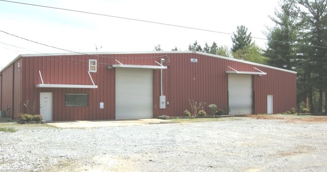
Property Detail
Beasley Rd
Atlanta-Sandy Springs-Roswell, GA
LL 972 D 17 S3
0052-0901-001
BARTOW
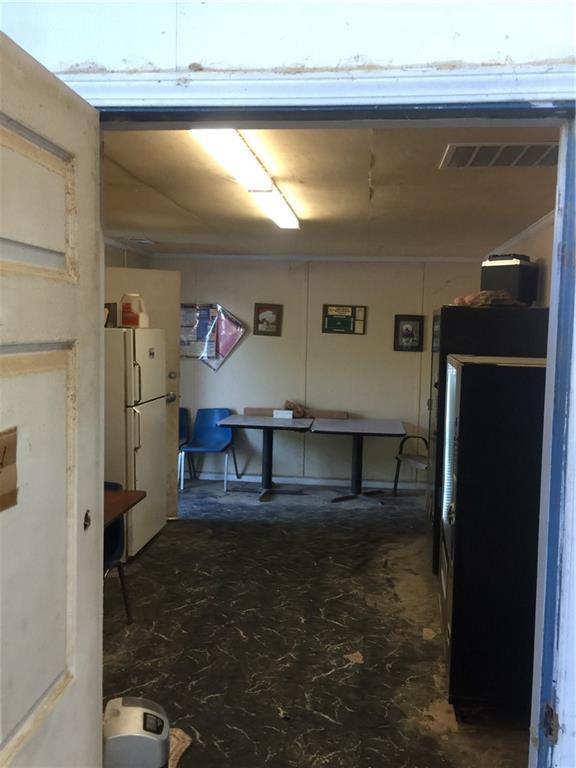
Industrialacreage
Georgia
I1
1-2
B and X Area of moderate flood hazard, usually the area between the limits of the 100-year and 500-year floods.
51.82 AC
2025
Kennesaw/Acworth
2025
Atlanta
961001
NEARBY LISTINGS FOR SALE OR LEASE
-
-
View all Cartersville listings for sale on LoopNet.com
DEMOGRAPHICS near Beasley Rd
1 mile
3 mile
5 mile
2025 Total Population
44
8,141
18,264
2030 Population
48
8,768
19,566
Pop Growth 2025-2030
+ 9.09%
+ 7.70%
+ 7.13%
Average Age
42
39
40
2025 Total Households
17
2,891
6,394
HH Growth 2025-2030
+ 5.88%
+ 7.78%
+ 7.18%
Median Household Inc
$87,500
$85,021
$90,001
Avg Household Size
2.50
2.80
2.80
2025 Avg HH Vehicles
2.00
2.00
3.00
Median Home Value
$259,999
$310,550
$323,849
Median Year Built
1989
1994
1994
Nearby Places
Map Layers
Map Styles
 Street
 Aerial
Transit
 Traffic
 Biking
Places
Listings with unknown addresses are not visible on the map
- Restaurants
- Banks
- Shops
- Fitness
- Groceries
SALE & LEASE HISTORY
LISTING DATE
SALE/LEASE

Jul 08, 2021
For Sale
Nearby Properties
Address
Land Use
TOTAL SIZE
Lot Size
Zoning
Address
Land Use
TOTAL SIZE
Lot Size
Zoning
94,726 SF
34.82 AC
Address
Land Use
TOTAL SIZE
Lot Size
Zoning
132,946 SF
26.63 AC
Address
Land Use
TOTAL SIZE
Lot Size
Zoning
2.74 AC
IN
Address
Land Use
TOTAL SIZE
Lot Size
Zoning
128.74 AC
A1
Address
Land Use
TOTAL SIZE
Lot Size
Zoning
242,214 SF
14.71 AC
IN
Address
Land Use
TOTAL SIZE
Lot Size
Zoning
85 AC
INDUSTRIAL
Address
Land Use
TOTAL SIZE
Lot Size
Zoning
58,074 SF
20.28 AC
I1
Address
Land Use
TOTAL SIZE
Lot Size
Zoning
99,532 SF
5.44 AC
IN
Address
Land Use
TOTAL SIZE
Lot Size
Zoning
15,297 SF
170.02 AC
A1
Address
Land Use
TOTAL SIZE
Lot Size
Zoning
57.89 AC
IN
Address
Land Use
TOTAL SIZE
Lot Size
Zoning
76,500 SF
Address
Land Use
TOTAL SIZE
Lot Size
Zoning
13,500 SF
55.40 AC
I2
Address
Land Use
TOTAL SIZE
Lot Size
Zoning
21,446 SF
14.87 AC
Address
Land Use
TOTAL SIZE
Lot Size
Zoning
25,480 SF
Address
Land Use
TOTAL SIZE
Lot Size
Zoning
24,840 SF
5.47 AC
Address
Land Use
TOTAL SIZE
Lot Size
Zoning
13,932 SF
7.82 AC
C1
Address
Land Use
TOTAL SIZE
Lot Size
Zoning
15,600 SF
4.25 AC
C1
Address
Land Use
TOTAL SIZE
Lot Size
Zoning
8,312 SF
3.51 AC
Address
Land Use
TOTAL SIZE
Lot Size
Zoning
34,440 SF
7.39 AC
C1
Address
Land Use
TOTAL SIZE
Lot Size
Zoning
26,900 SF
8 AC
Address
Land Use
TOTAL SIZE
Lot Size
Zoning
228.37 AC
A1
Address
Land Use
TOTAL SIZE
Lot Size
Zoning
184 AC
A1
Address
Land Use
TOTAL SIZE
Lot Size
Zoning
242.47 AC
A1
Address
Land Use
TOTAL SIZE
Lot Size
Zoning
54,000 SF
4 AC
IN
Address
Land Use
TOTAL SIZE
Lot Size
Zoning
199 AC
A1
Address
Land Use
TOTAL SIZE
Lot Size
Zoning
8.80 AC
Address
Land Use
TOTAL SIZE
Lot Size
Zoning
1,440 SF
35.45 AC
A1
Address
Land Use
TOTAL SIZE
Lot Size
Zoning
22.89 AC
IN
Address
Land Use
TOTAL SIZE
Lot Size
Zoning
8,840 SF
6 AC
A1
The World's #1 Commercial Real Estate Marketplace
Connect with us
© 2026 CoStar Group
The information above has been obtained from sources believed reliable. While we do not doubt its accuracy we have not verified it and make no guarantee, warranty or representation about it. It is your responsibility to independently confirm its accuracy and completeness. Any projections, opinions, assumptions, or estimates used are for example only and do not represent the current or future performance of the property. The value of this transaction to you depends on tax and other factors which should be evaluated by your tax, financial, and legal advisors. You and your advisors should conduct a careful, independent investigation of the property to determine to your satisfaction the suitability of the property for your needs.