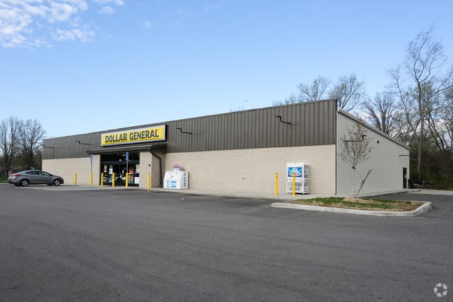
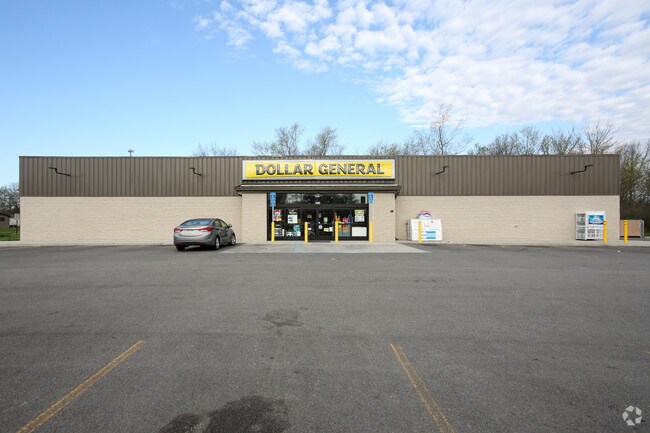
Property Record
Belmont, Girard, OH 44420
Property Detail
Belmont
Youngstown-Warren, OH
501 40 BELMONT PK LIBERTY AVE
12-430293
TRUMBULL
Departmentstore
Ohio
B and X Area of moderate flood hazard, usually the area between the limits of the 100-year and 500-year floods.
501
2025
0.10 AC
2025
Trumbull County
932000
Youngstown/Warren/Boardman
NEARBY LISTINGS FOR SALE OR LEASE
DEMOGRAPHICS near Belmont
1 mile
3 mile
5 mile
2025 Total Population
1,865
21,306
63,936
2030 Population
1,840
21,128
63,528
Pop Growth 2025-2030
(1.34%)
(0.84%)
(0.64%)
Average Age
45
43
43
2025 Total Households
785
9,327
27,596
HH Growth 2025-2030
(1.40%)
(0.88%)
(0.70%)
Median Household Inc
$68,586
$51,562
$46,728
Avg Household Size
2.30
2.20
2.20
2025 Avg HH Vehicles
2.00
2.00
2.00
Median Home Value
$156,842
$149,956
$136,097
Median Year Built
1967
1961
1961
Nearby Places
Map Layers
Map Styles
 Street
 Aerial
Layers
 Traffic
 Biking
Places
Listings with unknown addresses are not visible on the map
- Restaurants
- Banks
- Shops
- Fitness
- Groceries
SALE & LEASE HISTORY
LISTING DATE
SALE/LEASE

Jan 12, 2018
For Sale
Nearby Properties
Address
Land Use
TOTAL SIZE
Lot Size
Zoning
Address
Land Use
TOTAL SIZE
Lot Size
Zoning
67,680 SF
22.66 AC
Address
Land Use
TOTAL SIZE
Lot Size
Zoning
33,819 SF
25 AC
Address
Land Use
TOTAL SIZE
Lot Size
Zoning
6.58 AC
Address
Land Use
TOTAL SIZE
Lot Size
Zoning
55,398 SF
36.73 AC
Address
Land Use
TOTAL SIZE
Lot Size
Zoning
6,207 SF
0.88 AC
Address
Land Use
TOTAL SIZE
Lot Size
Zoning
116,176 SF
5.04 AC
Address
Land Use
TOTAL SIZE
Lot Size
Zoning
166,146 SF
22.30 AC
Address
Land Use
TOTAL SIZE
Lot Size
Zoning
9,999 SF
19.67 AC
Address
Land Use
TOTAL SIZE
Lot Size
Zoning
23,760 SF
7.40 AC
Address
Land Use
TOTAL SIZE
Lot Size
Zoning
53,934 SF
2.59 AC
Address
Land Use
TOTAL SIZE
Lot Size
Zoning
36,921 SF
3.47 AC
Address
Land Use
TOTAL SIZE
Lot Size
Zoning
66,738 SF
9.35 AC
Address
Land Use
TOTAL SIZE
Lot Size
Zoning
76,220 SF
12.16 AC
Address
Land Use
TOTAL SIZE
Lot Size
Zoning
72,771 SF
2.63 AC
Address
Land Use
TOTAL SIZE
Lot Size
Zoning
122,156 SF
10.77 AC
Address
Land Use
TOTAL SIZE
Lot Size
Zoning
2,012 SF
170 AC
Address
Land Use
TOTAL SIZE
Lot Size
Zoning
69,620 SF
40.15 AC
Address
Land Use
TOTAL SIZE
Lot Size
Zoning
36,544 SF
6.19 AC
Address
Land Use
TOTAL SIZE
Lot Size
Zoning
40,480 SF
7.34 AC
Address
Land Use
TOTAL SIZE
Lot Size
Zoning
47,026 SF
5.62 AC
Address
Land Use
TOTAL SIZE
Lot Size
Zoning
9,104 SF
4.50 AC
Address
Land Use
TOTAL SIZE
Lot Size
Zoning
17,913 SF
2.23 AC
Address
Land Use
TOTAL SIZE
Lot Size
Zoning
16,608 SF
2.50 AC
Address
Land Use
TOTAL SIZE
Lot Size
Zoning
45,368 SF
4.88 AC
Address
Land Use
TOTAL SIZE
Lot Size
Zoning
33,614 SF
43.10 AC
Address
Land Use
TOTAL SIZE
Lot Size
Zoning
25,320 SF
13.47 AC
Address
Land Use
TOTAL SIZE
Lot Size
Zoning
8.14 AC
Address
Land Use
TOTAL SIZE
Lot Size
Zoning
40,522 SF
5.45 AC
Address
Land Use
TOTAL SIZE
Lot Size
Zoning
5.31 AC
Address
Land Use
TOTAL SIZE
Lot Size
Zoning
20,742 SF
0.13 AC
The World's #1 Commercial Real Estate Marketplace
Connect with us
© 2026 CoStar Group
The information above has been obtained from sources believed reliable. While we do not doubt its accuracy we have not verified it and make no guarantee, warranty or representation about it. It is your responsibility to independently confirm its accuracy and completeness. Any projections, opinions, assumptions, or estimates used are for example only and do not represent the current or future performance of the property. The value of this transaction to you depends on tax and other factors which should be evaluated by your tax, financial, and legal advisors. You and your advisors should conduct a careful, independent investigation of the property to determine to your satisfaction the suitability of the property for your needs.