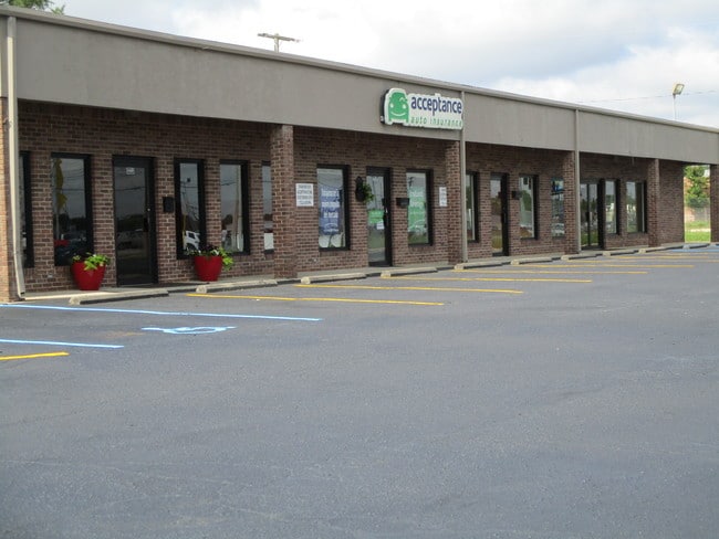
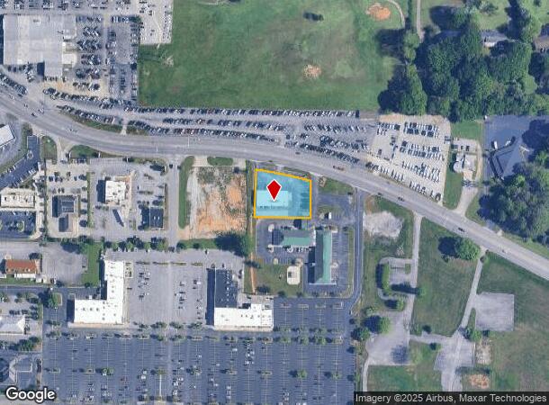
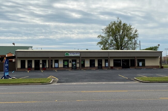
Property Record
1313 Point Mallard Pky Se, Decatur, AL 35601
NEARBY LISTINGS FOR SALE OR LEASE
Property Detail
1313 Point Mallard Pky Se
03-09-32-4-002-002.001
Handley Sub
Storebuilding
BEG AT SW COR OF THE SE1/4 OF SEC 32, T5S, R4W, TH E ALG SO BDRY 110', TH N ALG E R/W OF HWY 31 165', TH E 426.84', TH N 155.
X
Morgan
01103C0086F
Alabama
2025
0.70 AC
2024
Alabama North Area
005109
Other Market Areas
5,510 SF
Decatur, AL
DEMOGRAPHICS near 1313 Point Mallard Pky Se
1 Mile
3 Mile
5 Mile
2024 Total Population
1,525
37,015
61,575
2029 Population
1,527
37,145
61,949
Pop Growth 2024-2029
+ 0.13%
+ 0.35%
+ 0.61%
Average Age
39
39
40
2024 Total Households
626
14,912
25,020
HH Growth 2024-2029
+ 0.16%
+ 0.36%
+ 0.60%
Median Household Inc
$48,272
$47,300
$50,665
Avg Household Size
2.30
2.40
2.30
2024 Avg HH Vehicles
2.00
2.00
2.00
Median Home Value
$157,970
$149,339
$162,305
Median Year Built
1978
1973
1978
Nearby Places
Map Layers
Map Styles
 Street
 Aerial
- Restaurants
- Banks
- Shops
- Fitness
- Groceries
PUBLIC TRANSPORTATION
AIRPORT
Huntsville International-Carl T Jones Field
DRIVE
WALK
Distance
Huntsville International-Carl T Jones Field
30 min
19.0 mi
SALE & LEASE HISTORY
LISTING DATE
SALE/LEASE

Aug 22, 2019
For Lease
Nearby Properties
Address
Land Use
TOTAL SIZE
Lot Size
Zoning
Address
Land Use
TOTAL SIZE
Lot Size
Zoning
103,569 SF
6.69 AC
Address
Land Use
TOTAL SIZE
Lot Size
Zoning
7,812 SF
162 AC
Address
Land Use
TOTAL SIZE
Lot Size
Zoning
258,250 SF
55 AC
Address
Land Use
TOTAL SIZE
Lot Size
Zoning
133,056 SF
6.29 AC
Address
Land Use
TOTAL SIZE
Lot Size
Zoning
77,430 SF
19 AC
Address
Land Use
TOTAL SIZE
Lot Size
Zoning
157,720 SF
22 AC
Address
Land Use
TOTAL SIZE
Lot Size
Zoning
48,364 SF
1.80 AC
Address
Land Use
TOTAL SIZE
Lot Size
Zoning
40,212 SF
1.21 AC
Address
Land Use
TOTAL SIZE
Lot Size
Zoning
128,239 SF
7.10 AC
Address
Land Use
TOTAL SIZE
Lot Size
Zoning
51,958 SF
14 AC
Address
Land Use
TOTAL SIZE
Lot Size
Zoning
106,165 SF
0.80 AC
Address
Land Use
TOTAL SIZE
Lot Size
Zoning
377,685 SF
17 AC
Address
Land Use
TOTAL SIZE
Lot Size
Zoning
81,682 SF
13 AC
Address
Land Use
TOTAL SIZE
Lot Size
Zoning
205,279 SF
25.45 AC
Address
Land Use
TOTAL SIZE
Lot Size
Zoning
135,440 SF
6.76 AC
Address
Land Use
TOTAL SIZE
Lot Size
Zoning
220,128 SF
34 AC
Address
Land Use
TOTAL SIZE
Lot Size
Zoning
54,352 SF
10.70 AC
Address
Land Use
TOTAL SIZE
Lot Size
Zoning
40,712 SF
12 AC
Address
Land Use
TOTAL SIZE
Lot Size
Zoning
2,546 SF
9.30 AC
Address
Land Use
TOTAL SIZE
Lot Size
Zoning
64,449 SF
12 AC
Address
Land Use
TOTAL SIZE
Lot Size
Zoning
19,239 SF
4.50 AC
Address
Land Use
TOTAL SIZE
Lot Size
Zoning
4,865 SF
22 AC
Address
Land Use
TOTAL SIZE
Lot Size
Zoning
32,821 SF
1.68 AC
Address
Land Use
TOTAL SIZE
Lot Size
Zoning
4,181 SF
6.70 AC
Address
Land Use
TOTAL SIZE
Lot Size
Zoning
49,384 SF
1.07 AC
Address
Land Use
TOTAL SIZE
Lot Size
Zoning
52,800 SF
14.50 AC
Address
Land Use
TOTAL SIZE
Lot Size
Zoning
42,197 SF
3.75 AC
Address
Land Use
TOTAL SIZE
Lot Size
Zoning
53,680 SF
0.50 AC
Address
Land Use
TOTAL SIZE
Lot Size
Zoning
55,283 SF
4.48 AC
The World's #1 Commercial Real Estate Marketplace
Connect with us
© 2025 CoStar Group
The information above has been obtained from sources believed reliable. While we do not doubt its accuracy we have not verified it and make no guarantee, warranty or representation about it. It is your responsibility to independently confirm its accuracy and completeness. Any projections, opinions, assumptions, or estimates used are for example only and do not represent the current or future performance of the property. The value of this transaction to you depends on tax and other factors which should be evaluated by your tax, financial, and legal advisors. You and your advisors should conduct a careful, independent investigation of the property to determine to your satisfaction the suitability of the property for your needs.