Property Record
Bennett Rd, Hampden, MA 01036


Property Detail
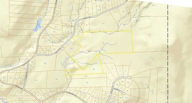
Bennett Rd
HAMP-000019-000062
HAMPDEN
Nonbuildableland
Massachusetts
C and X Area of minimal flood hazard, usually depicted on FIRMs as above the 500-year flood level.
61.82 AC
2025
Hampden County
2025
Hartford
813500
Springfield, MA
NEARBY LISTINGS FOR SALE OR LEASE
DEMOGRAPHICS near Bennett Rd
1 mile
3 mile
5 mile
2025 Total Population
518
4,293
21,622
2030 Population
521
4,282
21,676
Pop Growth 2025-2030
+ 0.58%
(0.26%)
+ 0.25%
Average Age
48
46
45
2025 Total Households
195
1,633
8,183
HH Growth 2025-2030
+ 0.51%
(0.37%)
+ 0.23%
Median Household Inc
$116,826
$114,002
$118,392
Avg Household Size
2.50
2.50
2.60
2025 Avg HH Vehicles
2.00
2.00
2.00
Median Home Value
$364,673
$363,861
$380,296
Median Year Built
1961
1967
1967
Nearby Places
Map Layers
Map Styles
 Street
 Aerial
Transit
 Traffic
 Biking
Places
Listings with unknown addresses are not visible on the map
- Restaurants
- Banks
- Shops
- Fitness
- Groceries
PUBLIC TRANSPORTATION
AIRPORT
Bradley International
Drive
Walk
Distance
Bradley International
48 min
22.9 mi
Worcester Regional
Drive
Walk
Distance
Worcester Regional
70 min
41.8 mi
Freight Ports
Port of Davisville, RI
Drive
Walk
Distance
Port of Davisville, RI
128 min
93.0 mi
Nearby Properties
Address
Land Use
TOTAL SIZE
Lot Size
Zoning
Address
Land Use
TOTAL SIZE
Lot Size
Zoning
231.55 AC
GR
Address
Land Use
TOTAL SIZE
Lot Size
Zoning
72,162 SF
23 AC
Address
Land Use
TOTAL SIZE
Lot Size
Zoning
58,185 SF
16.40 AC
Address
Land Use
TOTAL SIZE
Lot Size
Zoning
25,407 SF
3.11 AC
C
Address
Land Use
TOTAL SIZE
Lot Size
Zoning
6,815 SF
14.55 AC
Address
Land Use
TOTAL SIZE
Lot Size
Zoning
28,264 SF
1.90 AC
B
Address
Land Use
TOTAL SIZE
Lot Size
Zoning
Address
Land Use
TOTAL SIZE
Lot Size
Zoning
12,320 SF
15.45 AC
MU
Address
Land Use
TOTAL SIZE
Lot Size
Zoning
17,757 SF
1 AC
Address
Land Use
TOTAL SIZE
Lot Size
Zoning
1,583 SF
3.10 AC
Address
Land Use
TOTAL SIZE
Lot Size
Zoning
8,728 SF
0.48 AC
Address
Land Use
TOTAL SIZE
Lot Size
Zoning
182.62 AC
Address
Land Use
TOTAL SIZE
Lot Size
Zoning
4,164 SF
0.50 AC
BUS
Address
Land Use
TOTAL SIZE
Lot Size
Zoning
3,271 SF
1.37 AC
B
Address
Land Use
TOTAL SIZE
Lot Size
Zoning
10,905 SF
2.18 AC
BUS
Address
Land Use
TOTAL SIZE
Lot Size
Zoning
166 AC
R6
Address
Land Use
TOTAL SIZE
Lot Size
Zoning
11,603 SF
2.05 AC
BUS
Address
Land Use
TOTAL SIZE
Lot Size
Zoning
140.76 AC
Address
Land Use
TOTAL SIZE
Lot Size
Zoning
4,724 SF
0.64 AC
Address
Land Use
TOTAL SIZE
Lot Size
Zoning
8,181 SF
1.17 AC
B
Address
Land Use
TOTAL SIZE
Lot Size
Zoning
2,096 SF
0.84 AC
Address
Land Use
TOTAL SIZE
Lot Size
Zoning
3,046 SF
8.63 AC
BUS
Address
Land Use
TOTAL SIZE
Lot Size
Zoning
2,553 SF
3.36 AC
R6
Address
Land Use
TOTAL SIZE
Lot Size
Zoning
645 SF
0.23 AC
Address
Land Use
TOTAL SIZE
Lot Size
Zoning
5,072 SF
0.94 AC
Address
Land Use
TOTAL SIZE
Lot Size
Zoning
3.47 AC
BUS
Address
Land Use
TOTAL SIZE
Lot Size
Zoning
1,800 SF
58.27 AC
R60
Address
Land Use
TOTAL SIZE
Lot Size
Zoning
2.19 AC
R4
Address
Land Use
TOTAL SIZE
Lot Size
Zoning
1.34 AC
BUS
Address
Land Use
TOTAL SIZE
Lot Size
Zoning
23.76 AC
R60
The World's #1 Commercial Real Estate Marketplace
Connect with us
© 2026 CoStar Group
The information above has been obtained from sources believed reliable. While we do not doubt its accuracy we have not verified it and make no guarantee, warranty or representation about it. It is your responsibility to independently confirm its accuracy and completeness. Any projections, opinions, assumptions, or estimates used are for example only and do not represent the current or future performance of the property. The value of this transaction to you depends on tax and other factors which should be evaluated by your tax, financial, and legal advisors. You and your advisors should conduct a careful, independent investigation of the property to determine to your satisfaction the suitability of the property for your needs.