Property Record
Berend Rd, Pilot Point, TX 76258

Save to a Folder
{{folder.Name}}
{{folder.ListingIds.length}} Properties
{{folder.ListingIds.length}} Property
Create a New Folder
Property Detail
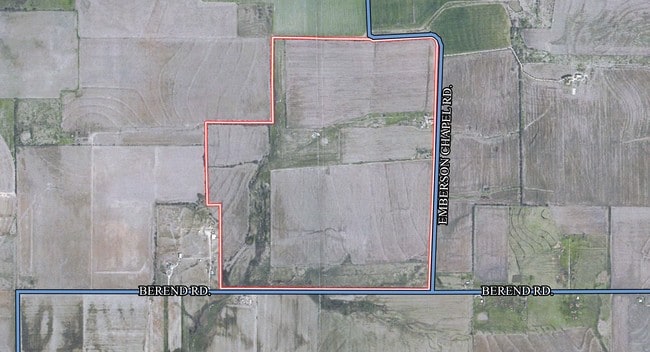
Berend Rd
135067
G-1131 SHANAHAN J B A-G1131, ACRES 180.144
Agriculturalland
GRAYSON
B and X Area of moderate flood hazard, usually the area between the limits of the 100-year and 500-year floods.
Texas
2024
180.14 AC
2025
Pilot Point
020129
Other Market Areas
1,090 SF
Sherman-Denison, TX
NEARBY LISTINGS FOR SALE OR LEASE
DEMOGRAPHICS near Berend Rd
1 mile
3 mile
5 mile
2025 Total Population
11
1,084
9,221
2030 Population
13
1,230
10,504
Pop Growth 2025-2030
+ 18.18%
+ 13.47%
+ 13.91%
Average Age
35
39
40
2025 Total Households
4
385
3,248
HH Growth 2025-2030
0.00%
+ 12.99%
+ 13.89%
Median Household Inc
$175,000
$94,344
$101,059
Avg Household Size
2.50
2.80
2.80
2025 Avg HH Vehicles
2.00
2.00
2.00
Median Home Value
$350,000
$369,871
$385,389
Median Year Built
2010
2002
2001
Nearby Places
Map Layers
Map Styles
 Street
 Aerial
Layers
 Traffic
 Biking
Places
Listings with unknown addresses are not visible on the map
- Restaurants
- Banks
- Shops
- Fitness
- Groceries
Nearby Properties
Address
Land Use
TOTAL SIZE
Lot Size
Zoning
Address
Land Use
TOTAL SIZE
Lot Size
Zoning
118,721 SF
4.68 AC
Address
Land Use
TOTAL SIZE
Lot Size
Zoning
312.59 AC
Address
Land Use
TOTAL SIZE
Lot Size
Zoning
210,260 SF
17.39 AC
Address
Land Use
TOTAL SIZE
Lot Size
Zoning
19,558 SF
2.53 AC
Address
Land Use
TOTAL SIZE
Lot Size
Zoning
51,500 SF
10 AC
Address
Land Use
TOTAL SIZE
Lot Size
Zoning
8,640 SF
16.40 AC
Address
Land Use
TOTAL SIZE
Lot Size
Zoning
1,200 SF
15 AC
Address
Land Use
TOTAL SIZE
Lot Size
Zoning
Address
Land Use
TOTAL SIZE
Lot Size
Zoning
41,862 SF
3.25 AC
Address
Land Use
TOTAL SIZE
Lot Size
Zoning
20,725 SF
1.86 AC
Address
Land Use
TOTAL SIZE
Lot Size
Zoning
8,146 SF
4.75 AC
Address
Land Use
TOTAL SIZE
Lot Size
Zoning
9,400 SF
0.98 AC
Address
Land Use
TOTAL SIZE
Lot Size
Zoning
23,276 SF
0.93 AC
12A
Address
Land Use
TOTAL SIZE
Lot Size
Zoning
23,808 SF
1.88 AC
Address
Land Use
TOTAL SIZE
Lot Size
Zoning
42,060 SF
2.10 AC
Address
Land Use
TOTAL SIZE
Lot Size
Zoning
25,665 SF
0.64 AC
Address
Land Use
TOTAL SIZE
Lot Size
Zoning
16,760 SF
0.79 AC
12A
Address
Land Use
TOTAL SIZE
Lot Size
Zoning
6,249 SF
11.93 AC
Address
Land Use
TOTAL SIZE
Lot Size
Zoning
5,484 SF
12.61 AC
Address
Land Use
TOTAL SIZE
Lot Size
Zoning
6,177 SF
2.67 AC
Address
Land Use
TOTAL SIZE
Lot Size
Zoning
138.03 AC
Address
Land Use
TOTAL SIZE
Lot Size
Zoning
9,504 SF
1.21 AC
Address
Land Use
TOTAL SIZE
Lot Size
Zoning
5,810 SF
13.45 AC
Address
Land Use
TOTAL SIZE
Lot Size
Zoning
16,952 SF
0.74 AC
Address
Land Use
TOTAL SIZE
Lot Size
Zoning
8.80 AC
Address
Land Use
TOTAL SIZE
Lot Size
Zoning
17,250 SF
0.61 AC
Address
Land Use
TOTAL SIZE
Lot Size
Zoning
20,700 SF
1.48 AC
Address
Land Use
TOTAL SIZE
Lot Size
Zoning
34,153 SF
3.67 AC
Address
Land Use
TOTAL SIZE
Lot Size
Zoning
3,279 SF
6.62 AC
Address
Land Use
TOTAL SIZE
Lot Size
Zoning
7.69 AC
The World's #1 Commercial Real Estate Marketplace
Connect with us
© 2026 CoStar Group
The information above has been obtained from sources believed reliable. While we do not doubt its accuracy we have not verified it and make no guarantee, warranty or representation about it. It is your responsibility to independently confirm its accuracy and completeness. Any projections, opinions, assumptions, or estimates used are for example only and do not represent the current or future performance of the property. The value of this transaction to you depends on tax and other factors which should be evaluated by your tax, financial, and legal advisors. You and your advisors should conduct a careful, independent investigation of the property to determine to your satisfaction the suitability of the property for your needs.