Property Record
Bert Winston Rd, Youngsville, NC 27596

NEARBY LISTINGS FOR SALE OR LEASE
Property Detail
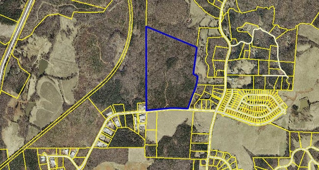
Bert Winston Rd
004577
Staunton
Vacantlandnec
Franklin
X
North Carolina
3720184400K
86.51 AC
2025
Franklin County
2025
Raleigh/Durham
060502
Raleigh-Cary, NC
DEMOGRAPHICS near Bert Winston Rd
1 Mile
3 Mile
5 Mile
2024 Total Population
1,280
16,056
29,765
2029 Population
1,595
19,909
36,687
Pop Growth 2024-2029
+ 24.61%
+ 24.00%
+ 23.26%
Average Age
37
39
39
2024 Total Households
450
6,091
11,187
HH Growth 2024-2029
+ 24.67%
+ 23.94%
+ 23.20%
Median Household Inc
$88,737
$67,177
$73,611
Avg Household Size
2.80
2.60
2.60
2024 Avg HH Vehicles
2.00
2.00
2.00
Median Home Value
$270,247
$246,361
$261,244
Median Year Built
2007
2003
2003
Nearby Places
Map Layers
Map Styles
 Street
 Aerial
- Restaurants
- Banks
- Shops
- Fitness
- Groceries
PUBLIC TRANSPORTATION
AIRPORT
Raleigh-Durham International
DRIVE
WALK
Distance
Raleigh-Durham International
48 min
29.2 mi
Freight Ports
Virginia Port Authority - Richmond
DRIVE
WALK
Distance
Virginia Port Authority - Richmond
155 min
126.5 mi
Nearby Properties
Address
Land Use
TOTAL SIZE
Lot Size
Zoning
Address
Land Use
TOTAL SIZE
Lot Size
Zoning
42,428 SF
77.35 AC
FCO R-8
Address
Land Use
TOTAL SIZE
Lot Size
Zoning
102,946 SF
43.23 AC
FCO GB
Address
Land Use
TOTAL SIZE
Lot Size
Zoning
20,981 SF
30.74 AC
FCO GB
Address
Land Use
TOTAL SIZE
Lot Size
Zoning
65,837 SF
30 AC
M U
Address
Land Use
TOTAL SIZE
Lot Size
Zoning
53,072 SF
20.91 AC
FCO GB
Address
Land Use
TOTAL SIZE
Lot Size
Zoning
63,604 SF
3.49 AC
C-2D
Address
Land Use
TOTAL SIZE
Lot Size
Zoning
112,694 SF
6.85 AC
M U
Address
Land Use
TOTAL SIZE
Lot Size
Zoning
117,140 SF
8.62 AC
M U
Address
Land Use
TOTAL SIZE
Lot Size
Zoning
3,813 SF
8.58 AC
MUD
Address
Land Use
TOTAL SIZE
Lot Size
Zoning
79,369 SF
4.62 AC
L I
Address
Land Use
TOTAL SIZE
Lot Size
Zoning
100,985 SF
10 AC
M U
Address
Land Use
TOTAL SIZE
Lot Size
Zoning
79,560 SF
9.43 AC
IND
Address
Land Use
TOTAL SIZE
Lot Size
Zoning
35,519 SF
15.46 AC
CIVIC
Address
Land Use
TOTAL SIZE
Lot Size
Zoning
27,618 SF
10 AC
C-3H
Address
Land Use
TOTAL SIZE
Lot Size
Zoning
5,600 SF
8.66 AC
M U-2
Address
Land Use
TOTAL SIZE
Lot Size
Zoning
1,680 SF
6.20 AC
RSH
Address
Land Use
TOTAL SIZE
Lot Size
Zoning
58,186 SF
63.99 AC
FCO HI
Address
Land Use
TOTAL SIZE
Lot Size
Zoning
58,678 SF
5.05 AC
M U
Address
Land Use
TOTAL SIZE
Lot Size
Zoning
59,900 SF
9.79 AC
M U
Address
Land Use
TOTAL SIZE
Lot Size
Zoning
65.20 AC
FCO R-8
Address
Land Use
TOTAL SIZE
Lot Size
Zoning
155.86 AC
FCO HI
Address
Land Use
TOTAL SIZE
Lot Size
Zoning
51,768 SF
8 AC
IND
Address
Land Use
TOTAL SIZE
Lot Size
Zoning
60,204 SF
10 AC
IND
Address
Land Use
TOTAL SIZE
Lot Size
Zoning
2,400 SF
1.90 AC
FCO NB
Address
Land Use
TOTAL SIZE
Lot Size
Zoning
82.67 AC
LI
Address
Land Use
TOTAL SIZE
Lot Size
Zoning
50.19 AC
FCO GB
Address
Land Use
TOTAL SIZE
Lot Size
Zoning
54,500 SF
4.06 AC
M U
Address
Land Use
TOTAL SIZE
Lot Size
Zoning
12,600 SF
2.34 AC
C 3H
Address
Land Use
TOTAL SIZE
Lot Size
Zoning
340.33 AC
FCO R-8
Address
Land Use
TOTAL SIZE
Lot Size
Zoning
10,956 SF
1.49 AC
C-3H
The World's #1 Commercial Real Estate Marketplace
Connect with us
© 2026 CoStar Group
The information above has been obtained from sources believed reliable. While we do not doubt its accuracy we have not verified it and make no guarantee, warranty or representation about it. It is your responsibility to independently confirm its accuracy and completeness. Any projections, opinions, assumptions, or estimates used are for example only and do not represent the current or future performance of the property. The value of this transaction to you depends on tax and other factors which should be evaluated by your tax, financial, and legal advisors. You and your advisors should conduct a careful, independent investigation of the property to determine to your satisfaction the suitability of the property for your needs.