Property Record
Bethel Rd, Simpsonville, SC 29681


NEARBY LISTINGS FOR SALE OR LEASE
Property Detail
Bethel Rd
Greenville-Anderson-Mauldin, SC
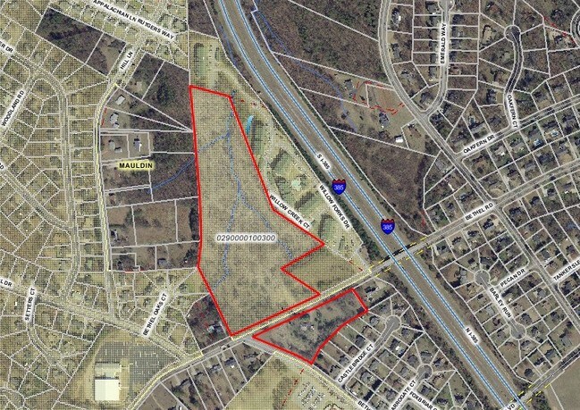
MAP 0290.00
0290.00-01-003.11
Greenville
Residentialacreage
South Carolina
X
003.11
45045C0419E
2.20 AC
2024
Mauldin/Fountain
2024
Greenville/Spartanburg
003008
DEMOGRAPHICS near Bethel Rd
1 Mile
3 Mile
5 Mile
2024 Total Population
5,776
53,587
137,424
2029 Population
6,338
59,091
151,821
Pop Growth 2024-2029
+ 9.73%
+ 10.27%
+ 10.48%
Average Age
42
41
40
2024 Total Households
2,407
21,478
54,722
HH Growth 2024-2029
+ 9.85%
+ 10.43%
+ 10.65%
Median Household Inc
$70,192
$85,766
$85,843
Avg Household Size
2.40
2.50
2.50
2024 Avg HH Vehicles
2.00
2.00
2.00
Median Home Value
$211,129
$249,776
$262,799
Median Year Built
1991
1996
1999
Nearby Places
Map Layers
Map Styles
 Street
 Aerial
- Restaurants
- Banks
- Shops
- Fitness
- Groceries
PUBLIC TRANSPORTATION
AIRPORT
Greenville Spartanburg International
DRIVE
WALK
Distance
Greenville Spartanburg International
24 min
11.4 mi
Freight Ports
North Charleston Terminal
DRIVE
WALK
Distance
North Charleston Terminal
221 min
193.3 mi
Nearby Properties
Address
Land Use
TOTAL SIZE
Lot Size
Zoning
Address
Land Use
TOTAL SIZE
Lot Size
Zoning
10.20 AC
R12
Address
Land Use
TOTAL SIZE
Lot Size
Zoning
23.23 AC
Address
Land Use
TOTAL SIZE
Lot Size
Zoning
11.91 AC
RM20
Address
Land Use
TOTAL SIZE
Lot Size
Zoning
6.27 AC
UVD
Address
Land Use
TOTAL SIZE
Lot Size
Zoning
12.31 AC
Address
Land Use
TOTAL SIZE
Lot Size
Zoning
17.59 AC
Address
Land Use
TOTAL SIZE
Lot Size
Zoning
29.21 AC
I1
Address
Land Use
TOTAL SIZE
Lot Size
Zoning
Address
Land Use
TOTAL SIZE
Lot Size
Zoning
Address
Land Use
TOTAL SIZE
Lot Size
Zoning
195.23 AC
RRROW
Address
Land Use
TOTAL SIZE
Lot Size
Zoning
9.46 AC
I1
Address
Land Use
TOTAL SIZE
Lot Size
Zoning
50.76 AC
PDC
Address
Land Use
TOTAL SIZE
Lot Size
Zoning
96.14 AC
NZ
Address
Land Use
TOTAL SIZE
Lot Size
Zoning
26.30 AC
ROI
Address
Land Use
TOTAL SIZE
Lot Size
Zoning
51.30 AC
RS
Address
Land Use
TOTAL SIZE
Lot Size
Zoning
2.97 AC
S1
Address
Land Use
TOTAL SIZE
Lot Size
Zoning
Address
Land Use
TOTAL SIZE
Lot Size
Zoning
3.20 AC
I1
Address
Land Use
TOTAL SIZE
Lot Size
Zoning
3,487 SF
18.52 AC
R15
Address
Land Use
TOTAL SIZE
Lot Size
Zoning
13.24 AC
ID
Address
Land Use
TOTAL SIZE
Lot Size
Zoning
16.05 AC
R12
Address
Land Use
TOTAL SIZE
Lot Size
Zoning
15.33 AC
S1
Address
Land Use
TOTAL SIZE
Lot Size
Zoning
17.07 AC
R12
Address
Land Use
TOTAL SIZE
Lot Size
Zoning
12.87 AC
RLO
Address
Land Use
TOTAL SIZE
Lot Size
Zoning
1,155 SF
34.77 AC
I1
Address
Land Use
TOTAL SIZE
Lot Size
Zoning
25.26 AC
RS
Address
Land Use
TOTAL SIZE
Lot Size
Zoning
4.74 AC
I1
Address
Land Use
TOTAL SIZE
Lot Size
Zoning
25.30 AC
R15
Address
Land Use
TOTAL SIZE
Lot Size
Zoning
3.55 AC
I1
Address
Land Use
TOTAL SIZE
Lot Size
Zoning
22.50 AC
RRROW
The World's #1 Commercial Real Estate Marketplace
Connect with us
© 2026 CoStar Group
The information above has been obtained from sources believed reliable. While we do not doubt its accuracy we have not verified it and make no guarantee, warranty or representation about it. It is your responsibility to independently confirm its accuracy and completeness. Any projections, opinions, assumptions, or estimates used are for example only and do not represent the current or future performance of the property. The value of this transaction to you depends on tax and other factors which should be evaluated by your tax, financial, and legal advisors. You and your advisors should conduct a careful, independent investigation of the property to determine to your satisfaction the suitability of the property for your needs.