Property Record
Bethlehem Pike, Hatfield, PA 19440
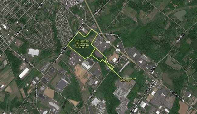
Property Detail
Bethlehem Pike
Philadelphia-Camden-Wilmington, PA-NJ-DE-MD
U 4-12-41
35-00-00367-003
MONTGOMERY
Industrialacreage
Pennsylvania
LI
3
B and X Area of moderate flood hazard, usually the area between the limits of the 100-year and 500-year floods.
33.50 AC
2024
West Montgomery County
2025
Philadelphia
200707
NEARBY LISTINGS FOR SALE OR LEASE
DEMOGRAPHICS near Bethlehem Pike
1 mile
3 mile
5 mile
2025 Total Population
2,488
50,929
138,130
2030 Population
2,558
52,947
141,274
Pop Growth 2025-2030
+ 2.81%
+ 3.96%
+ 2.28%
Average Age
49
43
42
2025 Total Households
1,085
19,410
52,721
HH Growth 2025-2030
+ 2.76%
+ 3.64%
+ 2.15%
Median Household Inc
$90,753
$100,006
$103,774
Avg Household Size
2.30
2.60
2.50
2025 Avg HH Vehicles
2.00
2.00
2.00
Median Home Value
$402,074
$410,957
$425,448
Median Year Built
1986
1979
1979
Nearby Places
Map Layers
Map Styles
 Street
 Aerial
Layers
 Traffic
 Biking
Places
Listings with unknown addresses are not visible on the map
- Restaurants
- Banks
- Shops
- Fitness
- Groceries
PUBLIC TRANSPORTATION
COMMUTER RAIL
Link Belt (R5 - Southeastern Pennsylvania Transportation Authority Regional Rail (SEPTA Regional Rail))
Drive
Walk
Distance
Link Belt (R5 - Southeastern Pennsylvania Transportation Authority Regional Rail (SEPTA Regional Rail))
7 min
4.1 mi
Colmar (R5 - Southeastern Pennsylvania Transportation Authority Regional Rail (SEPTA Regional Rail))
Drive
Walk
Distance
Colmar (R5 - Southeastern Pennsylvania Transportation Authority Regional Rail (SEPTA Regional Rail))
7 min
4.1 mi
AIRPORT
Lehigh Valley International
Drive
Walk
Distance
Lehigh Valley International
49 min
29.2 mi
Trenton Mercer
Drive
Walk
Distance
Trenton Mercer
58 min
34.4 mi
Philadelphia International
Drive
Walk
Distance
Philadelphia International
61 min
41.6 mi
Freight Ports
Port of Philadelphia
Drive
Walk
Distance
Port of Philadelphia
46 min
28.3 mi
SALE & LEASE HISTORY
LISTING DATE
SALE/LEASE

Mar 05, 2019
For Sale
Nearby Properties
Address
Land Use
TOTAL SIZE
Lot Size
Zoning
Address
Land Use
TOTAL SIZE
Lot Size
Zoning
437,908 SF
104.29 AC
INST
Address
Land Use
TOTAL SIZE
Lot Size
Zoning
977,439 SF
70.93 AC
GA
Address
Land Use
TOTAL SIZE
Lot Size
Zoning
412,306 SF
40.91 AC
I
Address
Land Use
TOTAL SIZE
Lot Size
Zoning
139,733 SF
46.65 AC
R130
Address
Land Use
TOTAL SIZE
Lot Size
Zoning
832,830 SF
53.72 AC
LI
Address
Land Use
TOTAL SIZE
Lot Size
Zoning
253,915 SF
17.78 AC
GA
Address
Land Use
TOTAL SIZE
Lot Size
Zoning
219,869 SF
41.98 AC
LI
Address
Land Use
TOTAL SIZE
Lot Size
Zoning
373,104 SF
31.94 AC
LI
Address
Land Use
TOTAL SIZE
Lot Size
Zoning
131,631 SF
18.12 AC
SC
Address
Land Use
TOTAL SIZE
Lot Size
Zoning
220,124 SF
33.16 AC
SC
Address
Land Use
TOTAL SIZE
Lot Size
Zoning
152,085 SF
38.16 AC
INST
Address
Land Use
TOTAL SIZE
Lot Size
Zoning
168,557 SF
44.77 AC
RA1
Address
Land Use
TOTAL SIZE
Lot Size
Zoning
444,718 SF
46.51 AC
LI
Address
Land Use
TOTAL SIZE
Lot Size
Zoning
324,796 SF
42.20 AC
LI
Address
Land Use
TOTAL SIZE
Lot Size
Zoning
216,372 SF
18.46 AC
INST
Address
Land Use
TOTAL SIZE
Lot Size
Zoning
502,169 SF
83.16 AC
LI
Address
Land Use
TOTAL SIZE
Lot Size
Zoning
35.37 AC
LI
Address
Land Use
TOTAL SIZE
Lot Size
Zoning
213,542 SF
26.53 AC
LI
Address
Land Use
TOTAL SIZE
Lot Size
Zoning
184,471 SF
0.80 AC
INST
Address
Land Use
TOTAL SIZE
Lot Size
Zoning
65,178 SF
16.86 AC
B
Address
Land Use
TOTAL SIZE
Lot Size
Zoning
198,551 SF
21.17 AC
LI
Address
Land Use
TOTAL SIZE
Lot Size
Zoning
94,598 SF
27.72 AC
INST
Address
Land Use
TOTAL SIZE
Lot Size
Zoning
77,878 SF
17.60 AC
INST
Address
Land Use
TOTAL SIZE
Lot Size
Zoning
301,131 SF
18.98 AC
LI
Address
Land Use
TOTAL SIZE
Lot Size
Zoning
230,016 SF
11.27 AC
LI
Address
Land Use
TOTAL SIZE
Lot Size
Zoning
182,010 SF
12.25 AC
LI
Address
Land Use
TOTAL SIZE
Lot Size
Zoning
40,754 SF
6.23 AC
LI
Address
Land Use
TOTAL SIZE
Lot Size
Zoning
95,494 SF
13.67 AC
C
Address
Land Use
TOTAL SIZE
Lot Size
Zoning
71,153 SF
20.48 AC
A1
Address
Land Use
TOTAL SIZE
Lot Size
Zoning
60,470 SF
14.60 AC
ER
The World's #1 Commercial Real Estate Marketplace
Connect with us
© 2026 CoStar Group
The information above has been obtained from sources believed reliable. While we do not doubt its accuracy we have not verified it and make no guarantee, warranty or representation about it. It is your responsibility to independently confirm its accuracy and completeness. Any projections, opinions, assumptions, or estimates used are for example only and do not represent the current or future performance of the property. The value of this transaction to you depends on tax and other factors which should be evaluated by your tax, financial, and legal advisors. You and your advisors should conduct a careful, independent investigation of the property to determine to your satisfaction the suitability of the property for your needs.