Property Record
Between Beith Rd & Welter Rd, Maple Park, IL 60151

NEARBY LISTINGS FOR SALE OR LEASE
Property Detail
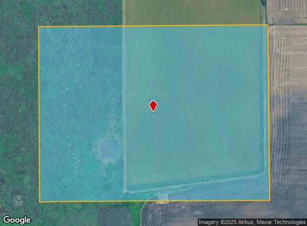
Between Beith Rd & Welter Rd
07-24-400-001
Kane
Farms
Illinois
X
1
17089C0250J
31 AC
2024
Western East/West Corr
2024
Chicago
852403
Chicago-Naperville-Elgin, IL-IN-WI
DEMOGRAPHICS near Between Beith Rd & Welter Rd
1 Mile
3 Mile
5 Mile
2024 Total Population
0
6,105
16,215
2029 Population
0
5,924
15,815
Pop Growth 2024-2029
0.00%
(2.96%)
(2.47%)
Average Age
0
43
41
2024 Total Households
0
2,162
5,587
HH Growth 2024-2029
0.00%
(3.10%)
(2.58%)
Median Household Inc
$0
$122,086
$131,891
Avg Household Size
.00
2.80
2.90
2024 Avg HH Vehicles
.00
2.00
3.00
Median Home Value
$0
$367,870
$379,342
Median Year Built
0
1988
1988
Nearby Places
Map Layers
Map Styles
 Street
 Aerial
- Restaurants
- Banks
- Shops
- Fitness
- Groceries
PUBLIC TRANSPORTATION
COMMUTER RAIL
Elburn Station (Union Pacific West Line - Northeast Illinois Regional Commuter Railroad (Metra))
DRIVE
WALK
Distance
Elburn Station (Union Pacific West Line - Northeast Illinois Regional Commuter Railroad (Metra))
12 min
4.6 mi
La Fox Station (Union Pacific West Line - Northeast Illinois Regional Commuter Railroad (Metra))
DRIVE
WALK
Distance
La Fox Station (Union Pacific West Line - Northeast Illinois Regional Commuter Railroad (Metra))
18 min
8.1 mi
Freight Ports
Port Milwaukee
DRIVE
WALK
Distance
Port Milwaukee
143 min
102.4 mi
Nearby Properties
Address
Land Use
TOTAL SIZE
Lot Size
Zoning
Address
Land Use
TOTAL SIZE
Lot Size
Zoning
61,500 SF
7.34 AC
Address
Land Use
TOTAL SIZE
Lot Size
Zoning
3,794 SF
11.81 AC
Address
Land Use
TOTAL SIZE
Lot Size
Zoning
0.47 AC
Address
Land Use
TOTAL SIZE
Lot Size
Zoning
2.90 AC
Address
Land Use
TOTAL SIZE
Lot Size
Zoning
14,700 SF
1.84 AC
Address
Land Use
TOTAL SIZE
Lot Size
Zoning
10,543 SF
1.31 AC
Address
Land Use
TOTAL SIZE
Lot Size
Zoning
3.02 AC
Address
Land Use
TOTAL SIZE
Lot Size
Zoning
11,150 SF
1.48 AC
Address
Land Use
TOTAL SIZE
Lot Size
Zoning
17,200 SF
3.32 AC
Address
Land Use
TOTAL SIZE
Lot Size
Zoning
21,600 SF
2.54 AC
Address
Land Use
TOTAL SIZE
Lot Size
Zoning
3.17 AC
Address
Land Use
TOTAL SIZE
Lot Size
Zoning
7,000 SF
3.35 AC
Address
Land Use
TOTAL SIZE
Lot Size
Zoning
10,076 SF
1.50 AC
Address
Land Use
TOTAL SIZE
Lot Size
Zoning
1.39 AC
Address
Land Use
TOTAL SIZE
Lot Size
Zoning
2,520 SF
0.71 AC
Address
Land Use
TOTAL SIZE
Lot Size
Zoning
3,018 SF
1.46 AC
Address
Land Use
TOTAL SIZE
Lot Size
Zoning
10,325 SF
1.34 AC
Address
Land Use
TOTAL SIZE
Lot Size
Zoning
1.47 AC
Address
Land Use
TOTAL SIZE
Lot Size
Zoning
Address
Land Use
TOTAL SIZE
Lot Size
Zoning
1.11 AC
Address
Land Use
TOTAL SIZE
Lot Size
Zoning
4,128 SF
4.67 AC
Address
Land Use
TOTAL SIZE
Lot Size
Zoning
10,000 SF
0.87 AC
Address
Land Use
TOTAL SIZE
Lot Size
Zoning
10,010 SF
0.89 AC
Address
Land Use
TOTAL SIZE
Lot Size
Zoning
Address
Land Use
TOTAL SIZE
Lot Size
Zoning
5.90 AC
Address
Land Use
TOTAL SIZE
Lot Size
Zoning
0.93 AC
Address
Land Use
TOTAL SIZE
Lot Size
Zoning
0.83 AC
Address
Land Use
TOTAL SIZE
Lot Size
Zoning
4,173 SF
0.31 AC
The World's #1 Commercial Real Estate Marketplace
Connect with us
© 2025 CoStar Group
The information above has been obtained from sources believed reliable. While we do not doubt its accuracy we have not verified it and make no guarantee, warranty or representation about it. It is your responsibility to independently confirm its accuracy and completeness. Any projections, opinions, assumptions, or estimates used are for example only and do not represent the current or future performance of the property. The value of this transaction to you depends on tax and other factors which should be evaluated by your tax, financial, and legal advisors. You and your advisors should conduct a careful, independent investigation of the property to determine to your satisfaction the suitability of the property for your needs.