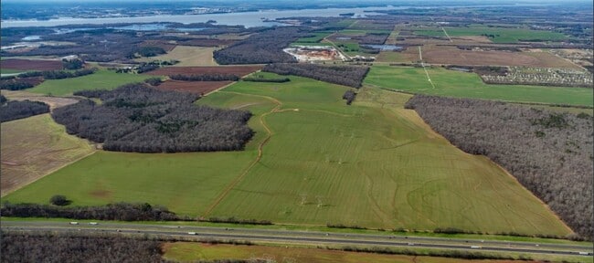
Property Record
Between Highway 31 S, Tanner, AL 35671


NEARBY LISTINGS FOR SALE OR LEASE
Property Detail
Between Highway 31 S
16-05-15-0-000-001.000
W/4 E/2 IN SEC 15 4 4ANNEXED INTO CITY OF HUNTSVILLE ORD #23-659
Cropfieldcropsrowcropsallsoilclasses
Limestone
AE
Alabama
01083C0279F
58 AC
2025
Outlying Limestone County
2025
Huntsville
021101
Huntsville, AL
DEMOGRAPHICS near Between Highway 31 S
1 Mile
3 Mile
5 Mile
2024 Total Population
0
1,427
5,823
2029 Population
0
1,700
6,930
Pop Growth 2024-2029
0.00%
+ 19.13%
+ 19.01%
Average Age
0
44
42
2024 Total Households
0
582
2,263
HH Growth 2024-2029
0.00%
+ 19.59%
+ 19.49%
Median Household Inc
$0
$55,819
$80,021
Avg Household Size
.00
2.40
2.60
2024 Avg HH Vehicles
.00
2.00
2.00
Median Home Value
$0
$271,578
$275,999
Median Year Built
0
1995
2001
Nearby Places
Map Layers
Map Styles
 Street
 Aerial
- Restaurants
- Banks
- Shops
- Fitness
- Groceries
PUBLIC TRANSPORTATION
AIRPORT
Huntsville International-Carl T Jones Field
DRIVE
WALK
Distance
Huntsville International-Carl T Jones Field
27 min
18.2 mi
Freight Ports
Port of Mobile
DRIVE
WALK
Distance
Port of Mobile
377 min
343.2 mi
SALE & LEASE HISTORY
LISTING DATE
SALE/LEASE

Feb 07, 2020
For Sale
Aug 29, 2022
For Sale
Nearby Properties
Address
Land Use
TOTAL SIZE
Lot Size
Zoning
Address
Land Use
TOTAL SIZE
Lot Size
Zoning
2,926 SF
190.98 AC
Address
Land Use
TOTAL SIZE
Lot Size
Zoning
492,372 SF
90.64 AC
Address
Land Use
TOTAL SIZE
Lot Size
Zoning
55,196 SF
21.21 AC
Address
Land Use
TOTAL SIZE
Lot Size
Zoning
Address
Land Use
TOTAL SIZE
Lot Size
Zoning
6,878 SF
139.27 AC
Address
Land Use
TOTAL SIZE
Lot Size
Zoning
2,156 SF
107 AC
Address
Land Use
TOTAL SIZE
Lot Size
Zoning
76,800 SF
15 AC
Address
Land Use
TOTAL SIZE
Lot Size
Zoning
568 SF
8.25 AC
Address
Land Use
TOTAL SIZE
Lot Size
Zoning
24.20 AC
Address
Land Use
TOTAL SIZE
Lot Size
Zoning
5,500 SF
8 AC
Address
Land Use
TOTAL SIZE
Lot Size
Zoning
27,360 SF
4.80 AC
Address
Land Use
TOTAL SIZE
Lot Size
Zoning
52,644 SF
10 AC
Address
Land Use
TOTAL SIZE
Lot Size
Zoning
246.29 AC
Address
Land Use
TOTAL SIZE
Lot Size
Zoning
196.30 AC
Address
Land Use
TOTAL SIZE
Lot Size
Zoning
18,462 SF
2.90 AC
Address
Land Use
TOTAL SIZE
Lot Size
Zoning
2,400 SF
19.86 AC
Address
Land Use
TOTAL SIZE
Lot Size
Zoning
17,196 SF
3 AC
Address
Land Use
TOTAL SIZE
Lot Size
Zoning
8,960 SF
0.51 AC
Address
Land Use
TOTAL SIZE
Lot Size
Zoning
Address
Land Use
TOTAL SIZE
Lot Size
Zoning
316 SF
43.50 AC
Address
Land Use
TOTAL SIZE
Lot Size
Zoning
219 AC
Address
Land Use
TOTAL SIZE
Lot Size
Zoning
8,250 SF
1.20 AC
Address
Land Use
TOTAL SIZE
Lot Size
Zoning
11,924 SF
3 AC
Address
Land Use
TOTAL SIZE
Lot Size
Zoning
700 SF
62 AC
Address
Land Use
TOTAL SIZE
Lot Size
Zoning
3,700 SF
13 AC
Address
Land Use
TOTAL SIZE
Lot Size
Zoning
7,037 SF
2.01 AC
Address
Land Use
TOTAL SIZE
Lot Size
Zoning
10.60 AC
Address
Land Use
TOTAL SIZE
Lot Size
Zoning
5,000 SF
1 AC
Address
Land Use
TOTAL SIZE
Lot Size
Zoning
146 AC
Address
Land Use
TOTAL SIZE
Lot Size
Zoning
12,770 SF
3 AC
The World's #1 Commercial Real Estate Marketplace
Connect with us
© 2026 CoStar Group
The information above has been obtained from sources believed reliable. While we do not doubt its accuracy we have not verified it and make no guarantee, warranty or representation about it. It is your responsibility to independently confirm its accuracy and completeness. Any projections, opinions, assumptions, or estimates used are for example only and do not represent the current or future performance of the property. The value of this transaction to you depends on tax and other factors which should be evaluated by your tax, financial, and legal advisors. You and your advisors should conduct a careful, independent investigation of the property to determine to your satisfaction the suitability of the property for your needs.