Property Record
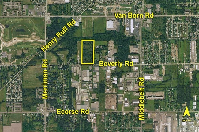
Beverly, Romulus, MI 48174


Property Detail
Beverly
Detroit-Warren-Dearborn, MI
02E1 THE E 3/5 OF THE S E 1/4 OF THE N W 1/4 OF SEC 2 EXCEPT THE WEST 5 ACRES THEREOF 19.02 ACRES
80-006-99-0005-000
WAYNE
Industrialacreage
Michigan
M1-LIG
0005
B and X Area of moderate flood hazard, usually the area between the limits of the 100-year and 500-year floods.
18.55 AC
2025
Airport District
2025
Detroit
985400
NEARBY LISTINGS FOR SALE OR LEASE
DEMOGRAPHICS near Beverly
1 mile
3 mile
5 mile
2025 Total Population
6,532
62,436
190,802
2030 Population
6,547
62,177
187,988
Pop Growth 2025-2030
+ 0.23%
(0.41%)
(1.47%)
Average Age
39
39
40
2025 Total Households
2,621
24,447
75,851
HH Growth 2025-2030
+ 0.11%
(0.53%)
(1.53%)
Median Household Inc
$52,172
$53,964
$63,075
Avg Household Size
2.40
2.50
2.50
2025 Avg HH Vehicles
2.00
2.00
2.00
Median Home Value
$122,391
$133,838
$162,226
Median Year Built
1969
1959
1958
Nearby Places
Map Layers
Map Styles
 Street
 Aerial
Transit
 Traffic
 Biking
Places
Listings with unknown addresses are not visible on the map
- Restaurants
- Banks
- Shops
- Fitness
- Groceries
PUBLIC TRANSPORTATION
COMMUTER RAIL
Drive
Walk
Distance
17 min
7.8 mi
AIRPORT
Detroit Metro Wayne County
Drive
Walk
Distance
Detroit Metro Wayne County
13 min
5.7 mi
Windsor International
Drive
Walk
Distance
Windsor International
49 min
29.4 mi
Freight Ports
Drive
Walk
Distance
69 min
53.5 mi
Nearby Properties
Address
Land Use
TOTAL SIZE
Lot Size
Zoning
Address
Land Use
TOTAL SIZE
Lot Size
Zoning
857,173 SF
84.70 AC
M-1/COND
Address
Land Use
TOTAL SIZE
Lot Size
Zoning
108,809 SF
AP-AIRPORT
Address
Land Use
TOTAL SIZE
Lot Size
Zoning
354,968 SF
25.72 AC
RC/M-1
Address
Land Use
TOTAL SIZE
Lot Size
Zoning
366,820 SF
20.83 AC
RC/M-1
Address
Land Use
TOTAL SIZE
Lot Size
Zoning
366,820 SF
20.72 AC
RC/M-1
Address
Land Use
TOTAL SIZE
Lot Size
Zoning
268,272 SF
22.70 AC
M-1/COND
Address
Land Use
TOTAL SIZE
Lot Size
Zoning
920,139 SF
56.56 AC
M2-GEN
Address
Land Use
TOTAL SIZE
Lot Size
Zoning
244,760 SF
22.63 AC
M-1/COND
Address
Land Use
TOTAL SIZE
Lot Size
Zoning
260,000 SF
20.50 AC
M-T
Address
Land Use
TOTAL SIZE
Lot Size
Zoning
186,738 SF
15.89 AC
RM-MLTI
Address
Land Use
TOTAL SIZE
Lot Size
Zoning
302,868 SF
19.94 AC
M-T
Address
Land Use
TOTAL SIZE
Lot Size
Zoning
6,128 SF
50.14 AC
RC-REG
Address
Land Use
TOTAL SIZE
Lot Size
Zoning
312,000 SF
21.91 AC
M-T
Address
Land Use
TOTAL SIZE
Lot Size
Zoning
299,904 SF
20.13 AC
M-T
Address
Land Use
TOTAL SIZE
Lot Size
Zoning
299,904 SF
18.68 AC
M-T
Address
Land Use
TOTAL SIZE
Lot Size
Zoning
165,200 SF
14.85 AC
M-1/COND
Address
Land Use
TOTAL SIZE
Lot Size
Zoning
1,278 SF
17.59 AC
M-T
Address
Land Use
TOTAL SIZE
Lot Size
Zoning
960 SF
62.42 AC
RC-REG
Address
Land Use
TOTAL SIZE
Lot Size
Zoning
280,510 SF
32.49 AC
M-T
Address
Land Use
TOTAL SIZE
Lot Size
Zoning
132,248 SF
5.96 AC
RC-REG
Address
Land Use
TOTAL SIZE
Lot Size
Zoning
261,835 SF
45.99 AC
M-T
Address
Land Use
TOTAL SIZE
Lot Size
Zoning
235,200 SF
21.93 AC
M-T
Address
Land Use
TOTAL SIZE
Lot Size
Zoning
207,205 SF
28.02 AC
I-1
Address
Land Use
TOTAL SIZE
Lot Size
Zoning
266,094 SF
22.92 AC
M-T
Address
Land Use
TOTAL SIZE
Lot Size
Zoning
354,444 SF
20.10 AC
I-1
Address
Land Use
TOTAL SIZE
Lot Size
Zoning
467,594 SF
34.54 AC
IND-B IND
Address
Land Use
TOTAL SIZE
Lot Size
Zoning
92,404 SF
24.63 AC
RC-REG
Address
Land Use
TOTAL SIZE
Lot Size
Zoning
92,404 SF
24.63 AC
RC-REG
Address
Land Use
TOTAL SIZE
Lot Size
Zoning
99.86 AC
Address
Land Use
TOTAL SIZE
Lot Size
Zoning
285,374 SF
6.73 AC
RC-REG
The World's #1 Commercial Real Estate Marketplace
Connect with us
© 2026 CoStar Group
The information above has been obtained from sources believed reliable. While we do not doubt its accuracy we have not verified it and make no guarantee, warranty or representation about it. It is your responsibility to independently confirm its accuracy and completeness. Any projections, opinions, assumptions, or estimates used are for example only and do not represent the current or future performance of the property. The value of this transaction to you depends on tax and other factors which should be evaluated by your tax, financial, and legal advisors. You and your advisors should conduct a careful, independent investigation of the property to determine to your satisfaction the suitability of the property for your needs.