Property Record
Bill Davis Rd, Manning, SC 29102

Property Detail
Bill Davis Rd
060-00-00-030-00
CLARENDON
Agriculturalland
South Carolina
AE The base floodplain where base flood elevations are provided. AE Zones are now used on new format FIRMs instead of A1-A30 Zones.
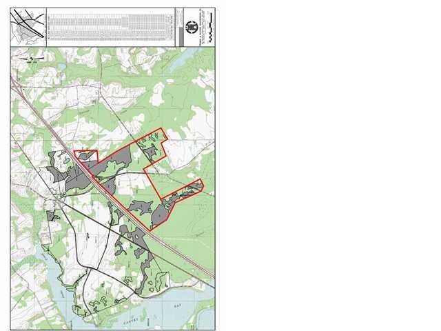
150.27 AC
2025
Orangeburg/Sumter
2025
Other Market Areas
960802
NEARBY LISTINGS FOR SALE OR LEASE
-
-
View all Manning listings for sale on LoopNet.com
DEMOGRAPHICS near Bill Davis Rd
1 mile
3 mile
5 mile
2025 Total Population
33
857
3,881
2030 Population
34
871
3,879
Pop Growth 2025-2030
+ 3.03%
+ 1.63%
(0.05%)
Average Age
51
49
49
2025 Total Households
15
381
1,707
HH Growth 2025-2030
0.00%
+ 1.57%
(0.12%)
Median Household Inc
$57,499
$37,222
$40,320
Avg Household Size
2.10
2.20
2.20
2025 Avg HH Vehicles
3.00
2.00
2.00
Median Home Value
$183,333
$143,220
$166,967
Median Year Built
1988
1986
1986
Nearby Places
Map Layers
Map Styles
 Street
 Aerial
Layers
 Traffic
 Biking
Places
Listings with unknown addresses are not visible on the map
- Restaurants
- Banks
- Shops
- Fitness
- Groceries
Nearby Properties
Address
Land Use
TOTAL SIZE
Lot Size
Zoning
Address
Land Use
TOTAL SIZE
Lot Size
Zoning
361.28 AC
Address
Land Use
TOTAL SIZE
Lot Size
Zoning
Address
Land Use
TOTAL SIZE
Lot Size
Zoning
Address
Land Use
TOTAL SIZE
Lot Size
Zoning
615.39 AC
Address
Land Use
TOTAL SIZE
Lot Size
Zoning
10.64 AC
Address
Land Use
TOTAL SIZE
Lot Size
Zoning
Address
Land Use
TOTAL SIZE
Lot Size
Zoning
3,042 SF
1,008.26 AC
Address
Land Use
TOTAL SIZE
Lot Size
Zoning
Address
Land Use
TOTAL SIZE
Lot Size
Zoning
4,990 SF
1.90 AC
Address
Land Use
TOTAL SIZE
Lot Size
Zoning
103.20 AC
Address
Land Use
TOTAL SIZE
Lot Size
Zoning
Address
Land Use
TOTAL SIZE
Lot Size
Zoning
2.60 AC
Address
Land Use
TOTAL SIZE
Lot Size
Zoning
8,102 SF
5.04 AC
Address
Land Use
TOTAL SIZE
Lot Size
Zoning
Address
Land Use
TOTAL SIZE
Lot Size
Zoning
Address
Land Use
TOTAL SIZE
Lot Size
Zoning
Address
Land Use
TOTAL SIZE
Lot Size
Zoning
0.83 AC
Address
Land Use
TOTAL SIZE
Lot Size
Zoning
5,702 SF
1.20 AC
Address
Land Use
TOTAL SIZE
Lot Size
Zoning
4,068 SF
0.93 AC
Address
Land Use
TOTAL SIZE
Lot Size
Zoning
Address
Land Use
TOTAL SIZE
Lot Size
Zoning
39 AC
Address
Land Use
TOTAL SIZE
Lot Size
Zoning
540.18 AC
Address
Land Use
TOTAL SIZE
Lot Size
Zoning
Address
Land Use
TOTAL SIZE
Lot Size
Zoning
25.33 AC
Address
Land Use
TOTAL SIZE
Lot Size
Zoning
1,183 SF
1 AC
Address
Land Use
TOTAL SIZE
Lot Size
Zoning
476.67 AC
Address
Land Use
TOTAL SIZE
Lot Size
Zoning
328.18 AC
Address
Land Use
TOTAL SIZE
Lot Size
Zoning
6.32 AC
Address
Land Use
TOTAL SIZE
Lot Size
Zoning
418.77 AC
The World's #1 Commercial Real Estate Marketplace
Connect with us
© 2026 CoStar Group
The information above has been obtained from sources believed reliable. While we do not doubt its accuracy we have not verified it and make no guarantee, warranty or representation about it. It is your responsibility to independently confirm its accuracy and completeness. Any projections, opinions, assumptions, or estimates used are for example only and do not represent the current or future performance of the property. The value of this transaction to you depends on tax and other factors which should be evaluated by your tax, financial, and legal advisors. You and your advisors should conduct a careful, independent investigation of the property to determine to your satisfaction the suitability of the property for your needs.