Property Record
Billingsley Rd, Waldorf, MD 20602

Property Detail
Billingsley Rd
08-356166
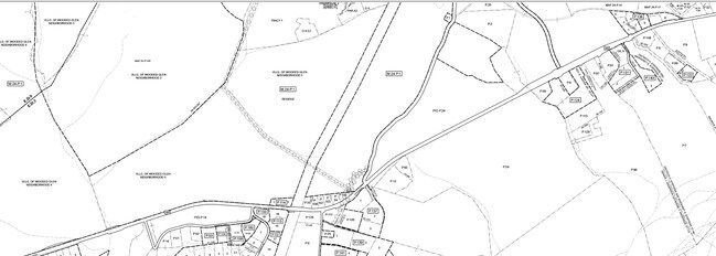
OPSP 18.8415 AC N RT 488 PINEY CHURCH RD
Commercialnec
CHARLES
PUD
Maryland
B and X Area of moderate flood hazard, usually the area between the limits of the 100-year and 500-year floods.
19.77 AC
0
Charles County
2025
Washington, DC
850906
Washington-Arlington-Alexandria, DC-VA-MD-WV
NEARBY LISTINGS FOR SALE OR LEASE
DEMOGRAPHICS near Billingsley Rd
1 mile
3 mile
5 mile
2025 Total Population
701
28,694
65,245
2030 Population
742
29,886
67,900
Pop Growth 2025-2030
+ 5.85%
+ 4.15%
+ 4.07%
Average Age
37
38
39
2025 Total Households
247
10,411
23,898
HH Growth 2025-2030
+ 5.67%
+ 4.26%
+ 4.16%
Median Household Inc
$117,916
$106,584
$101,672
Avg Household Size
2.80
2.70
2.70
2025 Avg HH Vehicles
2.00
2.00
2.00
Median Home Value
$466,666
$406,233
$392,755
Median Year Built
2011
1995
1992
Nearby Places
Map Layers
Map Styles
 Street
 Aerial
Layers
 Traffic
 Biking
Places
Listings with unknown addresses are not visible on the map
- Restaurants
- Banks
- Shops
- Fitness
- Groceries
PUBLIC TRANSPORTATION
AIRPORT
Ronald Reagan Washington Ntl
Drive
Walk
Distance
Ronald Reagan Washington Ntl
53 min
32.4 mi
Freight Ports
Port of Baltimore
Drive
Walk
Distance
Port of Baltimore
88 min
59.3 mi
SALE & LEASE HISTORY
LISTING DATE
SALE/LEASE

Sep 13, 2022
For Sale
Nearby Properties
Address
Land Use
TOTAL SIZE
Lot Size
Zoning
Address
Land Use
TOTAL SIZE
Lot Size
Zoning
289,883 SF
98.95 AC
PUD
Address
Land Use
TOTAL SIZE
Lot Size
Zoning
287,760 SF
16.27 AC
PUD
Address
Land Use
TOTAL SIZE
Lot Size
Zoning
250,272 SF
12.37 AC
PUD
Address
Land Use
TOTAL SIZE
Lot Size
Zoning
239,608 SF
11.28 AC
PUD
Address
Land Use
TOTAL SIZE
Lot Size
Zoning
239,208 SF
13.51 AC
PUD
Address
Land Use
TOTAL SIZE
Lot Size
Zoning
207,928 SF
15.50 AC
PUD
Address
Land Use
TOTAL SIZE
Lot Size
Zoning
141,578 SF
7.40 AC
PUD
Address
Land Use
TOTAL SIZE
Lot Size
Zoning
42.74 AC
PUD
Address
Land Use
TOTAL SIZE
Lot Size
Zoning
86,880 SF
22.18 AC
PUD
Address
Land Use
TOTAL SIZE
Lot Size
Zoning
145,749 SF
20.15 AC
PUD
Address
Land Use
TOTAL SIZE
Lot Size
Zoning
118,880 SF
3.78 AC
PUD
Address
Land Use
TOTAL SIZE
Lot Size
Zoning
121,968 SF
2.23 AC
PUD
Address
Land Use
TOTAL SIZE
Lot Size
Zoning
53,318 SF
20.01 AC
PUD
Address
Land Use
TOTAL SIZE
Lot Size
Zoning
84,240 SF
16.46 AC
PUD
Address
Land Use
TOTAL SIZE
Lot Size
Zoning
19,422 SF
76.18 AC
PUD
Address
Land Use
TOTAL SIZE
Lot Size
Zoning
83,328 SF
10.34 AC
PUD
Address
Land Use
TOTAL SIZE
Lot Size
Zoning
241,444 SF
10.76 AC
PUD
Address
Land Use
TOTAL SIZE
Lot Size
Zoning
191,746 SF
10.46 AC
PUD
Address
Land Use
TOTAL SIZE
Lot Size
Zoning
105,800 SF
73.87 AC
PUD
Address
Land Use
TOTAL SIZE
Lot Size
Zoning
41,004 SF
3.97 AC
RM
Address
Land Use
TOTAL SIZE
Lot Size
Zoning
76,819 SF
21.66 AC
RH
Address
Land Use
TOTAL SIZE
Lot Size
Zoning
44,510 SF
5.53 AC
PUD
Address
Land Use
TOTAL SIZE
Lot Size
Zoning
71,064 SF
20.42 AC
PUD
Address
Land Use
TOTAL SIZE
Lot Size
Zoning
177,123 SF
23.01 AC
PUD
Address
Land Use
TOTAL SIZE
Lot Size
Zoning
93,267 SF
6.12 AC
CC
Address
Land Use
TOTAL SIZE
Lot Size
Zoning
52,112 SF
1.45 AC
PUD
Address
Land Use
TOTAL SIZE
Lot Size
Zoning
103,000 SF
5.38 AC
IG
Address
Land Use
TOTAL SIZE
Lot Size
Zoning
60,903 SF
8.57 AC
UNK
Address
Land Use
TOTAL SIZE
Lot Size
Zoning
63,584 SF
8.08 AC
PUD
Address
Land Use
TOTAL SIZE
Lot Size
Zoning
71,532 SF
5.89 AC
PUD
The World's #1 Commercial Real Estate Marketplace
Connect with us
© 2026 CoStar Group
The information above has been obtained from sources believed reliable. While we do not doubt its accuracy we have not verified it and make no guarantee, warranty or representation about it. It is your responsibility to independently confirm its accuracy and completeness. Any projections, opinions, assumptions, or estimates used are for example only and do not represent the current or future performance of the property. The value of this transaction to you depends on tax and other factors which should be evaluated by your tax, financial, and legal advisors. You and your advisors should conduct a careful, independent investigation of the property to determine to your satisfaction the suitability of the property for your needs.