Property Record
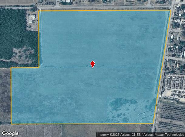
Billman Rd Nebreska Rd, Donna, TX 78537


NEARBY LISTINGS FOR SALE OR LEASE
Property Detail
Billman Rd Nebreska Rd
McAllen/Edinburg/Pharr
Hill Halbert - Seb
McAllen-Edinburg-Mission, TX
HILL HALBERT BLK 209 & S659.85-E325.19 BLK 210 48.76AC GR 46.10AC NET
H3475-00-209-0000-00
Hidalgo
Privatepreserveopenspacevacantlandforestlandconservation
Texas
2024
46.10 AC
2025
Outlying Hidalgo County
022109
DEMOGRAPHICS near Billman Rd Nebreska Rd
1 mile
3 mile
5 mile
2024 Total Population
4,383
55,005
133,384
2029 Population
4,725
58,737
141,462
Pop Growth 2024-2029
+ 7.80%
+ 6.78%
+ 6.06%
Average Age
35
35
34
2024 Total Households
1,311
15,985
37,322
HH Growth 2024-2029
+ 8.24%
+ 7.27%
+ 6.28%
Median Household Inc
$36,791
$35,855
$39,492
Avg Household Size
3.30
3.40
3.50
2024 Avg HH Vehicles
2.00
2.00
2.00
Median Home Value
$60,078
$70,525
$80,747
Median Year Built
1998
1995
1997
Nearby Places
Map Layers
Map Styles
 Street
 Aerial
Transit
 Traffic
 Biking
Places
Listings with unknown addresses are not visible on the map
- Restaurants
- Banks
- Shops
- Fitness
- Groceries
PUBLIC TRANSPORTATION
AIRPORT
McAllen International
Drive
Walk
Distance
McAllen International
19 min
12.6 mi
Valley International
Drive
Walk
Distance
Valley International
39 min
30.1 mi
Freight Ports
Port of Brownsville
Drive
Walk
Distance
Port of Brownsville
57 min
49.4 mi
SALE & LEASE HISTORY
LISTING DATE
SALE/LEASE

Sep 24, 2016
For Sale
Nearby Properties
Address
Land Use
TOTAL SIZE
Lot Size
Zoning
Address
Land Use
TOTAL SIZE
Lot Size
Zoning
109,578 SF
7.61 AC
Address
Land Use
TOTAL SIZE
Lot Size
Zoning
122,491 SF
28.72 AC
Address
Land Use
TOTAL SIZE
Lot Size
Zoning
137,414 SF
10 AC
Address
Land Use
TOTAL SIZE
Lot Size
Zoning
89,319 SF
29 AC
Address
Land Use
TOTAL SIZE
Lot Size
Zoning
240,421 SF
22.59 AC
Address
Land Use
TOTAL SIZE
Lot Size
Zoning
125,297 SF
21.80 AC
Address
Land Use
TOTAL SIZE
Lot Size
Zoning
1 SF
30 AC
CO
Address
Land Use
TOTAL SIZE
Lot Size
Zoning
216,738 SF
20.43 AC
Address
Land Use
TOTAL SIZE
Lot Size
Zoning
101,338 SF
21.50 AC
Address
Land Use
TOTAL SIZE
Lot Size
Zoning
114,263 SF
19.94 AC
Address
Land Use
TOTAL SIZE
Lot Size
Zoning
Address
Land Use
TOTAL SIZE
Lot Size
Zoning
1 SF
16.01 AC
Address
Land Use
TOTAL SIZE
Lot Size
Zoning
154,704 SF
25.81 AC
Address
Land Use
TOTAL SIZE
Lot Size
Zoning
74,640 SF
13.42 AC
Address
Land Use
TOTAL SIZE
Lot Size
Zoning
40,000 SF
2.70 AC
Address
Land Use
TOTAL SIZE
Lot Size
Zoning
1 SF
26.10 AC
Address
Land Use
TOTAL SIZE
Lot Size
Zoning
16,434 SF
13.78 AC
Address
Land Use
TOTAL SIZE
Lot Size
Zoning
46,796 SF
24 AC
Address
Land Use
TOTAL SIZE
Lot Size
Zoning
38,920 SF
11.10 AC
Address
Land Use
TOTAL SIZE
Lot Size
Zoning
1 SF
20.69 AC
Address
Land Use
TOTAL SIZE
Lot Size
Zoning
49,577 SF
3.10 AC
Address
Land Use
TOTAL SIZE
Lot Size
Zoning
35.14 AC
CO
Address
Land Use
TOTAL SIZE
Lot Size
Zoning
79,020 SF
15.48 AC
Address
Land Use
TOTAL SIZE
Lot Size
Zoning
25,146 SF
29.09 AC
RMH
Address
Land Use
TOTAL SIZE
Lot Size
Zoning
1 SF
18.33 AC
Address
Land Use
TOTAL SIZE
Lot Size
Zoning
71,811 SF
6.11 AC
Address
Land Use
TOTAL SIZE
Lot Size
Zoning
102,365 SF
6.67 AC
Address
Land Use
TOTAL SIZE
Lot Size
Zoning
192,776 SF
19.92 AC
Address
Land Use
TOTAL SIZE
Lot Size
Zoning
81,880 SF
6.95 AC
Address
Land Use
TOTAL SIZE
Lot Size
Zoning
332,033 SF
57.19 AC
The World's #1 Commercial Real Estate Marketplace
Connect with us
© 2026 CoStar Group
The information above has been obtained from sources believed reliable. While we do not doubt its accuracy we have not verified it and make no guarantee, warranty or representation about it. It is your responsibility to independently confirm its accuracy and completeness. Any projections, opinions, assumptions, or estimates used are for example only and do not represent the current or future performance of the property. The value of this transaction to you depends on tax and other factors which should be evaluated by your tax, financial, and legal advisors. You and your advisors should conduct a careful, independent investigation of the property to determine to your satisfaction the suitability of the property for your needs.