Property Record
Billy Maher Rd, Memphis, TN 38135


This Property Is For Sale
NEARBY LISTINGS FOR SALE OR LEASE
-
-
-
New Brownsville Road; Just North Of St Elmo
Memphis, TN 38135
$218,000 - $518,000
13.50 - 14.30 AC Lot
Land
-
-
-
-
-
View all Memphis listings for sale on LoopNet.com
Property Detail
Billy Maher Rd
B0-148-0-0479C
ES BILLY MAHER ROAD
Vacantlandnec
Shelby
AE
Tennessee
47157C0190G
3.73 AC
2024
North
2025
Memphis
020656
Memphis, TN-MS-AR
DEMOGRAPHICS near Billy Maher Rd
1 Mile
3 Mile
5 Mile
2024 Total Population
4,751
38,730
106,777
2029 Population
4,592
37,411
103,892
Pop Growth 2024-2029
(3.35%)
(3.41%)
(2.70%)
Average Age
38
40
38
2024 Total Households
1,652
14,194
39,057
HH Growth 2024-2029
(3.45%)
(3.54%)
(2.80%)
Median Household Inc
$99,499
$80,318
$62,637
Avg Household Size
2.90
2.70
2.70
2024 Avg HH Vehicles
2.00
2.00
2.00
Median Home Value
$293,161
$217,941
$194,323
Median Year Built
2000
1990
1983
Nearby Places
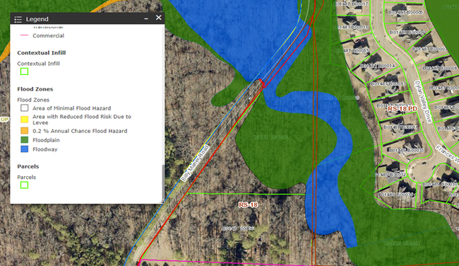
Map Layers
Map Styles
 Street
 Aerial
- Restaurants
- Banks
- Shops
- Fitness
- Groceries
PUBLIC TRANSPORTATION
AIRPORT
Memphis International
DRIVE
WALK
Distance
Memphis International
29 min
19.1 mi
Freight Ports
Port of Shreveport
DRIVE
WALK
Distance
Port of Shreveport
418 min
383.8 mi
Nearby Properties
Address
Land Use
TOTAL SIZE
Lot Size
Zoning
Address
Land Use
TOTAL SIZE
Lot Size
Zoning
39,018 SF
22.21 AC
RU-2
Address
Land Use
TOTAL SIZE
Lot Size
Zoning
67,640 SF
20.28 AC
R-M
Address
Land Use
TOTAL SIZE
Lot Size
Zoning
45,939 SF
5.70 AC
R-10
Address
Land Use
TOTAL SIZE
Lot Size
Zoning
181,319 SF
14.82 AC
CMU-2
Address
Land Use
TOTAL SIZE
Lot Size
Zoning
85,332 SF
10.51 AC
R-M
Address
Land Use
TOTAL SIZE
Lot Size
Zoning
50,538 SF
5 AC
R-10
Address
Land Use
TOTAL SIZE
Lot Size
Zoning
69,158 SF
7.75 AC
RU-3
Address
Land Use
TOTAL SIZE
Lot Size
Zoning
157.98 AC
AP
Address
Land Use
TOTAL SIZE
Lot Size
Zoning
40,030 SF
3.40 AC
CMU-2
Address
Land Use
TOTAL SIZE
Lot Size
Zoning
66,012 SF
5.71 AC
RU-3
Address
Land Use
TOTAL SIZE
Lot Size
Zoning
42,706 SF
3.94 AC
RS-10
Address
Land Use
TOTAL SIZE
Lot Size
Zoning
10,485 SF
5 AC
CA
Address
Land Use
TOTAL SIZE
Lot Size
Zoning
5,589 SF
8.52 AC
R-E
Address
Land Use
TOTAL SIZE
Lot Size
Zoning
53,204 SF
11.81 AC
CMU-2
Address
Land Use
TOTAL SIZE
Lot Size
Zoning
144.75 AC
CA
Address
Land Use
TOTAL SIZE
Lot Size
Zoning
15 AC
CMP-1
Address
Land Use
TOTAL SIZE
Lot Size
Zoning
17,198 SF
4.69 AC
CMU-2
Address
Land Use
TOTAL SIZE
Lot Size
Zoning
60,453 SF
7 AC
CMU-2
Address
Land Use
TOTAL SIZE
Lot Size
Zoning
39,898 SF
6.61 AC
SC-1
Address
Land Use
TOTAL SIZE
Lot Size
Zoning
91.87 AC
RS-10
Address
Land Use
TOTAL SIZE
Lot Size
Zoning
7,939 SF
1.02 AC
CMU-2
Address
Land Use
TOTAL SIZE
Lot Size
Zoning
50,688 SF
7.04 AC
SC-1
Address
Land Use
TOTAL SIZE
Lot Size
Zoning
14,392 SF
1.65 AC
CMU-2
Address
Land Use
TOTAL SIZE
Lot Size
Zoning
59,452 SF
3.98 AC
R-10
Address
Land Use
TOTAL SIZE
Lot Size
Zoning
40,932 SF
1.40 AC
CMU-2
Address
Land Use
TOTAL SIZE
Lot Size
Zoning
16,346 SF
11.45 AC
O-R-1
Address
Land Use
TOTAL SIZE
Lot Size
Zoning
121.88 AC
RS-10
Address
Land Use
TOTAL SIZE
Lot Size
Zoning
14,897 SF
2.04 AC
SC-1
Address
Land Use
TOTAL SIZE
Lot Size
Zoning
17,600 SF
2.59 AC
SC-1
Address
Land Use
TOTAL SIZE
Lot Size
Zoning
37.45 AC
RS-10
The World's #1 Commercial Real Estate Marketplace
Connect with us
© 2025 CoStar Group
The information above has been obtained from sources believed reliable. While we do not doubt its accuracy we have not verified it and make no guarantee, warranty or representation about it. It is your responsibility to independently confirm its accuracy and completeness. Any projections, opinions, assumptions, or estimates used are for example only and do not represent the current or future performance of the property. The value of this transaction to you depends on tax and other factors which should be evaluated by your tax, financial, and legal advisors. You and your advisors should conduct a careful, independent investigation of the property to determine to your satisfaction the suitability of the property for your needs.