Property Record
Bird River Beach Rd, Beach, MD

Property Detail
Bird River Beach Rd
15-1508550950
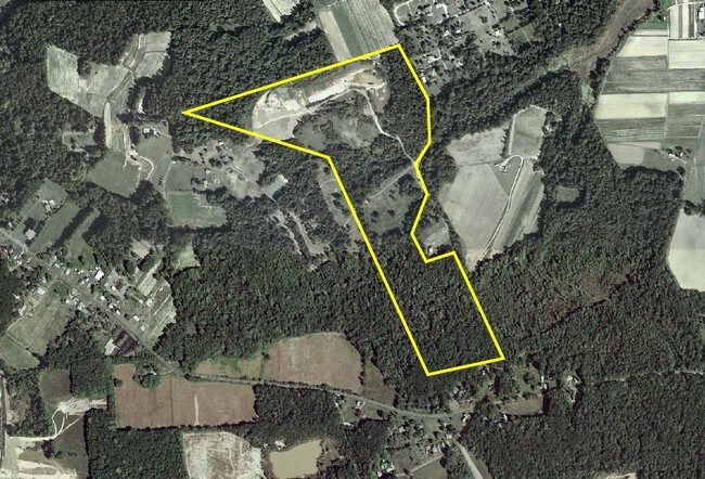
77.3702 AC SWS
Agriculturalland
BALTIMORE
B and X Area of moderate flood hazard, usually the area between the limits of the 100-year and 500-year floods.
Maryland
2024
77.37 AC
2025
Baltimore County East
451702
Baltimore
2,772 SF
Baltimore-Columbia-Towson, MD
NEARBY LISTINGS FOR SALE OR LEASE
DEMOGRAPHICS near Bird River Beach Rd
1 mile
3 mile
5 mile
2024 Total Population
2,710
29,255
116,179
2029 Population
2,795
29,679
117,299
Pop Growth 2024-2029
+ 3.14%
+ 1.45%
+ 0.96%
Average Age
42
40
41
2024 Total Households
1,134
11,217
44,777
HH Growth 2024-2029
+ 3.17%
+ 1.36%
+ 0.96%
Median Household Inc
$114,938
$100,421
$92,492
Avg Household Size
2.40
2.60
2.50
2024 Avg HH Vehicles
2.00
2.00
2.00
Median Home Value
$418,323
$373,385
$342,101
Median Year Built
2010
1991
1983
Nearby Places
Map Layers
Map Styles
 Street
 Aerial
Transit
 Traffic
 Biking
Places
Listings with unknown addresses are not visible on the map
- Restaurants
- Banks
- Shops
- Fitness
- Groceries
PUBLIC TRANSPORTATION
COMMUTER RAIL
Martin Airport Marc Nb (PENN - WASHINGTON - Maryland Transit Administration)
Drive
Walk
Distance
Martin Airport Marc Nb (PENN - WASHINGTON - Maryland Transit Administration)
9 min
3.7 mi
AIRPORT
Baltimore/Washington International Thurgood Marshall
Drive
Walk
Distance
Baltimore/Washington International Thurgood Marshall
42 min
26.8 mi
Freight Ports
Port of Baltimore
Drive
Walk
Distance
Port of Baltimore
30 min
18.1 mi
Nearby Properties
Address
Land Use
TOTAL SIZE
Lot Size
Zoning
Address
Land Use
TOTAL SIZE
Lot Size
Zoning
504,086 SF
7.48 AC
MH
Address
Land Use
TOTAL SIZE
Lot Size
Zoning
553,984 SF
7.42 AC
Address
Land Use
TOTAL SIZE
Lot Size
Zoning
83.12 AC
ML
Address
Land Use
TOTAL SIZE
Lot Size
Zoning
240,121 SF
9.97 AC
Address
Land Use
TOTAL SIZE
Lot Size
Zoning
225,070 SF
20.65 AC
Address
Land Use
TOTAL SIZE
Lot Size
Zoning
423,200 SF
22.60 AC
MH-1M
Address
Land Use
TOTAL SIZE
Lot Size
Zoning
14.19 AC
DR16
Address
Land Use
TOTAL SIZE
Lot Size
Zoning
21.83 AC
DR16
Address
Land Use
TOTAL SIZE
Lot Size
Zoning
440,340 SF
128.19 AC
Address
Land Use
TOTAL SIZE
Lot Size
Zoning
11.69 AC
DR16
Address
Land Use
TOTAL SIZE
Lot Size
Zoning
18 AC
DR16
Address
Land Use
TOTAL SIZE
Lot Size
Zoning
89,522 SF
4.03 AC
Address
Land Use
TOTAL SIZE
Lot Size
Zoning
128,400 SF
12.68 AC
Address
Land Use
TOTAL SIZE
Lot Size
Zoning
1,914,359 SF
24.44 AC
MHIM
Address
Land Use
TOTAL SIZE
Lot Size
Zoning
300,000 SF
85.04 AC
MH
Address
Land Use
TOTAL SIZE
Lot Size
Zoning
77,574 SF
3.23 AC
Address
Land Use
TOTAL SIZE
Lot Size
Zoning
141,550 SF
23.81 AC
ML
Address
Land Use
TOTAL SIZE
Lot Size
Zoning
3,844 SF
35.84 AC
Address
Land Use
TOTAL SIZE
Lot Size
Zoning
136,489 SF
33.41 AC
MLIM
Address
Land Use
TOTAL SIZE
Lot Size
Zoning
168,640 SF
19.02 AC
BRCS1
Address
Land Use
TOTAL SIZE
Lot Size
Zoning
103,432 SF
5.53 AC
Address
Land Use
TOTAL SIZE
Lot Size
Zoning
10.37 AC
DR16
Address
Land Use
TOTAL SIZE
Lot Size
Zoning
50,400 SF
7.13 AC
MH
Address
Land Use
TOTAL SIZE
Lot Size
Zoning
68,000 SF
29.42 AC
MH-1M
Address
Land Use
TOTAL SIZE
Lot Size
Zoning
59,400 SF
4.98 AC
MH
Address
Land Use
TOTAL SIZE
Lot Size
Zoning
134,100 SF
30.22 AC
MH
Address
Land Use
TOTAL SIZE
Lot Size
Zoning
13.82 AC
DR16
Address
Land Use
TOTAL SIZE
Lot Size
Zoning
142,008 SF
2.25 AC
BM
Address
Land Use
TOTAL SIZE
Lot Size
Zoning
86,304 SF
2.72 AC
Address
Land Use
TOTAL SIZE
Lot Size
Zoning
7.72 AC
DR16
The World's #1 Commercial Real Estate Marketplace
Connect with us
© 2026 CoStar Group
The information above has been obtained from sources believed reliable. While we do not doubt its accuracy we have not verified it and make no guarantee, warranty or representation about it. It is your responsibility to independently confirm its accuracy and completeness. Any projections, opinions, assumptions, or estimates used are for example only and do not represent the current or future performance of the property. The value of this transaction to you depends on tax and other factors which should be evaluated by your tax, financial, and legal advisors. You and your advisors should conduct a careful, independent investigation of the property to determine to your satisfaction the suitability of the property for your needs.