Property Record
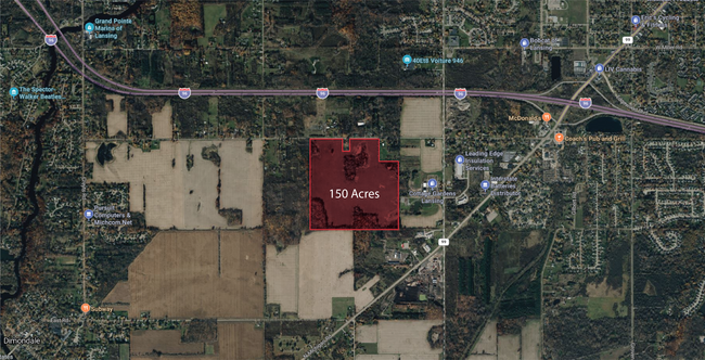
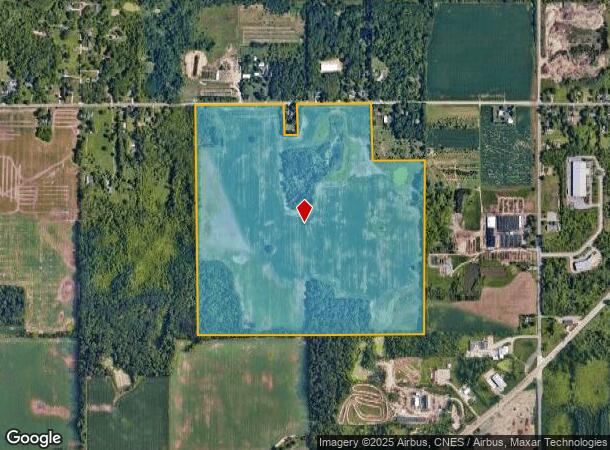
Bishop Hwy, Lansing, MI 48911
NEARBY LISTINGS FOR SALE OR LEASE
Property Detail
Bishop Hwy
080-012-300-081-00
E 1/2 OF SW 1/4 EXCEPT COM 145.3 FT W OF NE CORNER, S 2DEG 30MIN E 354 FT, W 154 FT, N 2DEG 30MIN W 354 FT, E TO BEG. W 1/2 OF SE 1/4 EXCEPT 597 FT OF N 645 FT. SEC.12, T3N,R3W, WINDSOR TWP 1982 PA 116 OF 1974, SEC.12,
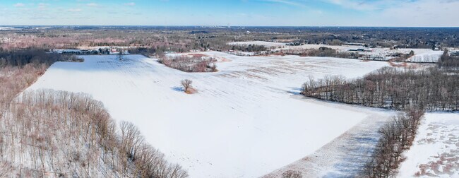
Agriculturalland
Eaton
X
Michigan
26065C0136D
149.96 AC
2024
Outlying Eaton County
2025
West Michigan
005201
Lansing-East Lansing, MI
DEMOGRAPHICS near Bishop Hwy
1 Mile
3 Mile
5 Mile
2024 Total Population
911
34,372
87,639
2029 Population
906
34,082
87,206
Pop Growth 2024-2029
(0.55%)
(0.84%)
(0.49%)
Average Age
41
38
40
2024 Total Households
346
13,394
36,827
HH Growth 2024-2029
(0.58%)
(1.00%)
(0.63%)
Median Household Inc
$63,470
$56,168
$56,485
Avg Household Size
2.50
2.50
2.30
2024 Avg HH Vehicles
2.00
2.00
2.00
Median Home Value
$156,296
$147,875
$140,838
Median Year Built
1973
1972
1969
Nearby Places
Map Layers
Map Styles
 Street
 Aerial
- Restaurants
- Banks
- Shops
- Fitness
- Groceries
PUBLIC TRANSPORTATION
AIRPORT
Capital Region International
DRIVE
WALK
Distance
Capital Region International
18 min
9.3 mi
Freight Ports
Port of Toledo
DRIVE
WALK
Distance
Port of Toledo
146 min
124.7 mi
SALE & LEASE HISTORY
LISTING DATE
SALE/LEASE

Dec 11, 2024
For Sale
Apr 07, 2025
For Sale
Nearby Properties
Address
Land Use
TOTAL SIZE
Lot Size
Zoning
Address
Land Use
TOTAL SIZE
Lot Size
Zoning
824,570 SF
47.65 AC
NONE
Address
Land Use
TOTAL SIZE
Lot Size
Zoning
144,630 SF
11.51 AC
M-1
Address
Land Use
TOTAL SIZE
Lot Size
Zoning
50,364 SF
25.57 AC
M-1
Address
Land Use
TOTAL SIZE
Lot Size
Zoning
53,147 SF
15.70 AC
C
Address
Land Use
TOTAL SIZE
Lot Size
Zoning
8,469 SF
160 AC
Address
Land Use
TOTAL SIZE
Lot Size
Zoning
1,496 SF
47.39 AC
RM-1
Address
Land Use
TOTAL SIZE
Lot Size
Zoning
7,689 SF
148.47 AC
DM-1 RE
Address
Land Use
TOTAL SIZE
Lot Size
Zoning
3,006 SF
136 AC
DM-1 RE
Address
Land Use
TOTAL SIZE
Lot Size
Zoning
53,147 SF
17.01 AC
NONE
Address
Land Use
TOTAL SIZE
Lot Size
Zoning
140,841 SF
199 AC
CUP
Address
Land Use
TOTAL SIZE
Lot Size
Zoning
110,839 SF
16.04 AC
NONE
Address
Land Use
TOTAL SIZE
Lot Size
Zoning
48,948 SF
2.10 AC
M-1
Address
Land Use
TOTAL SIZE
Lot Size
Zoning
126,015 SF
176 AC
CUP
Address
Land Use
TOTAL SIZE
Lot Size
Zoning
71,900 SF
5.08 AC
NONE
Address
Land Use
TOTAL SIZE
Lot Size
Zoning
43,150 SF
20.31 AC
NONE
Address
Land Use
TOTAL SIZE
Lot Size
Zoning
44,000 SF
5 AC
M-1
Address
Land Use
TOTAL SIZE
Lot Size
Zoning
112,168 SF
11.23 AC
CUP
Address
Land Use
TOTAL SIZE
Lot Size
Zoning
50 AC
R-1M
Address
Land Use
TOTAL SIZE
Lot Size
Zoning
9,168 SF
43.90 AC
NONE
Address
Land Use
TOTAL SIZE
Lot Size
Zoning
50,000 SF
4.22 AC
NONE
Address
Land Use
TOTAL SIZE
Lot Size
Zoning
53.59 AC
DM-1 RE
Address
Land Use
TOTAL SIZE
Lot Size
Zoning
74,798 SF
80 AC
Address
Land Use
TOTAL SIZE
Lot Size
Zoning
1,800 SF
80 AC
CUP
Address
Land Use
TOTAL SIZE
Lot Size
Zoning
73,136 SF
78 AC
CUP
Address
Land Use
TOTAL SIZE
Lot Size
Zoning
73,742 SF
76 AC
Address
Land Use
TOTAL SIZE
Lot Size
Zoning
60,000 SF
45 AC
DM-1 RE
Address
Land Use
TOTAL SIZE
Lot Size
Zoning
5,201 SF
78 AC
Address
Land Use
TOTAL SIZE
Lot Size
Zoning
38,338 SF
2.12 AC
B-2
Address
Land Use
TOTAL SIZE
Lot Size
Zoning
90,078 SF
164 AC
CUP
Address
Land Use
TOTAL SIZE
Lot Size
Zoning
74,461 SF
76 AC
CUP
The World's #1 Commercial Real Estate Marketplace
Connect with us
© 2026 CoStar Group
The information above has been obtained from sources believed reliable. While we do not doubt its accuracy we have not verified it and make no guarantee, warranty or representation about it. It is your responsibility to independently confirm its accuracy and completeness. Any projections, opinions, assumptions, or estimates used are for example only and do not represent the current or future performance of the property. The value of this transaction to you depends on tax and other factors which should be evaluated by your tax, financial, and legal advisors. You and your advisors should conduct a careful, independent investigation of the property to determine to your satisfaction the suitability of the property for your needs.