Property Record
Blaine Rd, Blaine, WA 98230

NEARBY LISTINGS FOR SALE OR LEASE
-
-
View all Blaine listings for sale on LoopNet.com
Property Detail
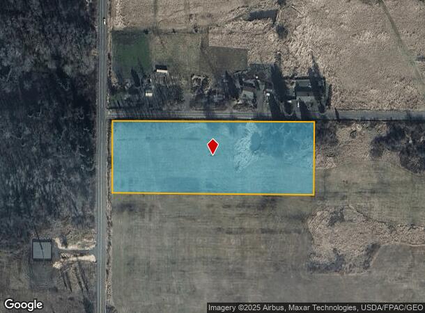
Blaine Rd
400132-039511-0000
N 300 FT OF W 750 FT OF NW NW-LESS RD
Commercialnec
Whatcom
X
Washington
53073C0661F
4.63 AC
2024
Bellingham/Northwest
2024
Other Market Areas
010406
Bellingham, WA
DEMOGRAPHICS near Blaine Rd
1 Mile
3 Mile
5 Mile
2024 Total Population
2,518
10,961
21,472
2029 Population
2,717
11,849
22,943
Pop Growth 2024-2029
+ 7.90%
+ 8.10%
+ 6.85%
Average Age
42
44
45
2024 Total Households
1,022
4,619
8,844
HH Growth 2024-2029
+ 8.32%
+ 8.47%
+ 7.13%
Median Household Inc
$79,951
$76,013
$81,098
Avg Household Size
2.40
2.30
2.40
2024 Avg HH Vehicles
2.00
2.00
2.00
Median Home Value
$434,210
$467,818
$506,393
Median Year Built
2000
1994
1993
Nearby Places
Map Layers
Map Styles
 Street
 Aerial
- Restaurants
- Banks
- Shops
- Fitness
- Groceries
PUBLIC TRANSPORTATION
AIRPORT
Bellingham International
DRIVE
WALK
Distance
Bellingham International
23 min
17.6 mi
Abbotsford International
DRIVE
WALK
Distance
Abbotsford International
47 min
26.4 mi
Vancouver International
DRIVE
WALK
Distance
Vancouver International
55 min
33.8 mi
Freight Ports
Port of Bellingham, WA
DRIVE
WALK
Distance
Port of Bellingham, WA
29 min
20.6 mi
Nearby Properties
Address
Land Use
TOTAL SIZE
Lot Size
Zoning
Address
Land Use
TOTAL SIZE
Lot Size
Zoning
553.45 AC
HII
Address
Land Use
TOTAL SIZE
Lot Size
Zoning
15,029 SF
81.12 AC
RC
Address
Land Use
TOTAL SIZE
Lot Size
Zoning
7,180 SF
143.85 AC
URM6
Address
Land Use
TOTAL SIZE
Lot Size
Zoning
34,258 SF
19.79 AC
RIM
Address
Land Use
TOTAL SIZE
Lot Size
Zoning
107,848 SF
10.93 AC
GI
Address
Land Use
TOTAL SIZE
Lot Size
Zoning
76.59 AC
URM6
Address
Land Use
TOTAL SIZE
Lot Size
Zoning
14,910 SF
21.98 AC
RC
Address
Land Use
TOTAL SIZE
Lot Size
Zoning
40,350 SF
9.69 AC
LII
Address
Land Use
TOTAL SIZE
Lot Size
Zoning
43,200 SF
9.22 AC
GC
Address
Land Use
TOTAL SIZE
Lot Size
Zoning
110,433 SF
10.97 AC
HII
Address
Land Use
TOTAL SIZE
Lot Size
Zoning
40,960 SF
57.29 AC
R10A
Address
Land Use
TOTAL SIZE
Lot Size
Zoning
361.32 AC
LII
Address
Land Use
TOTAL SIZE
Lot Size
Zoning
30,510 SF
8.19 AC
GC
Address
Land Use
TOTAL SIZE
Lot Size
Zoning
23,207 SF
5 AC
R10A
Address
Land Use
TOTAL SIZE
Lot Size
Zoning
69,343 SF
68.19 AC
URM6
Address
Land Use
TOTAL SIZE
Lot Size
Zoning
24,108 SF
3.50 AC
GI
Address
Land Use
TOTAL SIZE
Lot Size
Zoning
3,012 SF
16.70 AC
RGC
Address
Land Use
TOTAL SIZE
Lot Size
Zoning
7,236 SF
30.59 AC
NC
Address
Land Use
TOTAL SIZE
Lot Size
Zoning
13,455 SF
9.61 AC
R5A
Address
Land Use
TOTAL SIZE
Lot Size
Zoning
32,320 SF
3.88 AC
RGC
Address
Land Use
TOTAL SIZE
Lot Size
Zoning
12,671 SF
1.26 AC
RGC
Address
Land Use
TOTAL SIZE
Lot Size
Zoning
13,488 SF
5 AC
RIM
Address
Land Use
TOTAL SIZE
Lot Size
Zoning
6,933 SF
4.42 AC
GC
Address
Land Use
TOTAL SIZE
Lot Size
Zoning
4.11 AC
RC
Address
Land Use
TOTAL SIZE
Lot Size
Zoning
13,500 SF
19.93 AC
URM6
Address
Land Use
TOTAL SIZE
Lot Size
Zoning
6,549 SF
5.01 AC
RC
Address
Land Use
TOTAL SIZE
Lot Size
Zoning
23,244 SF
5 AC
HII
Address
Land Use
TOTAL SIZE
Lot Size
Zoning
174.74 AC
R10A
Address
Land Use
TOTAL SIZE
Lot Size
Zoning
2,765 SF
7.86 AC
RC
Address
Land Use
TOTAL SIZE
Lot Size
Zoning
5,520 SF
0.87 AC
GI
The World's #1 Commercial Real Estate Marketplace
Connect with us
© 2025 CoStar Group
The information above has been obtained from sources believed reliable. While we do not doubt its accuracy we have not verified it and make no guarantee, warranty or representation about it. It is your responsibility to independently confirm its accuracy and completeness. Any projections, opinions, assumptions, or estimates used are for example only and do not represent the current or future performance of the property. The value of this transaction to you depends on tax and other factors which should be evaluated by your tax, financial, and legal advisors. You and your advisors should conduct a careful, independent investigation of the property to determine to your satisfaction the suitability of the property for your needs.