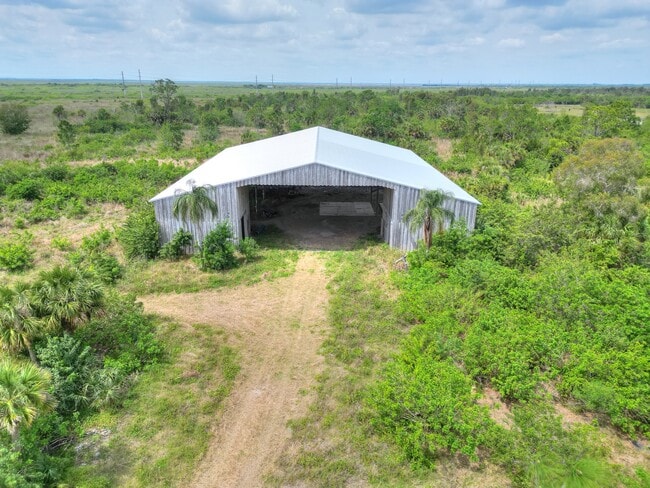
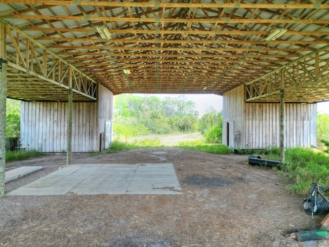
Property Record
1909 Unknown St, W Melbourne, FL 32904
NEARBY LISTINGS FOR SALE OR LEASE
Property Detail
1909 Unknown St
Palm Bay-Melbourne-Titusville, FL
Brevard
25-36-07-00-00001.0-0000.00
Florida
Residentialnec
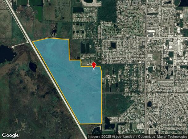
574.72 AC
AE
Brevard County
12009C0425G
Orlando
DEMOGRAPHICS near 1909 Unknown St
1 Mile
3 Mile
5 Mile
2024 Total Population
2,823
37,160
85,782
2029 Population
2,976
39,851
91,693
Pop Growth 2024-2029
+ 5.42%
+ 7.24%
+ 6.89%
Average Age
43
43
43
2024 Total Households
1,108
15,081
35,348
HH Growth 2024-2029
+ 4.96%
+ 6.89%
+ 6.56%
Median Household Inc
$75,497
$77,880
$76,551
Avg Household Size
2.50
2.40
2.30
2024 Avg HH Vehicles
2.00
2.00
2.00
Median Home Value
$324,123
$325,316
$342,607
Median Year Built
1984
1986
1986
Nearby Places
- Restaurants
- Banks
- Shops
- Fitness
- Groceries
PUBLIC TRANSPORTATION
AIRPORT
Melbourne Orlando International
DRIVE
WALK
Distance
Melbourne Orlando International
37 min
22.4 mi
Orlando International
DRIVE
WALK
Distance
Orlando International
57 min
43.3 mi
Freight Ports
Port Canaveral
DRIVE
WALK
Distance
Port Canaveral
28 min
15.0 mi
SALE & LEASE HISTORY
LISTING DATE
SALE/LEASE

Aug 28, 2025
For Sale
Nearby Properties
Address
Land Use
TOTAL SIZE
Lot Size
Zoning
Address
Land Use
TOTAL SIZE
Lot Size
Zoning
411,148 SF
8.13 AC
HC
Address
Land Use
TOTAL SIZE
Lot Size
Zoning
379,920 SF
19.73 AC
RU215
Address
Land Use
TOTAL SIZE
Lot Size
Zoning
326,407 SF
10 AC
C2
Address
Land Use
TOTAL SIZE
Lot Size
Zoning
497,135 SF
34.13 AC
CW
Address
Land Use
TOTAL SIZE
Lot Size
Zoning
308,576 SF
16.41 AC
C2
Address
Land Use
TOTAL SIZE
Lot Size
Zoning
68,677 SF
13.88 AC
RMU
Address
Land Use
TOTAL SIZE
Lot Size
Zoning
181,848 SF
8.20 AC
C2
Address
Land Use
TOTAL SIZE
Lot Size
Zoning
276,665 SF
38.95 AC
R2
Address
Land Use
TOTAL SIZE
Lot Size
Zoning
117,175 SF
8.06 AC
C2
Address
Land Use
TOTAL SIZE
Lot Size
Zoning
176,800 SF
19.23 AC
R3141
Address
Land Use
TOTAL SIZE
Lot Size
Zoning
230,561 SF
13.74 AC
R3141
Address
Land Use
TOTAL SIZE
Lot Size
Zoning
206,696 SF
11.43 AC
R3
Address
Land Use
TOTAL SIZE
Lot Size
Zoning
112,095 SF
9.50 AC
C2
Address
Land Use
TOTAL SIZE
Lot Size
Zoning
120,445 SF
9.40 AC
Address
Land Use
TOTAL SIZE
Lot Size
Zoning
95,862 SF
5 AC
C2
Address
Land Use
TOTAL SIZE
Lot Size
Zoning
100,050 SF
14.94 AC
R2
Address
Land Use
TOTAL SIZE
Lot Size
Zoning
87,441 SF
20.89 AC
R2
Address
Land Use
TOTAL SIZE
Lot Size
Zoning
156,248 SF
20.16 AC
C2
Address
Land Use
TOTAL SIZE
Lot Size
Zoning
110,630 SF
31.39 AC
R2
Address
Land Use
TOTAL SIZE
Lot Size
Zoning
117,078 SF
6.13 AC
R2A 8/1
Address
Land Use
TOTAL SIZE
Lot Size
Zoning
49,320 SF
4.03 AC
C2
Address
Land Use
TOTAL SIZE
Lot Size
Zoning
101,294 SF
20.14 AC
M2
Address
Land Use
TOTAL SIZE
Lot Size
Zoning
52,126 SF
4.93 AC
M1
Address
Land Use
TOTAL SIZE
Lot Size
Zoning
24,207 SF
40 AC
M2
Address
Land Use
TOTAL SIZE
Lot Size
Zoning
88,649 SF
10.75 AC
C2
Address
Land Use
TOTAL SIZE
Lot Size
Zoning
163,409 SF
11.95 AC
R3
Address
Land Use
TOTAL SIZE
Lot Size
Zoning
86,915 SF
10 AC
IP
Address
Land Use
TOTAL SIZE
Lot Size
Zoning
13,181 SF
23.70 AC
RVP
Address
Land Use
TOTAL SIZE
Lot Size
Zoning
77,885 SF
11.54 AC
BU2
Address
Land Use
TOTAL SIZE
Lot Size
Zoning
69,695 SF
13.55 AC
C2
The World's #1 Commercial Real Estate Marketplace
Connect with us
© 2025 CoStar Group
The information above has been obtained from sources believed reliable. While we do not doubt its accuracy we have not verified it and make no guarantee, warranty or representation about it. It is your responsibility to independently confirm its accuracy and completeness. Any projections, opinions, assumptions, or estimates used are for example only and do not represent the current or future performance of the property. The value of this transaction to you depends on tax and other factors which should be evaluated by your tax, financial, and legal advisors. You and your advisors should conduct a careful, independent investigation of the property to determine to your satisfaction the suitability of the property for your needs.