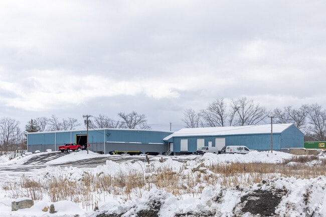
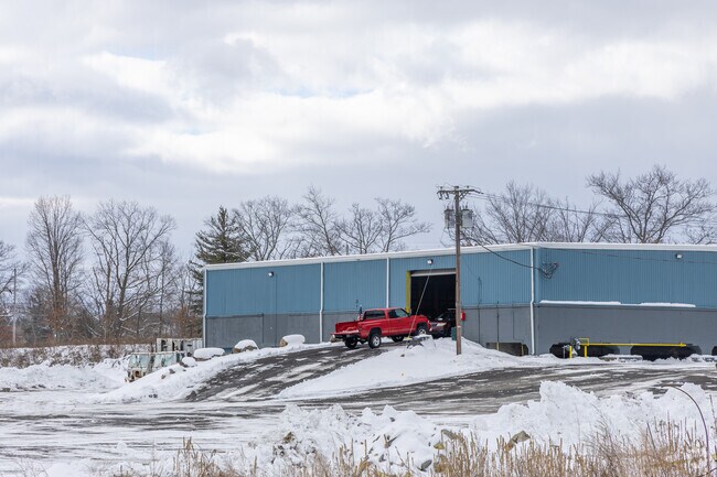
Property Record
Bligh St, Ayer, MA 01432

Current Lease Availabilities
Property Detail
Bligh St
AYER-000033-000000-000025
MIDDLESEX
Commercialbuilding
Massachusetts
LI
25
AE The base floodplain where base flood elevations are provided. AE Zones are now used on new format FIRMs instead of A1-A30 Zones.
7.50 AC
2025
Groton/Townsend
2025
Boston
325101
Boston-Cambridge-Newton, MA-NH
13,231 SF
NEARBY LISTINGS FOR SALE OR LEASE
DEMOGRAPHICS near Bligh St
1 mile
3 mile
5 mile
2025 Total Population
3,866
15,746
36,944
2030 Population
4,053
16,476
38,501
Pop Growth 2025-2030
+ 4.84%
+ 4.64%
+ 4.21%
Average Age
42
43
43
2025 Total Households
1,671
5,856
13,322
HH Growth 2025-2030
+ 4.91%
+ 4.97%
+ 4.45%
Median Household Inc
$82,389
$119,018
$133,385
Avg Household Size
2.20
2.40
2.50
2025 Avg HH Vehicles
2.00
2.00
2.00
Median Home Value
$448,643
$487,692
$603,651
Median Year Built
1956
1980
1978
Nearby Places
Map Layers
Map Styles
 Street
 Aerial
Transit
 Traffic
 Biking
Places
Listings with unknown addresses are not visible on the map
- Restaurants
- Banks
- Shops
- Fitness
- Groceries
PUBLIC TRANSPORTATION
COMMUTER RAIL
Ayer (Fitchburg/South Acton Line - Massachusetts Bay Transportation Authority Commuter Rail (Purple Line))
Drive
Walk
Distance
Ayer (Fitchburg/South Acton Line - Massachusetts Bay Transportation Authority Commuter Rail (Purple Line))
1 min
16 min
0.2 mi
Shirley (Fitchburg/South Acton Line - Massachusetts Bay Transportation Authority Commuter Rail (Purple Line))
Drive
Walk
Distance
Shirley (Fitchburg/South Acton Line - Massachusetts Bay Transportation Authority Commuter Rail (Purple Line))
10 min
4.0 mi
AIRPORT
Manchester Boston Regional
Drive
Walk
Distance
Manchester Boston Regional
57 min
32.9 mi
Worcester Regional
Drive
Walk
Distance
Worcester Regional
54 min
36.5 mi
Freight Ports
Port of Boston
Drive
Walk
Distance
Port of Boston
60 min
37.8 mi
Nearby Properties
Address
Land Use
TOTAL SIZE
Lot Size
Zoning
Address
Land Use
TOTAL SIZE
Lot Size
Zoning
329,818 SF
55 AC
A1
Address
Land Use
TOTAL SIZE
Lot Size
Zoning
164,000 SF
11 AC
4
Address
Land Use
TOTAL SIZE
Lot Size
Zoning
337,563 SF
21.31 AC
17
Address
Land Use
TOTAL SIZE
Lot Size
Zoning
832,622 SF
43.78 AC
I
Address
Land Use
TOTAL SIZE
Lot Size
Zoning
109,921 SF
7.22 AC
21
Address
Land Use
TOTAL SIZE
Lot Size
Zoning
373.10 AC
O
Address
Land Use
TOTAL SIZE
Lot Size
Zoning
353,742 SF
34.89 AC
C
Address
Land Use
TOTAL SIZE
Lot Size
Zoning
398,800 SF
21.92 AC
I
Address
Land Use
TOTAL SIZE
Lot Size
Zoning
214.69 AC
O
Address
Land Use
TOTAL SIZE
Lot Size
Zoning
214.32 AC
4
Address
Land Use
TOTAL SIZE
Lot Size
Zoning
202.78 AC
14
Address
Land Use
TOTAL SIZE
Lot Size
Zoning
342,309 SF
21.60 AC
I
Address
Land Use
TOTAL SIZE
Lot Size
Zoning
73,772 SF
36.70 AC
4
Address
Land Use
TOTAL SIZE
Lot Size
Zoning
60,968 SF
Address
Land Use
TOTAL SIZE
Lot Size
Zoning
293,250 SF
60.10 AC
LI
Address
Land Use
TOTAL SIZE
Lot Size
Zoning
343,400 SF
20 AC
LI
Address
Land Use
TOTAL SIZE
Lot Size
Zoning
105,559 SF
35.45 AC
A1
Address
Land Use
TOTAL SIZE
Lot Size
Zoning
142.59 AC
O
Address
Land Use
TOTAL SIZE
Lot Size
Zoning
216,289 SF
17.54 AC
I
Address
Land Use
TOTAL SIZE
Lot Size
Zoning
66,966 SF
C
Address
Land Use
TOTAL SIZE
Lot Size
Zoning
140.95 AC
4
Address
Land Use
TOTAL SIZE
Lot Size
Zoning
85,000 SF
31.56 AC
R1
Address
Land Use
TOTAL SIZE
Lot Size
Zoning
78,344 SF
7.65 AC
O
Address
Land Use
TOTAL SIZE
Lot Size
Zoning
131 AC
2
Address
Land Use
TOTAL SIZE
Lot Size
Zoning
162,000 SF
19.40 AC
I
Address
Land Use
TOTAL SIZE
Lot Size
Zoning
186,000 SF
16.02 AC
C
Address
Land Use
TOTAL SIZE
Lot Size
Zoning
134,920 SF
26.90 AC
I
Address
Land Use
TOTAL SIZE
Lot Size
Zoning
150,372 SF
15.74 AC
21
Address
Land Use
TOTAL SIZE
Lot Size
Zoning
162,932 SF
19.12 AC
C
Address
Land Use
TOTAL SIZE
Lot Size
Zoning
234,465 SF
16.13 AC
I
The World's #1 Commercial Real Estate Marketplace
Connect with us
© 2026 CoStar Group
The information above has been obtained from sources believed reliable. While we do not doubt its accuracy we have not verified it and make no guarantee, warranty or representation about it. It is your responsibility to independently confirm its accuracy and completeness. Any projections, opinions, assumptions, or estimates used are for example only and do not represent the current or future performance of the property. The value of this transaction to you depends on tax and other factors which should be evaluated by your tax, financial, and legal advisors. You and your advisors should conduct a careful, independent investigation of the property to determine to your satisfaction the suitability of the property for your needs.