Property Record
Blueberry Meadows Ln, , NY

Property Detail
Blueberry Meadows Ln
Albany-Schenectady-Troy, NY
RENSSELAER
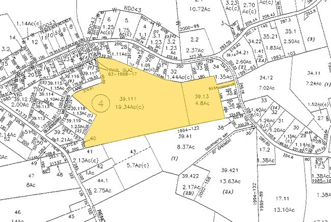
4489-178-4-39.111
New York
Residentialacreage
39.111
RA
17.87 AC
2025
Outer Rensselaer County
2024
Albany/Schenectady/Troy
052502
NEARBY LISTINGS FOR SALE OR LEASE
DEMOGRAPHICS near Blueberry Meadows Ln
1 mile
3 mile
5 mile
2024 Total Population
896
12,387
27,851
2029 Population
894
12,433
27,865
Pop Growth 2024-2029
(0.22%)
+ 0.37%
+ 0.05%
Average Age
51
45
44
2024 Total Households
432
5,244
11,588
HH Growth 2024-2029
(0.23%)
+ 0.31%
(0.03%)
Median Household Inc
$70,040
$100,406
$102,521
Avg Household Size
2.00
2.30
2.30
2024 Avg HH Vehicles
2.00
2.00
2.00
Median Home Value
$227,083
$314,987
$288,706
Median Year Built
1998
1977
1974
Nearby Places
Map Layers
Map Styles
 Street
 Aerial
Transit
 Traffic
 Biking
Places
Listings with unknown addresses are not visible on the map
- Restaurants
- Banks
- Shops
- Fitness
- Groceries
PUBLIC TRANSPORTATION
COMMUTER RAIL
Albany-Rensselaer Amtrak Station (Adirondack - Amtrak, Empire Service - Amtrak, Ethan Allen Express - Amtrak, Lake Shore Limited - Amtrak, Maple Leaf - Amtrak)
Drive
Walk
Distance
Albany-Rensselaer Amtrak Station (Adirondack - Amtrak, Empire Service - Amtrak, Ethan Allen Express - Amtrak, Lake Shore Limited - Amtrak, Maple Leaf - Amtrak)
13 min
8.0 mi
AIRPORT
Albany International
Drive
Walk
Distance
Albany International
27 min
16.8 mi
Freight Ports
Albany, NY Port
Drive
Walk
Distance
Albany, NY Port
16 min
10.8 mi
SALE & LEASE HISTORY
LISTING DATE
SALE/LEASE

Nov 07, 2019
For Sale
Aug 06, 2018
For Sale
Nearby Properties
Address
Land Use
TOTAL SIZE
Lot Size
Zoning
Address
Land Use
TOTAL SIZE
Lot Size
Zoning
1,015,740 SF
115.47 AC
HC
Address
Land Use
TOTAL SIZE
Lot Size
Zoning
278,670 SF
55.98 AC
PD-3
Address
Land Use
TOTAL SIZE
Lot Size
Zoning
44,712 SF
25.58 AC
R-3
Address
Land Use
TOTAL SIZE
Lot Size
Zoning
99,223 SF
15.47 AC
R-B
Address
Land Use
TOTAL SIZE
Lot Size
Zoning
6,720 SF
15.68 AC
R-3
Address
Land Use
TOTAL SIZE
Lot Size
Zoning
62,712 SF
17.45 AC
B-2
Address
Land Use
TOTAL SIZE
Lot Size
Zoning
177,492 SF
52.63 AC
R-B
Address
Land Use
TOTAL SIZE
Lot Size
Zoning
27,192 SF
8.52 AC
B-2
Address
Land Use
TOTAL SIZE
Lot Size
Zoning
5,532 SF
33.96 AC
R-40
Address
Land Use
TOTAL SIZE
Lot Size
Zoning
47,016 SF
13 AC
R-B
Address
Land Use
TOTAL SIZE
Lot Size
Zoning
4.76 AC
R-B
Address
Land Use
TOTAL SIZE
Lot Size
Zoning
2,187 SF
5.06 AC
R-3
Address
Land Use
TOTAL SIZE
Lot Size
Zoning
5,050 SF
7.07 AC
R-3
Address
Land Use
TOTAL SIZE
Lot Size
Zoning
102,000 SF
11.80 AC
PD-3
Address
Land Use
TOTAL SIZE
Lot Size
Zoning
133,680 SF
34.98 AC
R-B
Address
Land Use
TOTAL SIZE
Lot Size
Zoning
66,354 SF
10.26 AC
R-20
Address
Land Use
TOTAL SIZE
Lot Size
Zoning
20,320 SF
4.39 AC
PD-3
Address
Land Use
TOTAL SIZE
Lot Size
Zoning
23,498 SF
4.23 AC
B-2
Address
Land Use
TOTAL SIZE
Lot Size
Zoning
15,000 SF
2.53 AC
PDD
Address
Land Use
TOTAL SIZE
Lot Size
Zoning
0.42 AC
Address
Land Use
TOTAL SIZE
Lot Size
Zoning
8.41 AC
R-40
Address
Land Use
TOTAL SIZE
Lot Size
Zoning
3.84 AC
R-40
Address
Land Use
TOTAL SIZE
Lot Size
Zoning
Address
Land Use
TOTAL SIZE
Lot Size
Zoning
43,328 SF
7.46 AC
R-40
Address
Land Use
TOTAL SIZE
Lot Size
Zoning
14,653 SF
1.95 AC
HC
Address
Land Use
TOTAL SIZE
Lot Size
Zoning
34,184 SF
17.63 AC
HC
Address
Land Use
TOTAL SIZE
Lot Size
Zoning
5,844 SF
25.51 AC
R-B
Address
Land Use
TOTAL SIZE
Lot Size
Zoning
40,414 SF
3.33 AC
PD-1
Address
Land Use
TOTAL SIZE
Lot Size
Zoning
22,676 SF
10.27 AC
R-B
Address
Land Use
TOTAL SIZE
Lot Size
Zoning
3,970 SF
2.52 AC
HC
The World's #1 Commercial Real Estate Marketplace
Connect with us
© 2026 CoStar Group
The information above has been obtained from sources believed reliable. While we do not doubt its accuracy we have not verified it and make no guarantee, warranty or representation about it. It is your responsibility to independently confirm its accuracy and completeness. Any projections, opinions, assumptions, or estimates used are for example only and do not represent the current or future performance of the property. The value of this transaction to you depends on tax and other factors which should be evaluated by your tax, financial, and legal advisors. You and your advisors should conduct a careful, independent investigation of the property to determine to your satisfaction the suitability of the property for your needs.