Property Record
Boston Post Rd, Sudbury, MA 01776

Save to a Folder
{{folder.Name}}
{{folder.ListingIds.length}} Properties
{{folder.ListingIds.length}} Property
Create a New Folder
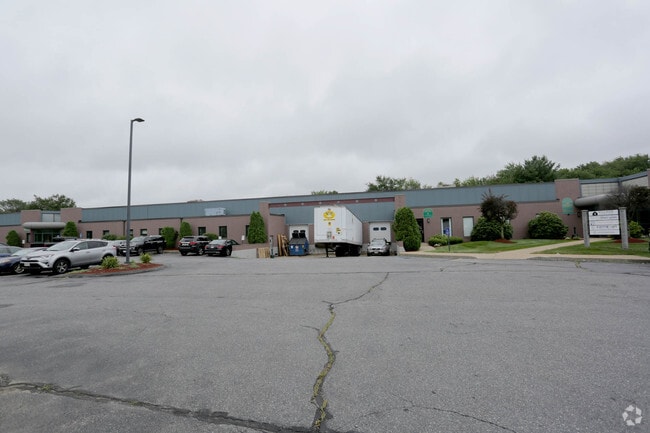
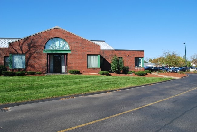
Property Detail
Boston Post Rd
SUDB-000009K-000000-000406
MIDDLESEX
Nonbuildableland
Massachusetts
RESA
0.50 AC
B and X Area of moderate flood hazard, usually the area between the limits of the 100-year and 500-year floods.
Concord/Maynard
2025
Boston
2025
Boston-Cambridge-Newton, MA-NH
365201
NEARBY LISTINGS FOR SALE OR LEASE
DEMOGRAPHICS near Boston Post Rd
1 mile
3 mile
5 mile
2025 Total Population
3,053
32,305
100,520
2030 Population
3,201
33,659
104,794
Pop Growth 2025-2030
+ 4.85%
+ 4.19%
+ 4.25%
Average Age
43
43
42
2025 Total Households
1,168
12,011
37,770
HH Growth 2025-2030
+ 4.97%
+ 4.34%
+ 4.38%
Median Household Inc
$212,981
$170,424
$145,373
Avg Household Size
2.60
2.60
2.60
2025 Avg HH Vehicles
2.00
2.00
2.00
Median Home Value
$892,776
$796,296
$775,382
Median Year Built
1989
1968
1968
Nearby Places
Map Layers
Map Styles
 Street
 Aerial
Layers
 Traffic
 Biking
Places
Listings with unknown addresses are not visible on the map
- Restaurants
- Banks
- Shops
- Fitness
- Groceries
PUBLIC TRANSPORTATION
COMMUTER RAIL
West Natick (Framingham/Worcester Line - MBTA)
Drive
Walk
Distance
West Natick (Framingham/Worcester Line - MBTA)
15 min
7.6 mi
Lincoln (Fitchburg Line - MBTA)
Drive
Walk
Distance
Lincoln (Fitchburg Line - MBTA)
14 min
7.6 mi
AIRPORT
General Edward Lawrence Logan International
Drive
Walk
Distance
General Edward Lawrence Logan International
40 min
24.8 mi
Worcester Regional
Drive
Walk
Distance
Worcester Regional
46 min
29.9 mi
Freight Ports
Port of Boston
Drive
Walk
Distance
Port of Boston
39 min
23.1 mi
SALE & LEASE HISTORY
LISTING DATE
SALE/LEASE

Nov 01, 2018
For Lease
Nearby Properties
Address
Land Use
TOTAL SIZE
Lot Size
Zoning
Address
Land Use
TOTAL SIZE
Lot Size
Zoning
24.78 AC
LID
Address
Land Use
TOTAL SIZE
Lot Size
Zoning
87,102 SF
8.26 AC
R40
Address
Land Use
TOTAL SIZE
Lot Size
Zoning
136,919 SF
13.42 AC
M
Address
Land Use
TOTAL SIZE
Lot Size
Zoning
51,524 SF
67.86 AC
R40
Address
Land Use
TOTAL SIZE
Lot Size
Zoning
225,181 SF
93.94 AC
RESA
Address
Land Use
TOTAL SIZE
Lot Size
Zoning
182,524 SF
3.60 AC
B2
Address
Land Use
TOTAL SIZE
Lot Size
Zoning
183,338 SF
4.85 AC
B2
Address
Land Use
TOTAL SIZE
Lot Size
Zoning
114,000 SF
31.53 AC
PRD
Address
Land Use
TOTAL SIZE
Lot Size
Zoning
239,454 SF
12.65 AC
R3
Address
Land Use
TOTAL SIZE
Lot Size
Zoning
44,301 SF
11.50 AC
LC
Address
Land Use
TOTAL SIZE
Lot Size
Zoning
126,828 SF
8.81 AC
R4
Address
Land Use
TOTAL SIZE
Lot Size
Zoning
162,704 SF
26.50 AC
RESA
Address
Land Use
TOTAL SIZE
Lot Size
Zoning
26.16 AC
LID
Address
Land Use
TOTAL SIZE
Lot Size
Zoning
27.16 AC
RESA
Address
Land Use
TOTAL SIZE
Lot Size
Zoning
28.26 AC
LID
Address
Land Use
TOTAL SIZE
Lot Size
Zoning
75,638 SF
23.51 AC
R3
Address
Land Use
TOTAL SIZE
Lot Size
Zoning
53.75 AC
Address
Land Use
TOTAL SIZE
Lot Size
Zoning
56,202 SF
37 AC
R30
Address
Land Use
TOTAL SIZE
Lot Size
Zoning
61,500 SF
13.67 AC
R3
Address
Land Use
TOTAL SIZE
Lot Size
Zoning
9.26 AC
LBD
Address
Land Use
TOTAL SIZE
Lot Size
Zoning
60,193 SF
15.67 AC
ID
Address
Land Use
TOTAL SIZE
Lot Size
Zoning
63,600 SF
12.75 AC
R3
Address
Land Use
TOTAL SIZE
Lot Size
Zoning
74,133 SF
7.32 AC
ID
Address
Land Use
TOTAL SIZE
Lot Size
Zoning
9.66 AC
LBD
Address
Land Use
TOTAL SIZE
Lot Size
Zoning
59,600 SF
3.19 AC
R1
Address
Land Use
TOTAL SIZE
Lot Size
Zoning
50,000 SF
13.30 AC
R3
Address
Land Use
TOTAL SIZE
Lot Size
Zoning
55,338 SF
0.96 AC
B2
Address
Land Use
TOTAL SIZE
Lot Size
Zoning
8.28 AC
LID
Address
Land Use
TOTAL SIZE
Lot Size
Zoning
43,302 SF
4.70 AC
LID
Address
Land Use
TOTAL SIZE
Lot Size
Zoning
22.61 AC
RESC
The World's #1 Commercial Real Estate Marketplace
Connect with us
© 2026 CoStar Group
The information above has been obtained from sources believed reliable. While we do not doubt its accuracy we have not verified it and make no guarantee, warranty or representation about it. It is your responsibility to independently confirm its accuracy and completeness. Any projections, opinions, assumptions, or estimates used are for example only and do not represent the current or future performance of the property. The value of this transaction to you depends on tax and other factors which should be evaluated by your tax, financial, and legal advisors. You and your advisors should conduct a careful, independent investigation of the property to determine to your satisfaction the suitability of the property for your needs.