Property Record
Boy Scout Camp Rd, , NC

Save to a Folder
{{folder.Name}}
{{folder.ListingIds.length}} Properties
{{folder.ListingIds.length}} Property
Create a New Folder
Property Detail
Boy Scout Camp Rd
Shelby-Kings Mountain, NC
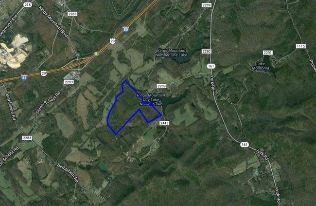
112.522AC OFF RD 2289
12879
CLEVELAND
Residentialacreage
North Carolina
R10
9
AE The base floodplain where base flood elevations are provided. AE Zones are now used on new format FIRMs instead of A1-A30 Zones.
112.52 AC
2025
Cleveland County
2025
Charlotte
950400
NEARBY LISTINGS FOR SALE OR LEASE
DEMOGRAPHICS near Boy Scout Camp Rd
1 mile
3 mile
5 mile
2025 Total Population
115
6,952
21,756
2030 Population
120
7,145
22,425
Pop Growth 2025-2030
+ 4.35%
+ 2.78%
+ 3.08%
Average Age
44
42
41
2025 Total Households
46
2,754
8,700
HH Growth 2025-2030
+ 4.35%
+ 2.80%
+ 3.11%
Median Household Inc
$80,555
$78,160
$64,008
Avg Household Size
2.40
2.50
2.40
2025 Avg HH Vehicles
2.00
2.00
2.00
Median Home Value
$253,333
$225,601
$226,160
Median Year Built
1984
1981
1979
Nearby Places
Map Layers
Map Styles
 Street
 Aerial
Layers
 Traffic
 Biking
Places
Listings with unknown addresses are not visible on the map
- Restaurants
- Banks
- Shops
- Fitness
- Groceries
PUBLIC TRANSPORTATION
AIRPORT
Charlotte/Douglas International
Drive
Walk
Distance
Charlotte/Douglas International
47 min
30.0 mi
Freight Ports
North Charleston Terminal
Drive
Walk
Distance
North Charleston Terminal
241 min
205.5 mi
SALE & LEASE HISTORY
LISTING DATE
SALE/LEASE

Sep 24, 2016
For Sale
Nearby Properties
Address
Land Use
TOTAL SIZE
Lot Size
Zoning
Address
Land Use
TOTAL SIZE
Lot Size
Zoning
828 SF
85.98 AC
R10
Address
Land Use
TOTAL SIZE
Lot Size
Zoning
300,993 SF
19.39 AC
HI
Address
Land Use
TOTAL SIZE
Lot Size
Zoning
135,000 SF
20.43 AC
HI
Address
Land Use
TOTAL SIZE
Lot Size
Zoning
125.73 AC
LI
Address
Land Use
TOTAL SIZE
Lot Size
Zoning
175,610 SF
25.84 AC
LI
Address
Land Use
TOTAL SIZE
Lot Size
Zoning
16,414 SF
5 AC
R10
Address
Land Use
TOTAL SIZE
Lot Size
Zoning
44,094 SF
2.67 AC
HI
Address
Land Use
TOTAL SIZE
Lot Size
Zoning
7,000 SF
536.04 AC
HI
Address
Land Use
TOTAL SIZE
Lot Size
Zoning
12,320 SF
11.48 AC
R06
Address
Land Use
TOTAL SIZE
Lot Size
Zoning
100,225 SF
10.48 AC
HI
Address
Land Use
TOTAL SIZE
Lot Size
Zoning
11,920 SF
3.10 AC
GB
Address
Land Use
TOTAL SIZE
Lot Size
Zoning
3,000 SF
19.94 AC
HI
Address
Land Use
TOTAL SIZE
Lot Size
Zoning
2,136 SF
8.67 AC
R06
Address
Land Use
TOTAL SIZE
Lot Size
Zoning
27,867 SF
3.85 AC
GB
Address
Land Use
TOTAL SIZE
Lot Size
Zoning
2,875 SF
4.76 AC
R06
Address
Land Use
TOTAL SIZE
Lot Size
Zoning
9,500 SF
16.88 AC
R20
Address
Land Use
TOTAL SIZE
Lot Size
Zoning
2,700 SF
11.39 AC
HI
Address
Land Use
TOTAL SIZE
Lot Size
Zoning
6,000 SF
12 AC
HI
Address
Land Use
TOTAL SIZE
Lot Size
Zoning
3,980 SF
208.89 AC
HI
Address
Land Use
TOTAL SIZE
Lot Size
Zoning
4,800 SF
664.86 AC
GB
Address
Land Use
TOTAL SIZE
Lot Size
Zoning
7,040 SF
6.02 AC
R20
Address
Land Use
TOTAL SIZE
Lot Size
Zoning
6,000 SF
3.85 AC
AA1
Address
Land Use
TOTAL SIZE
Lot Size
Zoning
4,283 SF
50.50 AC
R20
Address
Land Use
TOTAL SIZE
Lot Size
Zoning
16,607 SF
2.06 AC
R10
Address
Land Use
TOTAL SIZE
Lot Size
Zoning
5,236 SF
6.20 AC
LI
Address
Land Use
TOTAL SIZE
Lot Size
Zoning
1,672 SF
88.87 AC
HI
Address
Land Use
TOTAL SIZE
Lot Size
Zoning
2,896 SF
1.07 AC
GB
Address
Land Use
TOTAL SIZE
Lot Size
Zoning
3,568 SF
1.13 AC
GB
Address
Land Use
TOTAL SIZE
Lot Size
Zoning
25,630 SF
8.16 AC
LI
Address
Land Use
TOTAL SIZE
Lot Size
Zoning
12,960 SF
1.14 AC
GB
The World's #1 Commercial Real Estate Marketplace
Connect with us
© 2026 CoStar Group
The information above has been obtained from sources believed reliable. While we do not doubt its accuracy we have not verified it and make no guarantee, warranty or representation about it. It is your responsibility to independently confirm its accuracy and completeness. Any projections, opinions, assumptions, or estimates used are for example only and do not represent the current or future performance of the property. The value of this transaction to you depends on tax and other factors which should be evaluated by your tax, financial, and legal advisors. You and your advisors should conduct a careful, independent investigation of the property to determine to your satisfaction the suitability of the property for your needs.