Property Record
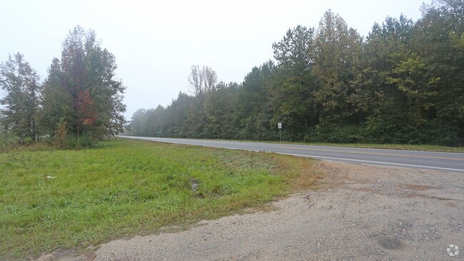
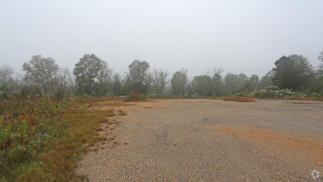
Boyd Springs Rd, Lapine, AL 36046

Property Detail
Boyd Springs Rd
Montgomery, AL
SEC 36 T13N R17E 36.2 AC IN E1/2 OF NE1/4 2307360000001003
23-07-36-0-000-001.003
MONTGOMERY
Timberlandforesttreesagricultural
Alabama
AE The base floodplain where base flood elevations are provided. AE Zones are now used on new format FIRMs instead of A1-A30 Zones.
36.20 AC
2025
Outlying Montgomery Cnty
2025
Montgomery
963500
NEARBY LISTINGS FOR SALE OR LEASE
-
-
View all Lapine listings for sale on LoopNet.com
DEMOGRAPHICS near Boyd Springs Rd
1 mile
3 mile
5 mile
2025 Total Population
168
491
1,510
2030 Population
169
493
1,517
Pop Growth 2025-2030
+ 0.60%
+ 0.41%
+ 0.46%
Average Age
46
46
46
2025 Total Households
74
215
665
HH Growth 2025-2030
+ 1.35%
+ 0.47%
+ 0.60%
Median Household Inc
$31,250
$33,402
$44,761
Avg Household Size
2.30
2.30
2.20
2025 Avg HH Vehicles
2.00
2.00
2.00
Median Home Value
$242,187
$232,237
$217,526
Median Year Built
1998
1995
1992
Nearby Places
Map Layers
Map Styles
 Street
 Aerial
Transit
 Traffic
 Biking
Places
Listings with unknown addresses are not visible on the map
- Restaurants
- Banks
- Shops
- Fitness
- Groceries
PUBLIC TRANSPORTATION
AIRPORT
Montgomery Regional (Dannelly Field)
Drive
Walk
Distance
Montgomery Regional (Dannelly Field)
39 min
26.1 mi
Freight Ports
Port of Panama City
Drive
Walk
Distance
Port of Panama City
233 min
160.4 mi
SALE & LEASE HISTORY
LISTING DATE
SALE/LEASE

Nov 15, 2016
For Sale
Nearby Properties
Address
Land Use
TOTAL SIZE
Lot Size
Zoning
Address
Land Use
TOTAL SIZE
Lot Size
Zoning
281.71 AC
Address
Land Use
TOTAL SIZE
Lot Size
Zoning
Address
Land Use
TOTAL SIZE
Lot Size
Zoning
231.27 AC
Address
Land Use
TOTAL SIZE
Lot Size
Zoning
Address
Land Use
TOTAL SIZE
Lot Size
Zoning
194.97 AC
Address
Land Use
TOTAL SIZE
Lot Size
Zoning
232.39 AC
Address
Land Use
TOTAL SIZE
Lot Size
Zoning
178.10 AC
Address
Land Use
TOTAL SIZE
Lot Size
Zoning
307.20 AC
Address
Land Use
TOTAL SIZE
Lot Size
Zoning
Address
Land Use
TOTAL SIZE
Lot Size
Zoning
158 AC
Address
Land Use
TOTAL SIZE
Lot Size
Zoning
160.10 AC
Address
Land Use
TOTAL SIZE
Lot Size
Zoning
156 AC
Address
Land Use
TOTAL SIZE
Lot Size
Zoning
253 AC
OT
Address
Land Use
TOTAL SIZE
Lot Size
Zoning
Address
Land Use
TOTAL SIZE
Lot Size
Zoning
167 AC
Address
Land Use
TOTAL SIZE
Lot Size
Zoning
114 AC
Address
Land Use
TOTAL SIZE
Lot Size
Zoning
143.14 AC
Address
Land Use
TOTAL SIZE
Lot Size
Zoning
Address
Land Use
TOTAL SIZE
Lot Size
Zoning
120 AC
Address
Land Use
TOTAL SIZE
Lot Size
Zoning
135.30 AC
Address
Land Use
TOTAL SIZE
Lot Size
Zoning
112 AC
Address
Land Use
TOTAL SIZE
Lot Size
Zoning
122 AC
Address
Land Use
TOTAL SIZE
Lot Size
Zoning
243 AC
OT
Address
Land Use
TOTAL SIZE
Lot Size
Zoning
2,800 SF
171 AC
OT
Address
Land Use
TOTAL SIZE
Lot Size
Zoning
128 AC
Address
Land Use
TOTAL SIZE
Lot Size
Zoning
118.90 AC
Address
Land Use
TOTAL SIZE
Lot Size
Zoning
100.90 AC
Address
Land Use
TOTAL SIZE
Lot Size
Zoning
70 AC
Address
Land Use
TOTAL SIZE
Lot Size
Zoning
115.50 AC
Address
Land Use
TOTAL SIZE
Lot Size
Zoning
93.80 AC
The World's #1 Commercial Real Estate Marketplace
Connect with us
© 2026 CoStar Group
The information above has been obtained from sources believed reliable. While we do not doubt its accuracy we have not verified it and make no guarantee, warranty or representation about it. It is your responsibility to independently confirm its accuracy and completeness. Any projections, opinions, assumptions, or estimates used are for example only and do not represent the current or future performance of the property. The value of this transaction to you depends on tax and other factors which should be evaluated by your tax, financial, and legal advisors. You and your advisors should conduct a careful, independent investigation of the property to determine to your satisfaction the suitability of the property for your needs.