Property Record
Braddock Rd, Jacksonville, FL 32219

NEARBY LISTINGS FOR SALE OR LEASE
Property Detail
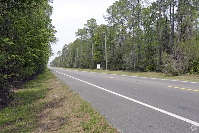
Braddock Rd
Jacksonville, FL
Section Land
002474-0200
24-1N-25E 945.91 PT SEC 19,24, FRATIONAL PT SEC 18, 25, 30, RECD O/R 20900-374 BEING PARCEL B, PT CLOSED R/W ORD 2024-696-E
Timberlandforesttreesagricultural
Duval
2024
Florida
2025
945.77 AC
010601
Northwest Jacksonville
3,240 SF
Jacksonville (Florida)
DEMOGRAPHICS near Braddock Rd
1 Mile
3 Mile
5 Mile
2024 Total Population
128
4,602
23,283
2029 Population
136
5,074
25,521
Pop Growth 2024-2029
+ 6.25%
+ 10.26%
+ 9.61%
Average Age
40
39
39
2024 Total Households
43
1,583
8,236
HH Growth 2024-2029
+ 6.98%
+ 11.12%
+ 10.14%
Median Household Inc
$74,999
$69,617
$69,989
Avg Household Size
2.80
2.80
2.70
2024 Avg HH Vehicles
2.00
2.00
2.00
Median Home Value
$290,624
$255,681
$229,070
Median Year Built
2010
2004
2001
Nearby Places
Map Layers
Map Styles
 Street
 Aerial
- Restaurants
- Banks
- Shops
- Fitness
- Groceries
PUBLIC TRANSPORTATION
AIRPORT
Jacksonville International
DRIVE
WALK
Distance
Jacksonville International
14 min
7.2 mi
Freight Ports
Jacksonville Port
DRIVE
WALK
Distance
Jacksonville Port
25 min
14.7 mi
SALE & LEASE HISTORY
LISTING DATE
SALE/LEASE

Mar 30, 2017
For Sale
Nearby Properties
Address
Land Use
TOTAL SIZE
Lot Size
Zoning
Address
Land Use
TOTAL SIZE
Lot Size
Zoning
744.81 AC
PUD
Address
Land Use
TOTAL SIZE
Lot Size
Zoning
260.03 AC
PUD
Address
Land Use
TOTAL SIZE
Lot Size
Zoning
132.15 AC
PBF-3
Address
Land Use
TOTAL SIZE
Lot Size
Zoning
66.30 AC
PUD
Address
Land Use
TOTAL SIZE
Lot Size
Zoning
170.39 AC
PUD
Address
Land Use
TOTAL SIZE
Lot Size
Zoning
2,216 SF
275.40 AC
PUD
Address
Land Use
TOTAL SIZE
Lot Size
Zoning
131.41 AC
PUD
Address
Land Use
TOTAL SIZE
Lot Size
Zoning
261.83 AC
PBF-3
Address
Land Use
TOTAL SIZE
Lot Size
Zoning
720 SF
7.93 AC
ROS
Address
Land Use
TOTAL SIZE
Lot Size
Zoning
21,994 SF
12.01 AC
RR-ACRE
Address
Land Use
TOTAL SIZE
Lot Size
Zoning
67.30 AC
PUD
Address
Land Use
TOTAL SIZE
Lot Size
Zoning
14,004 SF
10.73 AC
IH
Address
Land Use
TOTAL SIZE
Lot Size
Zoning
37.06 AC
PUD
Address
Land Use
TOTAL SIZE
Lot Size
Zoning
53 AC
PUD
Address
Land Use
TOTAL SIZE
Lot Size
Zoning
45.53 AC
PUD
Address
Land Use
TOTAL SIZE
Lot Size
Zoning
17,636 SF
11.15 AC
IL
Address
Land Use
TOTAL SIZE
Lot Size
Zoning
15,738 SF
46.83 AC
RR-ACRE
Address
Land Use
TOTAL SIZE
Lot Size
Zoning
24,824 SF
13.31 AC
AGR
Address
Land Use
TOTAL SIZE
Lot Size
Zoning
39.06 AC
PUD
Address
Land Use
TOTAL SIZE
Lot Size
Zoning
1,622 SF
10.29 AC
IL
Address
Land Use
TOTAL SIZE
Lot Size
Zoning
5,632 SF
2.12 AC
RM
Address
Land Use
TOTAL SIZE
Lot Size
Zoning
13,835 SF
390.40 AC
AGR
Address
Land Use
TOTAL SIZE
Lot Size
Zoning
7,543 SF
4.81 AC
RR-ACRE
Address
Land Use
TOTAL SIZE
Lot Size
Zoning
9,342 SF
2 AC
IL
Address
Land Use
TOTAL SIZE
Lot Size
Zoning
1,016 SF
4.95 AC
IL
Address
Land Use
TOTAL SIZE
Lot Size
Zoning
7,971 SF
8.84 AC
RR-ACRE
Address
Land Use
TOTAL SIZE
Lot Size
Zoning
4,554 SF
211 AC
OR
Address
Land Use
TOTAL SIZE
Lot Size
Zoning
19.63 AC
PUD
Address
Land Use
TOTAL SIZE
Lot Size
Zoning
2,383 SF
22.23 AC
AGR
The World's #1 Commercial Real Estate Marketplace
Connect with us
© 2025 CoStar Group
The information above has been obtained from sources believed reliable. While we do not doubt its accuracy we have not verified it and make no guarantee, warranty or representation about it. It is your responsibility to independently confirm its accuracy and completeness. Any projections, opinions, assumptions, or estimates used are for example only and do not represent the current or future performance of the property. The value of this transaction to you depends on tax and other factors which should be evaluated by your tax, financial, and legal advisors. You and your advisors should conduct a careful, independent investigation of the property to determine to your satisfaction the suitability of the property for your needs.