Property Record
Brannan Island Rd, Isleton, CA 95641
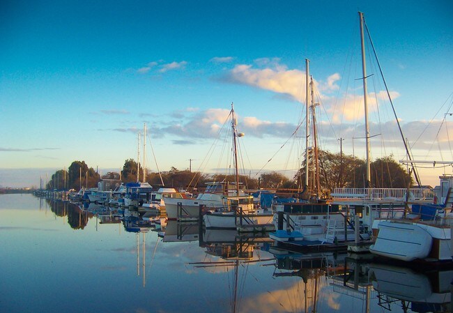
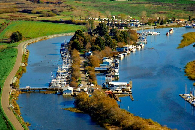

Property Detail
Brannan Island Rd
156-0080-047
SLS NO 1062 LOCATED IN SEC 10 & 11 TWP 3 N R 3 EM D B & M & BEING FURTHER DES IN BK 732 OF O RPG 432 ALSO KNOWN AS OWL ISLAND CONTG 9.22 AC EXC MINERAL RIGHTS
Miscellaneous
SACRAMENTO
SPA
California
AE The base floodplain where base flood elevations are provided. AE Zones are now used on new format FIRMs instead of A1-A30 Zones.
0.49 AC
2024
Sacramento
2025
Sacramento-Roseville-Folsom, CA
009800
NEARBY LISTINGS FOR SALE OR LEASE
DEMOGRAPHICS near Brannan Island Rd
1 mile
3 mile
5 mile
2025 Total Population
240
956
2,433
2030 Population
235
931
2,368
Pop Growth 2025-2030
(2.08%)
(2.62%)
(2.67%)
Average Age
54
52
48
2025 Total Households
139
509
1,125
HH Growth 2025-2030
(2.16%)
(2.55%)
(2.58%)
Median Household Inc
$48,124
$60,153
$70,178
Avg Household Size
1.70
1.90
2.10
2025 Avg HH Vehicles
2.00
2.00
2.00
Median Home Value
$233,333
$265,789
$384,301
Median Year Built
1990
1982
1974
Nearby Places
Map Layers
Map Styles
 Street
 Aerial
Layers
 Traffic
 Biking
Places
Listings with unknown addresses are not visible on the map
- Restaurants
- Banks
- Shops
- Fitness
- Groceries
PUBLIC TRANSPORTATION
AIRPORT
Stockton Metro
Drive
Walk
Distance
Stockton Metro
48 min
34.7 mi
Freight Ports
Port of Stockton
Drive
Walk
Distance
Port of Stockton
38 min
27.2 mi
SALE & LEASE HISTORY
LISTING DATE
SALE/LEASE

Oct 05, 2017
For Sale
May 24, 2019
For Sale
Nearby Properties
Address
Land Use
TOTAL SIZE
Lot Size
Zoning
Address
Land Use
TOTAL SIZE
Lot Size
Zoning
153,371 SF
15.46 AC
C-O
Address
Land Use
TOTAL SIZE
Lot Size
Zoning
530.29 AC
AG-80
Address
Land Use
TOTAL SIZE
Lot Size
Zoning
628.94 AC
AG-80
Address
Land Use
TOTAL SIZE
Lot Size
Zoning
AG80 F
Address
Land Use
TOTAL SIZE
Lot Size
Zoning
513.57 AC
AG-80
Address
Land Use
TOTAL SIZE
Lot Size
Zoning
495.61 AC
AG-80
Address
Land Use
TOTAL SIZE
Lot Size
Zoning
Address
Land Use
TOTAL SIZE
Lot Size
Zoning
378.70 AC
SPA AG-80
Address
Land Use
TOTAL SIZE
Lot Size
Zoning
475.67 AC
A2
Address
Land Use
TOTAL SIZE
Lot Size
Zoning
349.12 AC
AG-80 SPA
Address
Land Use
TOTAL SIZE
Lot Size
Zoning
374.77 AC
AG40
Address
Land Use
TOTAL SIZE
Lot Size
Zoning
Address
Land Use
TOTAL SIZE
Lot Size
Zoning
1,381 SF
8.80 AC
DW
Address
Land Use
TOTAL SIZE
Lot Size
Zoning
377.90 AC
A2
Address
Land Use
TOTAL SIZE
Lot Size
Zoning
Address
Land Use
TOTAL SIZE
Lot Size
Zoning
339.78 AC
A2
Address
Land Use
TOTAL SIZE
Lot Size
Zoning
Address
Land Use
TOTAL SIZE
Lot Size
Zoning
249.63 AC
AG-80
Address
Land Use
TOTAL SIZE
Lot Size
Zoning
315.82 AC
A2
Address
Land Use
TOTAL SIZE
Lot Size
Zoning
Address
Land Use
TOTAL SIZE
Lot Size
Zoning
206.31 AC
AG-80
Address
Land Use
TOTAL SIZE
Lot Size
Zoning
198 AC
SPA AG-80
Address
Land Use
TOTAL SIZE
Lot Size
Zoning
Address
Land Use
TOTAL SIZE
Lot Size
Zoning
Address
Land Use
TOTAL SIZE
Lot Size
Zoning
6.90 AC
DW-R
Address
Land Use
TOTAL SIZE
Lot Size
Zoning
24.03 AC
SPA
Address
Land Use
TOTAL SIZE
Lot Size
Zoning
200 AC
A2
Address
Land Use
TOTAL SIZE
Lot Size
Zoning
195.48 AC
A2
Address
Land Use
TOTAL SIZE
Lot Size
Zoning
9.09 AC
C-O
Address
Land Use
TOTAL SIZE
Lot Size
Zoning
The World's #1 Commercial Real Estate Marketplace
Connect with us
© 2026 CoStar Group
The information above has been obtained from sources believed reliable. While we do not doubt its accuracy we have not verified it and make no guarantee, warranty or representation about it. It is your responsibility to independently confirm its accuracy and completeness. Any projections, opinions, assumptions, or estimates used are for example only and do not represent the current or future performance of the property. The value of this transaction to you depends on tax and other factors which should be evaluated by your tax, financial, and legal advisors. You and your advisors should conduct a careful, independent investigation of the property to determine to your satisfaction the suitability of the property for your needs.