Property Record
Brick Kiln Rd, Salisbury, MD 21801


Property Detail
Brick Kiln Rd
09-016368
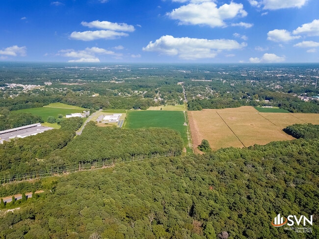
76.33 AC ES BRICK KILN RD 416 W OF SALISBURY
Industrialgeneral
WICOMICO
R-20
Maryland
B and X Area of moderate flood hazard, usually the area between the limits of the 100-year and 500-year floods.
76.33 AC
2025
Chesapeake Bay/Salisbury
2025
Other Market Areas
010300
Salisbury, MD
NEARBY LISTINGS FOR SALE OR LEASE
-
-
View all Salisbury listings for sale on LoopNet.com
DEMOGRAPHICS near Brick Kiln Rd
1 mile
3 mile
5 mile
2025 Total Population
2,501
35,580
75,398
2030 Population
2,558
36,249
77,247
Pop Growth 2025-2030
+ 2.28%
+ 1.88%
+ 2.45%
Average Age
38
38
38
2025 Total Households
974
12,895
28,942
HH Growth 2025-2030
+ 2.36%
+ 1.88%
+ 2.54%
Median Household Inc
$47,229
$56,290
$67,538
Avg Household Size
2.40
2.50
2.40
2025 Avg HH Vehicles
1.00
2.00
2.00
Median Home Value
$163,636
$260,123
$258,495
Median Year Built
1984
1973
1982
Nearby Places
Map Layers
Map Styles
 Street
 Aerial
Layers
 Traffic
 Biking
Places
Listings with unknown addresses are not visible on the map
- Restaurants
- Banks
- Shops
- Fitness
- Groceries
PUBLIC TRANSPORTATION
AIRPORT
Salisbury-Ocean City Wicomico Regional
Drive
Walk
Distance
Salisbury-Ocean City Wicomico Regional
19 min
9.1 mi
Freight Ports
Port of Baltimore
Drive
Walk
Distance
Port of Baltimore
159 min
104.9 mi
SALE & LEASE HISTORY
LISTING DATE
SALE/LEASE

Oct 15, 2021
For Sale
Nearby Properties
Address
Land Use
TOTAL SIZE
Lot Size
Zoning
Address
Land Use
TOTAL SIZE
Lot Size
Zoning
1,792 SF
76.32 AC
R20
Address
Land Use
TOTAL SIZE
Lot Size
Zoning
602,336 SF
22.69 AC
H
Address
Land Use
TOTAL SIZE
Lot Size
Zoning
208,457 SF
3.05 AC
C
Address
Land Use
TOTAL SIZE
Lot Size
Zoning
118,330 SF
1.99 AC
CBD
Address
Land Use
TOTAL SIZE
Lot Size
Zoning
103,992 SF
0.59 AC
CBD
Address
Land Use
TOTAL SIZE
Lot Size
Zoning
105,626 SF
53.26 AC
R-8
Address
Land Use
TOTAL SIZE
Lot Size
Zoning
6,136 SF
52.49 AC
R-10
Address
Land Use
TOTAL SIZE
Lot Size
Zoning
40,690 SF
9.02 AC
PDD
Address
Land Use
TOTAL SIZE
Lot Size
Zoning
3,408 SF
69.67 AC
I
Address
Land Use
TOTAL SIZE
Lot Size
Zoning
76,999 SF
7.72 AC
R-8
Address
Land Use
TOTAL SIZE
Lot Size
Zoning
60,949 SF
14.13 AC
R-8
Address
Land Use
TOTAL SIZE
Lot Size
Zoning
58,528 SF
15.05 AC
R8
Address
Land Use
TOTAL SIZE
Lot Size
Zoning
1,034 SF
18.79 AC
R-8A
Address
Land Use
TOTAL SIZE
Lot Size
Zoning
41,473 SF
1.20 AC
CBD
Address
Land Use
TOTAL SIZE
Lot Size
Zoning
195,541 SF
51.98 AC
Address
Land Use
TOTAL SIZE
Lot Size
Zoning
43,164 SF
1.83 AC
CBD
Address
Land Use
TOTAL SIZE
Lot Size
Zoning
37,198 SF
6.15 AC
LI
Address
Land Use
TOTAL SIZE
Lot Size
Zoning
15,260 SF
13.52 AC
R5A
Address
Land Use
TOTAL SIZE
Lot Size
Zoning
38,485 SF
24.09 AC
R-20
Address
Land Use
TOTAL SIZE
Lot Size
Zoning
1,804 SF
99.10 AC
R-20
Address
Land Use
TOTAL SIZE
Lot Size
Zoning
48,270 SF
2.30 AC
GC
Address
Land Use
TOTAL SIZE
Lot Size
Zoning
266,900 SF
2.03 AC
GC
Address
Land Use
TOTAL SIZE
Lot Size
Zoning
53,979 SF
4.92 AC
GC
Address
Land Use
TOTAL SIZE
Lot Size
Zoning
37,645 SF
16.43 AC
IP
Address
Land Use
TOTAL SIZE
Lot Size
Zoning
49,068 SF
2.92 AC
PRD
Address
Land Use
TOTAL SIZE
Lot Size
Zoning
135,750 SF
13.75 AC
R8
Address
Land Use
TOTAL SIZE
Lot Size
Zoning
36,177 SF
1.58 AC
GC
Address
Land Use
TOTAL SIZE
Lot Size
Zoning
20,970 SF
3.52 AC
Address
Land Use
TOTAL SIZE
Lot Size
Zoning
74,641 SF
7.10 AC
GC
Address
Land Use
TOTAL SIZE
Lot Size
Zoning
34,200 SF
15.95 AC
R-5A
The World's #1 Commercial Real Estate Marketplace
Connect with us
© 2026 CoStar Group
The information above has been obtained from sources believed reliable. While we do not doubt its accuracy we have not verified it and make no guarantee, warranty or representation about it. It is your responsibility to independently confirm its accuracy and completeness. Any projections, opinions, assumptions, or estimates used are for example only and do not represent the current or future performance of the property. The value of this transaction to you depends on tax and other factors which should be evaluated by your tax, financial, and legal advisors. You and your advisors should conduct a careful, independent investigation of the property to determine to your satisfaction the suitability of the property for your needs.